1990s Maps of Marion County, South Carolina
Explore 5 historic maps of Marion County from the 1990s. These maps offer a rare glimpse into what life looked like during the 1990s — showing old roads, neighborhoods, homes, and landmarks that have changed or disappeared over time.
Whether you're researching your family's past, planning a metal detecting trip, or studying how Marion County's landscape evolved across the 1990s, these high-resolution maps are a powerful tool for exploring the history of this region.
- Focus on a specific era: All maps on this page are from the 1990s, giving you a focused view of this time period.
- See what’s changed: Compare century-old streets, trails, and buildings to today's modern landscape using overlays and satellite layers.
- Research with precision: Use these maps for genealogy, historical research, land use analysis, or educational projects.
- View, download, or print: Maps are fully viewable online in high resolution, and can be downloaded or printed for your own records.
Start exploring Marion County's history through authentic maps from the 1990s. This is your window into the past.
Marion County, SC maps
(5)- 1990 Map of Brittons Neck
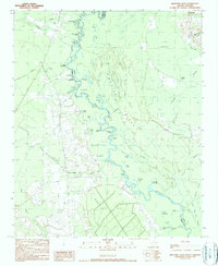 1990 Brittons Neck1990 Print · USGSThe river landings and deep wetlands of the South Carolina Lowcountry are captured here during the late twentieth century. Genealogists and local historians can trace family ties through Brittons Neck and remote river access points like Locust Tree Landing and Hughes Landing.
 - 1990 Map of Pamplico South
 1990 Pamplico South1990 Print · USGSThe Pee Dee region of Florence County is shown in the mid-1980s, bordered by the winding Great Pee Dee River and Lynches River. Researchers can locate rural community hubs like Butler Crossroads, Hannah, and the Mt Zion Ch area.
 - 1990 Map of Snow Island
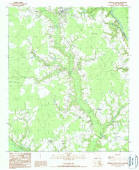
 1990 Snow Island1990 Print · USGSThe river-bound territory of Marion and Florence counties is captured in the late twentieth century, showing a landscape of dense swamps and shifting oxbows. Local historians can trace the geography of Snow Island, the reaches of Brittons Neck, and the location of Sampson Landing.
 - 1990 Map of Johnsonville
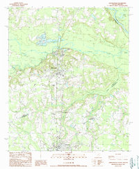 1990 Johnsonville1990 Print · USGSCoastal plain river systems and rural crossroads define this South Carolina landscape during the early 1990s. Researchers can trace the development of Johnsonville and Hemingway or locate family sites near Ard Crossroads and Crooks Crossroads.
 - 1990 Map of Gresham
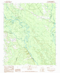
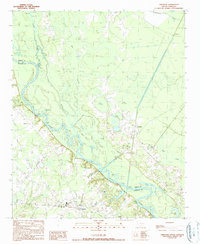 1990 Gresham1990 Print · USGSMarion and Florence counties met along the river in the 1990s, defined by the winding course of the Great Pee Dee River. Genealogists and historians can trace old community hubs like Gresham and Kingsburg or locate riverfront sites like Catfish Landing.
End of results
Showing maps 1-5 of 5
Top cities of Marion County
Frequently asked questions
- What are the different types of historical maps available for Marion County?
- What is the oldest map of Marion County?
- Where can I purchase historical maps of Marion County for my home or office?
- Where can I download high-res historical maps of Marion County?
- Are there historical topographic maps available for Marion County?
- Is there historical aerial imagery available for Marion County?
- Where are historical maps of Marion County sourced from?