1950s Maps of Butte County, South Dakota
Explore 32 historic maps of Butte County from the 1950s. These maps offer a rare glimpse into what life looked like during the 1950s — showing old roads, neighborhoods, homes, and landmarks that have changed or disappeared over time.
Whether you're researching your family's past, planning a metal detecting trip, or studying how Butte County's landscape evolved across the 1950s, these high-resolution maps are a powerful tool for exploring the history of this region.
- Focus on a specific era: All maps on this page are from the 1950s, giving you a focused view of this time period.
- See what’s changed: Compare century-old streets, trails, and buildings to today's modern landscape using overlays and satellite layers.
- Research with precision: Use these maps for genealogy, historical research, land use analysis, or educational projects.
- View, download, or print: Maps are fully viewable online in high resolution, and can be downloaded or printed for your own records.
Start exploring Butte County's history through authentic maps from the 1950s. This is your window into the past.
Butte County, SD maps
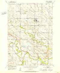
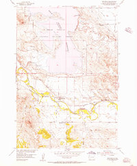
(32)- 1951 Map of Volunteer, 1953 Print
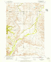
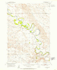 1951 Volunteer1953 Print · USGSWestern South Dakota's river country is documented here in the early fifties during the Missouri River Basin development era. Genealogists and historians can locate rural schoolhouses like Wetz Sch and Meyer Sch or the riverside settlement of Volunteer.3 unique versions available
 - 1951 Map of Vale, 1953 Print
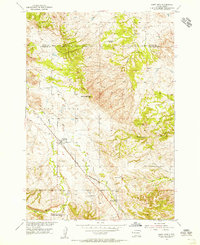
 1951 Vale1953 Print · USGSVale and the surrounding Butte County ranchlands are captured in the early fifties during the expansion of the Missouri River Basin irrigation network. Researchers can trace the Chicago and North Western rail line and locate early landmarks like Old Vale Cem and the Wagner Historical Monument.3 unique versions available
 - 1951 Map of Volunteer SE, 1953 Print
 1951 Volunteer SE1953 Print · USGSMeade County prairie and river breaks are captured here in the early fifties during the Missouri River Basin development program. Trace rural landmarks like the Volunteer Sch and topographic features such as Englishman Butte and the Belle Fourche River.2 unique versions available
 - 1951 Map of Vale SE, 1953 Print
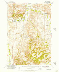
 1951 Vale SE1953 Print · USGSMeade and Butte counties are captured here in the early fifties, showing a rural landscape defined by the Belle Fourche River and intensive irrigation. Genealogists and researchers can locate numerous local landmarks including Empire Ch, the Chicago and North Western rail line, and South Highland Sch (Abandoned).3 unique versions available
 - 1951 Map of Newell, 1953 Print
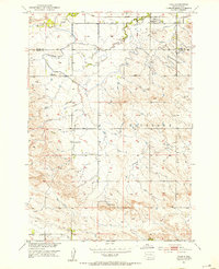
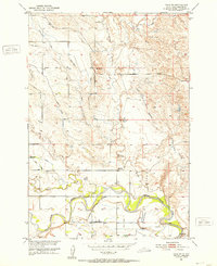
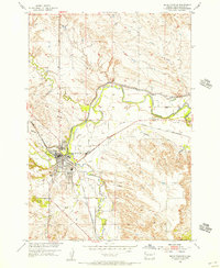
 1951 Newell1953 Print · USGSButte County ranching and irrigation are in full focus during the early fifties, centered on the research hub of Newell. Genealogists and historians can trace the foundations of this community through family-proximate sites like Riverside Sch, Wilson Cem, and the rail stop at Morsman Siding.2 unique versions available
 - 1951 Map of Vale NE, 1953 Print
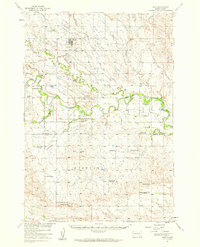
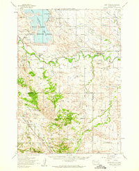
 1951 Vale NE1953 Print · USGSButte County, South Dakota, is captured in the early 1950s during a period of significant Missouri River Basin development. Researchers can trace rural community life through the Fairview School and Plainview School, or study the engineering of the Belle Fourche River irrigation system.4 unique versions available
 - 1951 Map of Nisland, 1953 Print
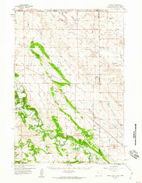
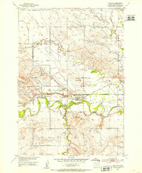 1951 Nisland1953 Print · USGSNisland and the surrounding Butte County ranchlands are seen here in the early fifties during the height of Missouri River Basin development. Researchers can trace the extensive irrigation network through the South Canal and locate rural landmarks like Horse Creek Sch and the County Fairground.2 unique versions available
 - 1951 Map of Vale, 1959 Print
 1951 Vale1959 Print · USGSThe Butte and Meade county line in the early fifties shows a landscape of irrigated prairies and river bends shaped by the Belle Fourche River. Genealogists and local historians can trace rural school districts like Plainview Sch and find family sites near Vale Cem or the Chicago and North Western rail line.
 - 1953 Map of Rapid City, 1964 Print
 1953 Rapid City1964 Print · USGSWestern South Dakota's transition from the Black Hills to the open prairie is captured here during the mid-fifties. Researchers can trace the development of Ellsworth Air Force Base alongside historic landmarks like Bear Butte and the Lower Alkali School.3 unique versions available
 - 1954 Map of The Forks
 1954 The Forks1954 Print · USGSThe Wyoming and South Dakota borderlands appear in the mid-fifties as a landscape of isolated ranches and early industrial mining. Family historians can trace the locations of Sunny Slope Sch, the Old Railroad Grade, and numerous homesteads such as Helmer Ranch.
 - 1954 Map of Saint Onge SE, 1955 Print
 1954 Saint Onge SE1955 Print · USGSThe rolling ranchlands of Meade and Lawrence counties are captured in the mid-1950s, highlighting a network of rural schoolhouses. Genealogists can locate family landmarks like Big Bottom Sch, Oakdale Sch, and the prominent Snake Bench.4 unique versions available
 - 1954 Map of Saint Onge, 1955 Print
 1954 Saint Onge1955 Print · USGSLawrence County saw steady ranching and rail activity during the mid-fifties as the Missouri River Basin program advanced. Genealogists can trace family footprints through sites like the Saint Onge Cem, the Dane Ch, and the Middle False Bottom Sch.3 unique versions available
 - 1954 Map of Jolly, 1956 Print
 1954 Jolly1956 Print · USGSThe Black Hills foothills in the mid-fifties show a landscape of rural industry and changing education patterns along the Butte County line. Genealogists can locate several decommissioned schoolhouses, including White Sch (Abandoned) and Todd Sch (Abandoned), alongside the Chicago North Western tracks.4 unique versions available
 - 1954 Map of Belle Fourche, 1956 Print
 1954 Belle Fourche1956 Print · USGSBelle Fourche in the mid-fifties is a thriving rail and irrigation hub at the meeting of the Belle Fourche River and Redwater Creek. Researchers can trace old property lines near Pine Slope Cemetery, the Chicago and North Western line, or the local Ingersoll Sch.3 unique versions available
 - 1954 Map of Fruitdale, 1956 Print
 1954 Fruitdale1956 Print · USGSIn the mid-1950s, the area around Fruitdale was a center for Missouri River Basin irrigation and rail transport. Genealogists can trace family footprints at the Danish Cem or locate the old Orman Sch and Snoma Sch.3 unique versions available
 - 1954 Map of Saint Onge, 1959 Print
 1954 Saint Onge1959 Print · USGSWestern South Dakota's ranching and irrigation heartland is documented here in the mid-1950s. Genealogists can locate family-named landmarks and rural institutions such as the Saint Onge Cem, Middle False Bottom Sch, and Nisland.
 - 1954 Map of Lemmon, 1964 Print
 1954 Lemmon1964 Print · USGSThe high plains of South Dakota and North Dakota are documented here during the mid-twentieth century. Family researchers can trace dozens of country school sites like Green Cabin School and Bierke School alongside landmarks like The Castles.2 unique versions available
 - 1954 Map of Ekalaka, 1966 Print
 1954 Ekalaka1966 Print · USGSSoutheastern Montana and its borderlands with the Dakotas and Wyoming appear here in the mid-fifties, showing a remote ranching landscape. Genealogists can trace family roots through numerous rural landmarks like the Sherwin School, St Marys Ch, and Powderville.3 unique versions available
 - 1954 Map of Gillette, 1975 Print
 1954 Gillette1975 Print · USGSGillette and the northeast Wyoming ranching country are captured here in the mid-1950s as coal and bentonite mining shaped the local economy. Genealogists can trace family landmarks like the Bethlehem Church, Wellman School, and early settlements along the Chicago Burlington and Quincy RR.
 - 1955 Map of Gillette, 1976 Print
 1955 Gillette1976 Print · USGSNortheastern Wyoming in the mid-twentieth century is captured here as the energy and ranching landscape began to shift. Genealogists and historians can trace the foundations of local communities through sites like Wyodak, the Pleasantdale Community Building, and landmarks like Devils Tower National Monument.
 - 1956 Map of Ekalaka
 1956 Ekalaka1956 Print · USGSSoutheast Montana and the Wyoming borderlands are shown here in the mid-fifties, capturing a landscape of remote ranching outposts and isolated country schools. Genealogists can trace family roots through landmarks like Boyes, Alzada, and Peabody School.
 - 1957 Map of Lemmon
 1957 Lemmon1957 Print · USGSThe northwestern plains of South Dakota and North Dakota are captured here in the mid-fifties, centered on the rail hub of Lemmon. Genealogists and historians can trace dozens of rural schoolhouses and vanished sites like Imogene and the Shadehill Reservoir area.
 - 1957 Map of Rapid City
 1957 Rapid City1957 Print · USGSWestern South Dakota in the mid-fifties reveals a landscape of high-altitude forests and growing military installations. Researchers can trace the development of Ellsworth Air Force Base, locate the Theodore Roosevelt Monument, and find rural landmarks like Lower Alkali School.
 - 1957 Map of Colony, 1959 Print
 1957 Colony1959 Print · USGSNortheastern Wyoming ranching and mining land near the tri-state border are captured here in the late fifties. Genealogists can locate family landmarks like the Sloan Brothers Ranch while tracing the Bentonite Spur and Colony clay industry.3 unique versions available
 - 1958 Map of Gillette
 1958 Gillette1958 Print · USGSNortheastern Wyoming and the Black Hills are captured here in the late fifties, showcasing a landscape of high-plains ranching and emerging energy production. Researchers can trace the rail-side growth of Gillette and find historic rural landmarks like the Wyodak Coal Mine, Bethlehem Church, and Devils Tower National Monument.2 unique versions available
Showing maps 1-25 of 32
Top cities of Butte County
- Belle Fourche historical maps
- Newell historical maps
- Nisland historical maps
- Vale historical maps
- Fruitdale historical maps
Frequently asked questions
- What are the different types of historical maps available for Butte County?
- What is the oldest map of Butte County?
- Where can I purchase historical maps of Butte County for my home or office?
- Where can I download high-res historical maps of Butte County?
- Are there historical topographic maps available for Butte County?
- Is there historical aerial imagery available for Butte County?
- Where are historical maps of Butte County sourced from?