Old Maps of Butte County, South Dakota for Genealogy
Trace your family roots with 338 historic maps of Butte County. These high-res maps reveal old neighborhoods, homesites, landmarks, and streets — helping you uncover where your ancestors lived and how the area evolved over time.
- Explore historic neighborhoods: Identify where your relatives may have lived in the 1800s or 1900s.
- Compare maps over time: Trace the changes in streets, buildings, and landmarks for multi-generational research.
- Perfect for genealogy & ancestry research: Used by family historians and researchers to map out lineage and migration.
These maps are an incredible resource for exploring your personal connection to Butte County's past.
Butte County, SD maps
(338)- 1901 Map of Aladdin, 1954 Print
 1901 Aladdin1954 Print · USGSCrook County ranching and rail life at the turn of the century is preserved here, from the mountain slopes to the river valleys. Genealogists can trace early homesteads and shipping points like Aladdin, Beulah, and the VVV Ranch.
 - 1903 Map of Aladdin
 1903 Aladdin1903 Print · USGSThe northern Black Hills region at the turn of the century reveals a landscape defined by the arrival of the Wyoming and Missouri River R.R. and expansive cattle ranching. Researchers can trace the early footprints of settlements like Aladdin and Beulah, alongside established landmarks like the VVV Ranch and Schoolmarm Butte.3 unique versions available
 - 1905 Map of Saint Onge
 1905 Saint Onge1905 Print · USGSWestern South Dakota's ranching and rail landscape comes into focus at the dawn of the twentieth century. Researchers can trace the Chicago and Northwestern Ry through Saint Onge or locate early water projects like the Redwater Ditch and the settlement at Snoma.2 unique versions available
 - 1905 Map of Indian
 1905 Indian1905 Print · USGSWestern South Dakota's open range is captured here at the beginning of the century, showing the isolated ranching outposts that once served the frontier. Genealogists and historians can locate early family landmarks like O'Connor's Ranch, Indian Road Ranch, and Grant's Road Ranch.
 - 1906 Map of Two Top
 1906 Two Top1906 Print · USGSButte County at the dawn of the twentieth century was a landscape of open range and vital watercourses. Researchers can locate early landmarks like Road Ranch and trace the paths of Willow Creek, Indian Creek, and Two Top Peak.
 - 1906 Map of Vale
 1906 Vale1906 Print · USGSThe high plains of western South Dakota are captured here in the early twentieth century as ranching and river-fed agriculture began to take root. Researchers can trace the early footprints of Vale and Butte Hall along the winding Belle Fourche River.2 unique versions available
 - 1907 Map of Belle Fourche
 1907 Belle Fourche1907 Print · USGSEarly ranching and rail development in the Black Hills foothills appear here in the first decade of the 1900s. Researchers can trace the legacy of cattle country through family-named sites like O Connors Ranch and the early settlements of Minnesela and Saint Onge.2 unique versions available
 - 1907 Map of Redwater
 1907 Redwater1907 Print · USGSBelle Fourche and the surrounding Black Hills foothills are documented here at the height of the early rail era. Researchers can trace the original routes of the Chicago and Northwestern RR and locate early sites like Minnesela and Concordia.2 unique versions available
 - 1913 Map of Newell
 1913 Newell1913 Print · USGSButte and Meade Counties were being reshaped by new rails and irrigation projects in the decade before the Great War. Researchers can trace the path of the Chicago and Northwestern Ry and locate early settlements like Newell, Vale, and Station Elm.2 unique versions available
 - 1935 Map of Hoover
 1935 Hoover1935 Print · USGSThe high plains of South Dakota in the mid-thirties reveal a landscape of remote ranching outposts and conservation lands. Genealogists and researchers can trace family-named landmarks like JB Ranch and early settlements such as Hoover and Murchison.
 - 1935 Map of Harding
 1935 Harding1935 Print · USGSNorthwestern South Dakota in the mid-1930s was a vast expanse of range land where local life centered on the Custer National Forest and isolated outposts. Genealogists and historians can trace the early road networks and rural hubs like Harding, Gustave, and Mud Butte along the banks of the North Fork Moreau River.
 - 1951 Map of Volunteer, 1953 Print
 1951 Volunteer1953 Print · USGSWestern South Dakota's river country is documented here in the early fifties during the Missouri River Basin development era. Genealogists and historians can locate rural schoolhouses like Wetz Sch and Meyer Sch or the riverside settlement of Volunteer.3 unique versions available
 - 1951 Map of Vale, 1953 Print
 1951 Vale1953 Print · USGSVale and the surrounding Butte County ranchlands are captured in the early fifties during the expansion of the Missouri River Basin irrigation network. Researchers can trace the Chicago and North Western rail line and locate early landmarks like Old Vale Cem and the Wagner Historical Monument.3 unique versions available
 - 1951 Map of Volunteer SE, 1953 Print
 1951 Volunteer SE1953 Print · USGSMeade County prairie and river breaks are captured here in the early fifties during the Missouri River Basin development program. Trace rural landmarks like the Volunteer Sch and topographic features such as Englishman Butte and the Belle Fourche River.2 unique versions available
 - 1951 Map of Vale SE, 1953 Print
 1951 Vale SE1953 Print · USGSMeade and Butte counties are captured here in the early fifties, showing a rural landscape defined by the Belle Fourche River and intensive irrigation. Genealogists and researchers can locate numerous local landmarks including Empire Ch, the Chicago and North Western rail line, and South Highland Sch (Abandoned).3 unique versions available
 - 1951 Map of Newell, 1953 Print
 1951 Newell1953 Print · USGSButte County ranching and irrigation are in full focus during the early fifties, centered on the research hub of Newell. Genealogists and historians can trace the foundations of this community through family-proximate sites like Riverside Sch, Wilson Cem, and the rail stop at Morsman Siding.2 unique versions available
 - 1951 Map of Vale NE, 1953 Print
 1951 Vale NE1953 Print · USGSButte County, South Dakota, is captured in the early 1950s during a period of significant Missouri River Basin development. Researchers can trace rural community life through the Fairview School and Plainview School, or study the engineering of the Belle Fourche River irrigation system.4 unique versions available
 - 1951 Map of Nisland, 1953 Print
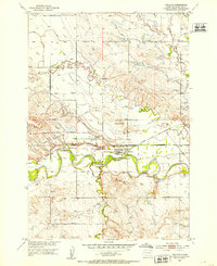 1951 Nisland1953 Print · USGSNisland and the surrounding Butte County ranchlands are seen here in the early fifties during the height of Missouri River Basin development. Researchers can trace the extensive irrigation network through the South Canal and locate rural landmarks like Horse Creek Sch and the County Fairground.2 unique versions available
 - 1951 Map of Vale, 1959 Print
 1951 Vale1959 Print · USGSThe Butte and Meade county line in the early fifties shows a landscape of irrigated prairies and river bends shaped by the Belle Fourche River. Genealogists and local historians can trace rural school districts like Plainview Sch and find family sites near Vale Cem or the Chicago and North Western rail line.
 - 1953 Map of Rapid City, 1964 Print
 1953 Rapid City1964 Print · USGSWestern South Dakota's transition from the Black Hills to the open prairie is captured here during the mid-fifties. Researchers can trace the development of Ellsworth Air Force Base alongside historic landmarks like Bear Butte and the Lower Alkali School.3 unique versions available
 - 1954 Map of The Forks
 1954 The Forks1954 Print · USGSThe Wyoming and South Dakota borderlands appear in the mid-fifties as a landscape of isolated ranches and early industrial mining. Family historians can trace the locations of Sunny Slope Sch, the Old Railroad Grade, and numerous homesteads such as Helmer Ranch.
 - 1954 Map of Saint Onge SE, 1955 Print
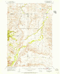 1954 Saint Onge SE1955 Print · USGSThe rolling ranchlands of Meade and Lawrence counties are captured in the mid-1950s, highlighting a network of rural schoolhouses. Genealogists can locate family landmarks like Big Bottom Sch, Oakdale Sch, and the prominent Snake Bench.4 unique versions available
 - 1954 Map of Saint Onge, 1955 Print
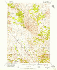 1954 Saint Onge1955 Print · USGSLawrence County saw steady ranching and rail activity during the mid-fifties as the Missouri River Basin program advanced. Genealogists can trace family footprints through sites like the Saint Onge Cem, the Dane Ch, and the Middle False Bottom Sch.3 unique versions available
 - 1954 Map of Jolly, 1956 Print
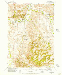 1954 Jolly1956 Print · USGSThe Black Hills foothills in the mid-fifties show a landscape of rural industry and changing education patterns along the Butte County line. Genealogists can locate several decommissioned schoolhouses, including White Sch (Abandoned) and Todd Sch (Abandoned), alongside the Chicago North Western tracks.4 unique versions available
 - 1954 Map of Belle Fourche, 1956 Print
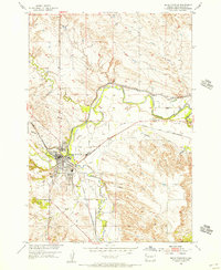 1954 Belle Fourche1956 Print · USGSBelle Fourche in the mid-fifties is a thriving rail and irrigation hub at the meeting of the Belle Fourche River and Redwater Creek. Researchers can trace old property lines near Pine Slope Cemetery, the Chicago and North Western line, or the local Ingersoll Sch.3 unique versions available
Showing maps 1-25 of 338
Top cities of Butte County
- Belle Fourche historical maps
- Newell historical maps
- Nisland historical maps
- Vale historical maps
- Fruitdale historical maps
Frequently asked questions
- What are the different types of historical maps available for Butte County?
- What is the oldest map of Butte County?
- Where can I purchase historical maps of Butte County for my home or office?
- Where can I download high-res historical maps of Butte County?
- Are there historical topographic maps available for Butte County?
- Is there historical aerial imagery available for Butte County?
- Where are historical maps of Butte County sourced from?