1980s Maps of Butte County, South Dakota
Explore 15 historic maps of Butte County from the 1980s. These maps offer a rare glimpse into what life looked like during the 1980s — showing old roads, neighborhoods, homes, and landmarks that have changed or disappeared over time.
Whether you're researching your family's past, planning a metal detecting trip, or studying how Butte County's landscape evolved across the 1980s, these high-resolution maps are a powerful tool for exploring the history of this region.
- Focus on a specific era: All maps on this page are from the 1980s, giving you a focused view of this time period.
- See what’s changed: Compare century-old streets, trails, and buildings to today's modern landscape using overlays and satellite layers.
- Research with precision: Use these maps for genealogy, historical research, land use analysis, or educational projects.
- View, download, or print: Maps are fully viewable online in high resolution, and can be downloaded or printed for your own records.
Start exploring Butte County's history through authentic maps from the 1980s. This is your window into the past.
Butte County, SD maps
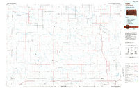
(15)- 1980 Map of Elkhorn Creek East
 1980 Elkhorn Creek East1980 Print · USGSThe Montana-South Dakota borderlands are mapped here in the early 1980s, revealing a landscape of winding prairie drainages and tri-county boundaries. Trace the paths of South Beaver Dam Creek, Elkhorn Creek, and Frozen Horse Creek across the high plains.
 - 1980 Map of Redig
 1980 Redig1980 Print · USGSNorthwest South Dakota is captured in the early eighties as a landscape of isolated ranges and sprawling ranchland. Researchers can locate remote outposts like Redig and Harding, or trace the rugged geography of Slim Buttes and the Short Pine Hills.
 - 1980 Map of Elkhorn Creek SE
 1980 Elkhorn Creek SE1980 Print · USGSThe Montana-South Dakota borderlands are captured here in the early seventies, showing the remote drainages of Carter and Butte counties. Genealogists and historians can trace family-named landmarks like Watson Draw and the winding course of Frozen Horse Creek.
 - 1980 Map of Beverly Creek, 1981 Print
 1980 Beverly Creek1981 Print · USGSWest of the Moreau River in the early 1980s, this region captures the high plains at the meeting point of three counties. Genealogists and historians can trace the isolated settlement at Mud Butte and rural road networks near Beverly Creek and Cabin Creek.
 - 1980 Map of Zeona, 1981 Print
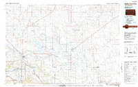
 1980 Zeona1981 Print · USGSThe ranching country of western South Dakota is captured here in the late seventies, centered on the small community of Zeona. Researchers can trace the confluence of the North Fork Moreau River and locate local landmarks like Immanuel Ch and Ruby Cem.
 - 1981 Map of Alzada, 1982 Print
 1981 Alzada1982 Print · USGSThe high plains of the Montana-Wyoming borderland appear here in the early eighties as a network of isolated ranches and creek drainages. Genealogists and historians can trace family-named sites like Ridgway and Albion or locate landmarks such as the Sky Ranch and the Claypits.
 - 1983 Map of Belle Fourche
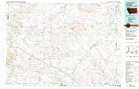
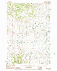
 1983 Belle Fourche1983 Print · USGSWestern South Dakota's ranching and irrigation systems are well-established in this early 1980s survey. Researchers can trace historic family holdings like McClure Ranch and the path of the Chicago and North Western railroad near Belle Fourche.
 - 1984 Map of Slaughter Reservoir
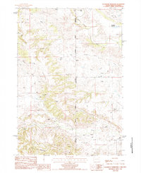 1984 Slaughter Reservoir1984 Print · USGSThe high plains of the South Dakota and Wyoming border come into focus in the mid-1980s, showcasing a landscape of uranium mining and cattle ranching. Trace family legacies at Budmayr Ranch and Massie Ranch or follow the waters of Hay Creek to The Forks.
 - 1984 Map of Camp Creek
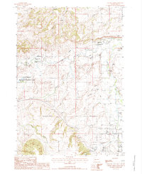
 1984 Camp Creek1984 Print · USGSMeade County ranching country comes into focus in the mid-1980s, showcasing the remote settlements and airstrips of the South Dakota plains. Researchers can locate family landmarks like the Vig Ranch Landing Strip, the small community of Opal, and the high terrain of Fox Ridge.2 unique versions available
 - 1984 Map of Faith
 1984 Faith1984 Print · USGSWestern South Dakota's open plains and river breaks appear here in the mid-1980s, centered on the ranching country around Faith. Researchers can trace remote settlements and essential water infrastructure like Sorum, Bixby Gaging Station, and Mourine Lake.3 unique versions available
 - 1984 Map of Sourdough Flats
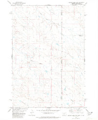
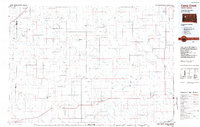
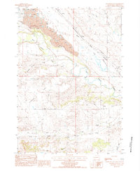 1984 Sourdough Flats1984 Print · USGSButte County in the early 1980s reveals a prairie landscape of clay pits and isolated ranch settlements. Genealogists and historians can trace family-named locations like Soper and Gray or follow the Chicago and North Western rail line through Sourdough Flats.
 - 1984 Map of Middle Creek Butte
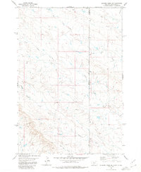
 1984 Middle Creek Butte1984 Print · USGSThe high plains of the Wyoming-South Dakota border are captured here in the early 1980s, showcasing an era of heavy clay mining and ranching. Researchers can trace the industrial footprint of numerous Claypit sites or locate family landmarks like the Tope Ranch and McLeod Ranch near the Belle Fourche River.
 - 1984 Map of Gravel Draw
 1984 Gravel Draw1984 Print · USGSThe high plains of the tri-state border region are mapped here in the early eighties, showing the convergence of Wyoming, Montana, and South Dakota. Researchers can locate remote family outposts like Geisinger Ranch and industrial landmarks such as the Claypit near Crow Creek.
 - 1984 Map of Beulah
 1984 Beulah1984 Print · USGSThe Wyoming-South Dakota borderlands come alive in this mid-eighties survey of the high plains and Black Hills. Genealogists and local historians can trace the area's development through landmarks like the Beulah townsite, the Cem, and the Mc Nenny National Fish Hatchery.2 unique versions available
 - 1984 Map of Chicken Creek, 1985 Print
 1984 Chicken Creek1985 Print · USGSThe confluence of Redwater River and Spearfish Creek highlights this mid-1980s South Dakota landscape. Researchers can trace land use through the Abandoned Canal, Clay Pits, and the Higgins settlement.
End of results
Showing maps 1-15 of 15
Top cities of Butte County
- Belle Fourche historical maps
- Newell historical maps
- Nisland historical maps
- Vale historical maps
- Fruitdale historical maps
Frequently asked questions
- What are the different types of historical maps available for Butte County?
- What is the oldest map of Butte County?
- Where can I purchase historical maps of Butte County for my home or office?
- Where can I download high-res historical maps of Butte County?
- Are there historical topographic maps available for Butte County?
- Is there historical aerial imagery available for Butte County?
- Where are historical maps of Butte County sourced from?