2020s Maps of Kenel District, South Dakota
Explore 11 historic maps of Kenel District from the 2020s. These maps offer a rare glimpse into what life looked like during the 2020s — showing old roads, neighborhoods, homes, and landmarks that have changed or disappeared over time.
Whether you're researching your family's past, planning a metal detecting trip, or studying how Kenel District's landscape evolved across the 2020s, these high-resolution maps are a powerful tool for exploring the history of this region.
- Focus on a specific era: All maps on this page are from the 2020s, giving you a focused view of this time period.
- See what’s changed: Compare century-old streets, trails, and buildings to today's modern landscape using overlays and satellite layers.
- Research with precision: Use these maps for genealogy, historical research, land use analysis, or educational projects.
- View, download, or print: Maps are fully viewable online in high resolution, and can be downloaded or printed for your own records.
Start exploring Kenel District's history through authentic maps from the 2020s. This is your window into the past.
Kenel District, SD maps
(11)- 2020 Map of Fort Yates SE, 2020 Print
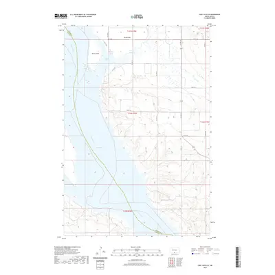 2020 Fort Yates SE2020 Print · USGSCovers Kenel District, including Fort Yates District, Sioux County, and other nearby areas
 - 2020 Map of Fort Yates, 2020 Print
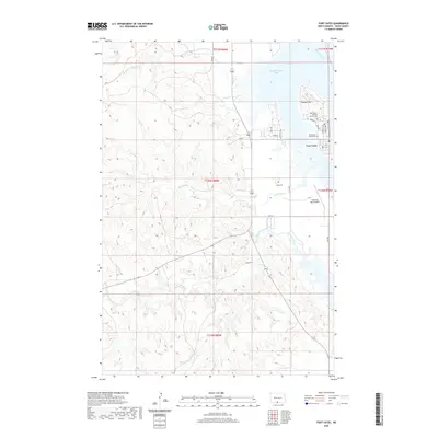 2020 Fort Yates2020 Print · USGSCovers Kenel District, including Fort Yates District, Fort Yates, and other nearby areas
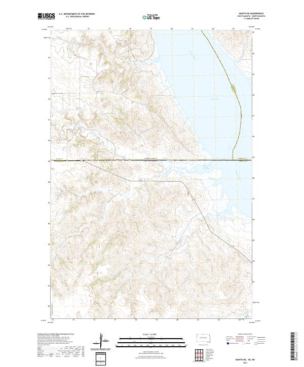
 - 2021 Map of Mahto NW, 2021 Print
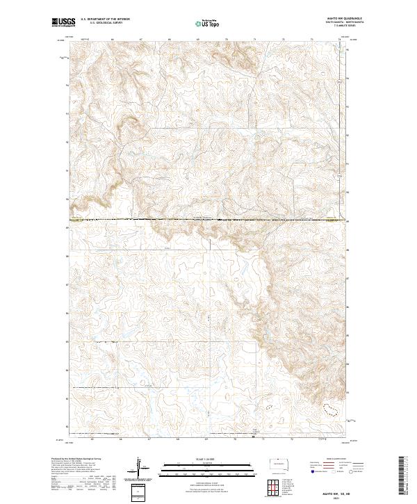 2021 Mahto NW2021 Print · USGSThe borderlands of North and South Dakota are captured here in the early twenty-first century, showing a landscape of wide-open prairie and winding drainages. Researchers can trace the path of Joe Bush Cr or locate the Hope Lutheran Cem near the southern boundary.
 - 2021 Map of Mahto, 2021 Print
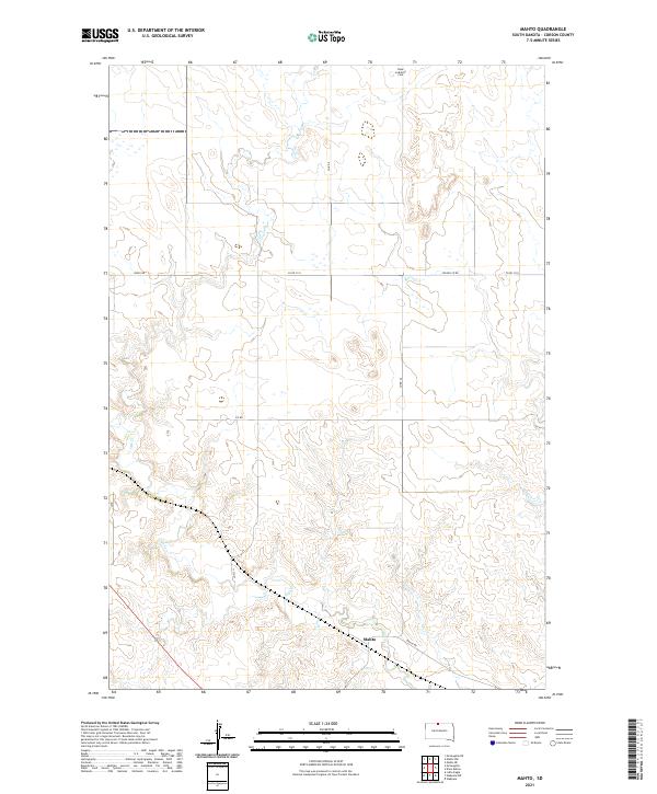 2021 Mahto2021 Print · USGSCorson County’s open prairie and ranch lands are documented here in the early twenty-first century. Researchers can locate the Hope Lutheran Cem and trace the road network connecting the settlement of Mahto along the banks of Oak Cr.
 - 2021 Map of Kline Buttes, 2021 Print
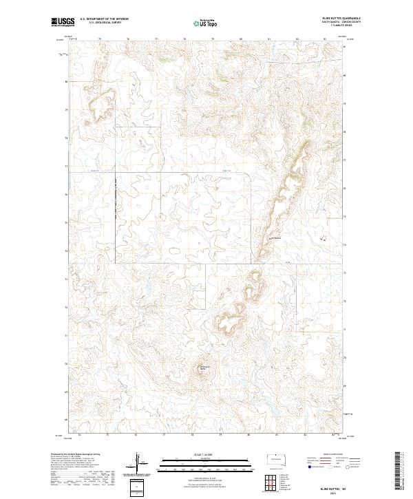 2021 Kline Buttes2021 Print · USGSCorson County remains a land of wide-open spaces and distinct geological formations as seen in the early twenty-first century. Genealogists and local historians can locate specific land tracts across township lines and trace features like Kline Buttes, Lonesome Butte, and Hunkpapa Cr.
 - 2021 Map of Kenel, 2021 Print
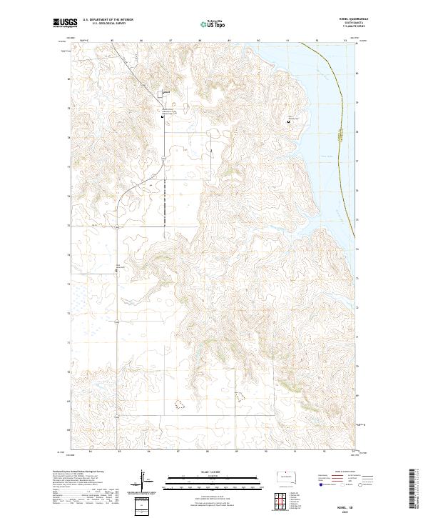 2021 Kenel2021 Print · USGSThe bluffs of the Standing Rock region overlook the Missouri River in this modern survey of North Dakota. Genealogists can locate several memorial sites including Saint Lukes Cem and the Church of the Assumption of the Blessed Virgin Cem near the community of Kenel.
 - 2021 Map of Mahto NE, 2021 Print
 2021 Mahto NE2021 Print · USGSThe borderlands of the Dakotas meet along the Missouri River and Lake Oahe in the early twenty-first century. Genealogists and researchers can trace the natural drainages of Blackfoot Cr, Fireheart Cr, and State Line Bay.
 - 2021 Map of Pollock NW, 2021 Print
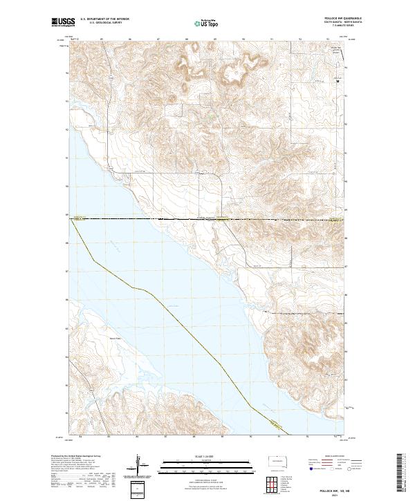 2021 Pollock NW2021 Print · USGSThe Missouri River borderlands between South Dakota and North Dakota appear here during the modern era of the Oahe reservoir. Genealogists and local historians can locate the Dale Cem and trace the drainage of Hunkpapa Cr near the Kenel Flats shoreline.
 - 2021 Map of Pollock SE, 2021 Print
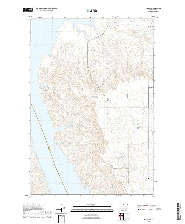 2021 Pollock SE2021 Print · USGSThe bluffs of the Missouri River valley are captured here in the early twenty-first century as they overlook the waters of Lake Oahe. Genealogists and local historians can locate rural landmarks such as Gale Cem and Kvarness Cem near the banks of Shaw Cr.
 - 2024 Map of Fort Yates, 2024 Print
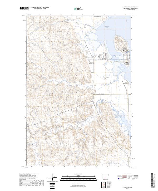 2024 Fort Yates2024 Print · USGSThe Standing Rock Sioux Reservation landscape is documented here in its modern form, centered on the community of Fort Yates. Local researchers can trace civic landmarks like the Sioux County Courthouse, Sitting Bull College, and the Reed Cem.
 - 2024 Map of Fort Yates SE, 2024 Print
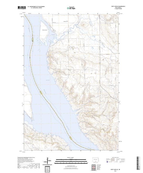 2024 Fort Yates SE2024 Print · USGSThe Missouri River corridor in Emmons County is seen here in a modern survey of its expansive reservoir landscape. Researchers can trace the shoreline of Lake Oahe and the shifting topography of Winona Island and Winona Flats along the Sioux County line.
End of results
Showing maps 1-11 of 11
Top cities near Kenel District
- McLaughlin historical maps
- Wakpala historical maps
- Fort Yates District historical maps
- Fort Yates historical maps
Top neighborhoods of Kenel District
Frequently asked questions
- What are the different types of historical maps available for Kenel District?
- What is the oldest map of Kenel District?
- Where can I purchase historical maps of Kenel District for my home or office?
- Where can I download high-res historical maps of Kenel District?
- Are there historical topographic maps available for Kenel District?
- Is there historical aerial imagery available for Kenel District?
- Where are historical maps of Kenel District sourced from?