1900s (20th Century) Maps of Haakon County, South Dakota
Explore 68 historic maps of Haakon County from the 1900s (20th Century). These maps offer a rare glimpse into what life looked like during the 1900s — showing old roads, neighborhoods, homes, and landmarks that have changed or disappeared over time.
Whether you're researching your family's past, planning a metal detecting trip, or studying how Haakon County's landscape evolved across the 1900s, these high-resolution maps are a powerful tool for exploring the history of this region.
- Focus on a specific era: All maps on this page are from the 1900s, giving you a focused view of this time period.
- See what’s changed: Compare century-old streets, trails, and buildings to today's modern landscape using overlays and satellite layers.
- Research with precision: Use these maps for genealogy, historical research, land use analysis, or educational projects.
- View, download, or print: Maps are fully viewable online in high resolution, and can be downloaded or printed for your own records.
Start exploring Haakon County's history through authentic maps from the 1900s. This is your window into the past.
Haakon County, SD maps
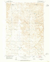
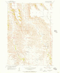
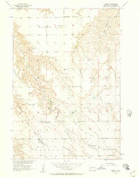
(68)- 1953 Map of Belvidere NE, 1955 Print
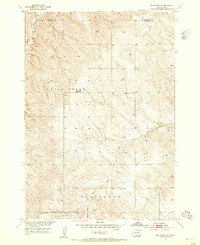 1953 Belvidere NE1955 Print · USGSThe ranching country of western South Dakota is captured here during the mid-fifties Missouri River Basin development program. Genealogists can locate rural school sites like Highland Center Sch and the Harris Sch (Abandoned) along the banks of Indian Creek.2 unique versions available
 - 1953 Map of Philip Junction, 1955 Print
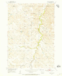
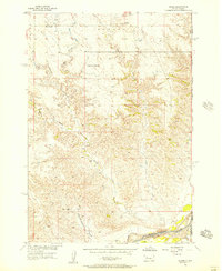
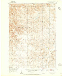 1953 Philip Junction1955 Print · USGSJackson and Haakon Counties during the early 1950s show a spare rangeland landscape at the height of the Missouri River Basin development program. Researchers can trace the rural infrastructure of the day, including Philip Junction, the isolated Schimke Sch, and the courses of Brady Creek.2 unique versions available
 - 1953 Map of Philip, 1955 Print
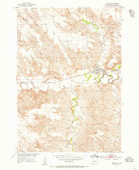
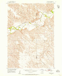
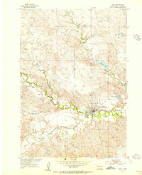 1953 Philip1955 Print · USGSMid-century Haakon County comes alive in this survey of the river forks and rail lines just as the Missouri River Basin development was underway. Genealogists and local historians can trace the foundations of Philip along the Chicago and North Western tracks, including landmarks like Sunshine Sch and Masonic Cem.2 unique versions available
 - 1953 Map of Philip SE, 1955 Print
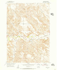
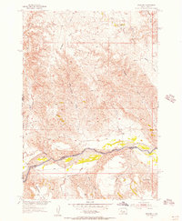
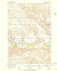 1953 Philip SE1955 Print · USGSHaakon County's open ranching country is meticulously detailed in the early fifties, as the railroad and river systems shaped life on the Dakota plains. Genealogists and historians can trace the transition of rural education via sites like the Magnuson Sch or the Berry Sch, while tracking the path of the Chicago and North Western line.2 unique versions available
 - 1953 Map of Rapid City, 1964 Print
 1953 Rapid City1964 Print · USGSWestern South Dakota's transition from the Black Hills to the open prairie is captured here during the mid-fifties. Researchers can trace the development of Ellsworth Air Force Base alongside historic landmarks like Bear Butte and the Lower Alkali School.3 unique versions available
 - 1954 Map of Belvidere NW, 1955 Print
 1954 Belvidere NW1955 Print · USGSMid-century ranching life in Jackson County is visible here through its network of remote prairie schools and water landmarks. Researchers can trace local history at the South Creek Ch, the West Indian Creek Sch, and the Bachin Dam.
 - 1954 Map of Kadoka NE, 1955 Print
 1954 Kadoka NE1955 Print · USGSJackson and Haakon counties come into focus in the mid-fifties, showing a landscape defined by the winding White Willow Creek and isolated ranching life. Researchers can locate family landmarks like Brady Sch and vital water sources such as Hockel Dam and Neiderworder Dam.
 - 1954 Map of Powell, 1956 Print
 1954 Powell1956 Print · USGSHaakon County ranching country and the river valley are captured here in the mid-fifties, just as the Missouri River Basin development was underway. Genealogists and historians can trace the Chicago and North Western rail line through Powell and locate the rural Cherry Sch.
 - 1954 Map of Midland, 1956 Print
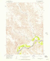
 1954 Midland1956 Print · USGSMidland and the surrounding Haakon County prairie are shown here in the mid-fifties as the local rail-and-river economy flourished. You can locate the Center School, trace the Chicago and North Western rail line, and find the Midland Cemetery.3 unique versions available
 - 1954 Map of Nowlin, 1956 Print
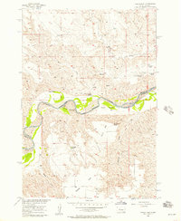
 1954 Nowlin1956 Print · USGSHaakon County’s prairie landscape is captured here in the mid-1950s, centered on the railroad outpost of Nowlin along the Bad River. Genealogists and local historians can locate the Nowlin Cem and trace the original Chicago and North Western RR line through Kunkle Flat.
 - 1954 Map of Midland SE, 1966 Print
 1954 Midland SE1966 Print · USGSMid-century ranching country along the Haakon and Jones county border is defined here by the winding Bad River and the Chicago and North Western rail line. Genealogists can locate the rural White Bell Sch and trace local landmarks like Madsen and the Gravel Pits.2 unique versions available
 - 1954 Map of Pierre, 1968 Print
 1954 Pierre1968 Print · USGSThe Missouri River and the newly formed Oahe Reservoir define central South Dakota in the 1950s. Genealogists and local historians can trace early settlements and rail stops like Eakin Siding, Mission Ridge, and Ottumwa.2 unique versions available
 - 1955 Map of Bridger, 1956 Print
 1955 Bridger1956 Print · USGSThe Cheyenne River Indian Reservation and the settlement of Bridger are documented during the mid-fifties. Genealogists and researchers can locate family-named landmarks like VJ Ranch, Hatchet Spring, and the expansive Barthold Flat.
 - 1955 Map of Rattlesnake Lake SE, 1956 Print
 1955 Rattlesnake Lake SE1956 Print · USGSThe Cheyenne River breaks and the plains of Haakon County are captured here in the mid-fifties. Researchers can trace rural school locations like Malone Sch, livestock landmarks such as White Thunder Ranch, and water sources like Beerwagon Spring.
 - 1955 Map of Pedro, 1956 Print
 1955 Pedro1956 Print · USGSThe Cheyenne River valley in Pennington County is documented here during the mid-1950s as a landscape of isolated family ranches and river-bottom agriculture. Genealogists and historians can trace family-named sites like Bourne Sch, Rose Cem, and the settlement of Pedro.
 - 1955 Map of Rattlesnake Lake SW, 1956 Print
 1955 Rattlesnake Lake SW1956 Print · USGSThe Cheyenne River breaks of Haakon and Ziebach counties are captured here in the mid-1950s, showing a remote ranching landscape before modern consolidation. Genealogists and local historians can locate early rural landmarks like Harding Grove Sch and the Elshers Sch (Abandoned) along the edge of Milesville Flat.
 - 1955 Map of Bridger SE, 1956 Print
 1955 Bridger SE1956 Print · USGSZiebach and Haakon counties meet along the high plains river breaks in the mid-1950s. Historians and researchers can trace the vital water sources and ranching landmarks of the era, including Bull Ranch, Black Bull Spring, and the Cheyenne River.2 unique versions available
 - 1955 Map of Howes, 1957 Print
 1955 Howes1957 Print · USGSThe Cheyenne River valley in the mid-1950s reveals a sparse ranching landscape shaped by deep creek breaks and isolated landmarks. Genealogists and local historians can trace the foundations of Howes, Plainview Ch, and the rural Negro Creek Sch.2 unique versions available
 - 1955 Map of Pedro SE, 1957 Print
 1955 Pedro SE1957 Print · USGSPennington County ranching country is captured here during the mid-fifties as part of the Missouri River Basin development era. Researchers can trace the holdings of several local families at Dale Ranch and Knutson Ranch or find the remote Pleasant View Sch.
 - 1955 Map of Hilland NW, 1957 Print
 1955 Hilland NW1957 Print · USGSHaakon County ranching life is preserved here in the mid-1950s, showing a landscape defined by family ranchsteads and rural schoolhouses. Researchers can trace land ties at Joe Price Ranch, locate the Dowling Cem, or find the now-vanished Ramey Sch.2 unique versions available
 - 1955 Map of Hot Springs, 1958 Print
 1955 Hot Springs1958 Print · USGSThe Black Hills and South Dakota badlands are captured here in the mid-fifties, during a peak of military and industrial activity. Researchers can locate the Black Hills Ordnance Depot, early Uranium Mines, and historic rail stops like Pringle or Oglala.5 unique versions available
 - 1955 Map of Martin, 1968 Print
 1955 Martin1968 Print · USGSTribal lands and rail corridors define the South Dakota plains in the mid-fifties, from the sand hills to the badlands. Genealogists and historians can trace the early layout of Pine Ridge Indian Reservation settlements and find small rail towns like Stamford and Witten.2 unique versions available
 - 1956 Map of Kirley, 1957 Print
 1956 Kirley1957 Print · USGSThe rural prairie of Haakon County is captured here in the mid-1950s, showing a landscape defined by elevated plateaus and scattered homesteads. Genealogists can locate community touchstones like Robbs Flat Cem, Deep Creek Ch, and the Markwed Sch.3 unique versions available
 - 1956 Map of Cherry Creek NW, 1957 Print
 1956 Cherry Creek NW1957 Print · USGSThe river valley along the Ziebach and Haakon county line is captured in the mid-1950s, showing the intersection of ranching and reservation land. Genealogists and historians can trace the legacy of local families at Red Fox Ranch, Motley Ranch, and White Cloud Ranch.2 unique versions available
 - 1956 Map of Carlin Flat, 1957 Print
 1956 Carlin Flat1957 Print · USGSMid-century ranching life in South Dakota centers on the winding Cheyenne River at the boundary of Haakon and Ziebach counties. Genealogists and local historians can trace family-named sites like Annis Ranch, the Carlin Sch, and the Buffalo Cem.2 unique versions available
Showing maps 1-25 of 68
Top cities of Haakon County
Frequently asked questions
- What are the different types of historical maps available for Haakon County?
- What is the oldest map of Haakon County?
- Where can I purchase historical maps of Haakon County for my home or office?
- Where can I download high-res historical maps of Haakon County?
- Are there historical topographic maps available for Haakon County?
- Is there historical aerial imagery available for Haakon County?
- Where are historical maps of Haakon County sourced from?