1960s Maps of Hughes County, South Dakota
Explore 18 historic maps of Hughes County from the 1960s. These maps offer a rare glimpse into what life looked like during the 1960s — showing old roads, neighborhoods, homes, and landmarks that have changed or disappeared over time.
Whether you're researching your family's past, planning a metal detecting trip, or studying how Hughes County's landscape evolved across the 1960s, these high-resolution maps are a powerful tool for exploring the history of this region.
- Focus on a specific era: All maps on this page are from the 1960s, giving you a focused view of this time period.
- See what’s changed: Compare century-old streets, trails, and buildings to today's modern landscape using overlays and satellite layers.
- Research with precision: Use these maps for genealogy, historical research, land use analysis, or educational projects.
- View, download, or print: Maps are fully viewable online in high resolution, and can be downloaded or printed for your own records.
Start exploring Hughes County's history through authentic maps from the 1960s. This is your window into the past.
Hughes County, SD maps
(18)- 1966 Map of Lower Brule NW, 1967 Print
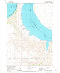
 1966 Lower Brule NW1967 Print · USGSThe Missouri River valley in the mid-1960s shows a landscape transformed by the waters of Lake Sharpe. Researchers can locate rural landmarks like the Boot Bar Sch and Hidden Valley Sch alongside the West Bend Recreation Area.
 - 1966 Map of Joe Creek, 1967 Print
 1966 Joe Creek1967 Print · USGSThe Missouri River and the newly formed Lake Sharpe dominate the landscape in the mid-1960s, showing the intersection of tribal lands and new reservoirs. Genealogists and local historians can trace rural school locations like Riverdale Sch and Busy Bee Sch along the Joe Creek drainage.
 - 1966 Map of Joe Creek NW, 1967 Print
 1966 Joe Creek NW1967 Print · USGSThe Missouri River valley in the mid-1960s reveals a landscape transformed by the waters of Lake Sharpe along the reservation borders. Genealogists and historians can trace local landmarks like Holy Faith Cem, La Roche Sch, and the Clark Ranch.
 - 1966 Map of Lower Brule SW, 1967 Print
 1966 Lower Brule SW1967 Print · USGSLyman County, South Dakota is captured in the mid-sixties during the development of the Missouri River Basin. Genealogists and historians can trace local landmarks like Messiah Ch, Black Dog Sch, and the winding Medicine Creek.
 - 1966 Map of Joe Creek SE, 1967 Print
 1966 Joe Creek SE1967 Print · USGSLyman County ranchlands meet the rising waters of the Missouri River in the mid-sixties, just as the regional geography was being reshaped. Genealogists can trace the Lower Brule Indian Reservation Boundary and drainage basins like Bad Horse Creek and Dorman.
 - 1966 Map of Lower Brule NE, 1967 Print
 1966 Lower Brule NE1967 Print · USGSThe Missouri River valley in the mid-sixties reveals a landscape reshaped by the rising waters of Missouri River Lake Sharpe. Local historians can trace the borders of the Lower Brule Indian Reservation Boundary and locate a small Cem near the bluffs.
 - 1966 Map of Lower Brule, 1967 Print
 1966 Lower Brule1967 Print · USGSThe Missouri River breaks and the waters of Lake Sharpe define this mid-1960s look at the Lower Brule community. Researchers can locate the Council House, Christ Ch, and early recreation sites like the Counselor Creek Recreation Area.2 unique versions available
 - 1967 Map of Pierre NE, 1968 Print
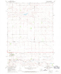
 1967 Pierre NE1968 Print · USGSNorth of the South Dakota state capital in the late sixties, the landscape shows a transition from urban development to open prairie bluffs. Researchers can trace the Old RR Grade, locate the Mentor Sch, and find the mid-century Drive-in Theater near Snake Butte.
 - 1967 Map of Canning, 1968 Print
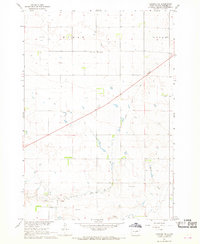
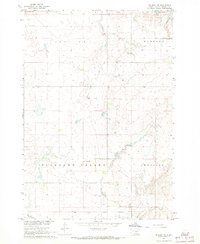
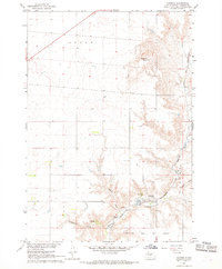 1967 Canning1968 Print · USGSHughes County in the late sixties reveals a landscape of high plains and deep draws structured by the railroad. Genealogists and local historians can trace the tracks of the Chicago and North Western through Canning or locate the Old Indian Treaty Boundary.
 - 1967 Map of Onida SE, 1968 Print
 1967 Onida SE1968 Print · USGSCentral South Dakota agriculture and rail transport come into focus in the late sixties along the Sully and Hughes county line. Genealogists and historians can trace the Chicago and North Western tracks past Eakin and locate the rural Felicia Sch.
 - 1967 Map of Onida SW, 1968 Print
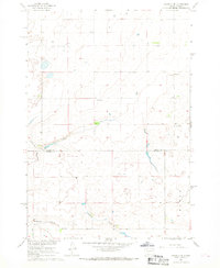
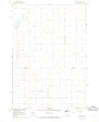 1967 Onida SW1968 Print · USGSThe central South Dakota prairie is captured here in the late sixties as the area straddled the Sully and Hughes county lines. Genealogists and local historians can locate rural landmarks like Goodwater Sch and trace the boundaries of Byron and Logan townships.
 - 1967 Map of Canning NW, 1968 Print
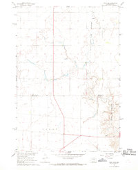
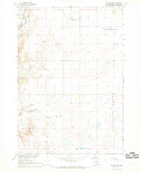
 1967 Canning NW1968 Print · USGSHughes County’s prairie landscape is captured here in the late sixties, showcasing the rural townships of Byron and Logan. Local historians can trace the path of an Old Railroad Grade and locate the site of the Sunnyside Sch.
 - 1967 Map of Blunt, 1968 Print
 1967 Blunt1968 Print · USGSCentering on the railroad town of Blunt in the late 1960s, this survey shows a prairie landscape tied to the rails and creek beds. Genealogists and researchers can locate Lincoln Sch, trace the Chicago and North Western line, or find the Roadside Park.
 - 1967 Map of Okobojo SE, 1968 Print
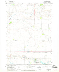
 1967 Okobojo SE1968 Print · USGSThe border of Sully and Hughes Counties comes into focus in the late sixties, showing a landscape of upland prairie and localized industry. Researchers can trace the rural features of the era, from the small settlement of Gray Goose to the Landing Strip and various Gravel Pits dotting the plains.
 - 1967 Map of Blunt SE, 1968 Print
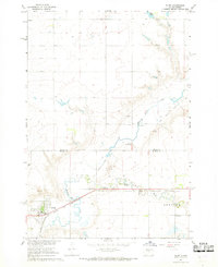
 1967 Blunt SE1968 Print · USGSThe high plains of Sully and Hughes counties come into focus during the late sixties as the Missouri River Basin development program reached its peak. Researchers can trace the rugged drainage of Medicine Creek and the distinctive elevations of Medicine Knoll.
 - 1967 Map of De Grey NE, 1968 Print
 1967 De Grey NE1968 Print · USGSHughes County prairie lands in the late sixties reveal a transition from open range to organized township sections. Researchers can trace the Old Indian Treaty Boundary and locate local landmarks like Beth Eden Sch and Woodruff Lake.
 - 1967 Map of De Grey NW, 1969 Print
 1967 De Grey NW1969 Print · USGSHughes County’s high prairie is captured in the late sixties, just as the Missouri River Basin development was reshaping the region. Genealogists and local historians can trace the Old Indian Treaty Boundary and locate the rural Valley Sch along the Chicago and North Western rail line.
 - 1968 Map of Harrold, 1971 Print
 1968 Harrold1971 Print · USGSThe rail-and-prairie town of Harrold is shown in the late sixties as the hub of a developing agricultural landscape. Researchers can trace the Chicago and North Western tracks, find family roots at St John Cem, or locate landmarks like the Harrold Municipal Airport.
End of results
Showing maps 1-18 of 18
Top cities of Hughes County
Frequently asked questions
- What are the different types of historical maps available for Hughes County?
- What is the oldest map of Hughes County?
- Where can I purchase historical maps of Hughes County for my home or office?
- Where can I download high-res historical maps of Hughes County?
- Are there historical topographic maps available for Hughes County?
- Is there historical aerial imagery available for Hughes County?
- Where are historical maps of Hughes County sourced from?