Old Maps of Marshall County, South Dakota for Genealogy
Trace your family roots with 150 historic maps of Marshall County. These high-res maps reveal old neighborhoods, homesites, landmarks, and streets — helping you uncover where your ancestors lived and how the area evolved over time.
- Explore historic neighborhoods: Identify where your relatives may have lived in the 1800s or 1900s.
- Compare maps over time: Trace the changes in streets, buildings, and landmarks for multi-generational research.
- Perfect for genealogy & ancestry research: Used by family historians and researchers to map out lineage and migration.
These maps are an incredible resource for exploring your personal connection to Marshall County's past.
Marshall County, SD maps
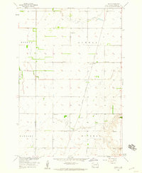
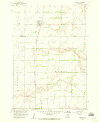
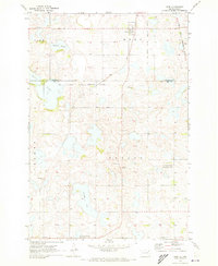
(150)- 1953 Map of Britton East, 1954 Print
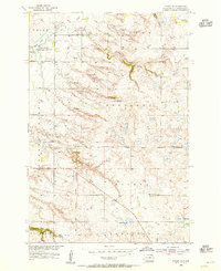
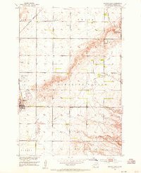 1953 Britton East1954 Print · USGSIn the early fifties, the hub of Britton sat at a vital crossroads for the Great Northern and Milwaukee Road railways. Researchers can find rural landmarks like Pleasant Hill Cem, three numbered schools, and the White Lake State Game Refuge.2 unique versions available
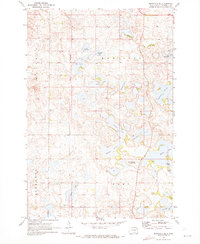
 - 1953 Map of Newark SW, 1955 Print
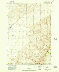
 1953 Newark SW1955 Print · USGSThe borderlands of Marshall and Brown Counties are captured here in the mid-1950s, showing a landscape shaped by water management and rail. Researchers can locate the Great Northern tracks, the rural School No 3, and hydrology like Flowing Well.
 - 1953 Map of Kidder, 1955 Print
 1953 Kidder1955 Print · USGSKidder and the surrounding townships sat at a critical railroad juncture in the early fifties along the North Dakota and South Dakota border. Genealogists and local historians can trace the foundations of this prairie community through landmarks like Pleasant Valley Ch and Holy Sepulcher Cem.2 unique versions available
 - 1953 Map of Newark, 1955 Print
 1953 Newark1955 Print · USGSThe North Dakota and South Dakota borderlands come alive in this mid-century survey of the Newark vicinity. Genealogists and local historians can trace the tracks of the Milwaukee Road past the Chadwick Sch and Brampton Cem.2 unique versions available
 - 1953 Map of Milbank, 1958 Print
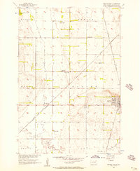
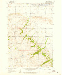
 1953 Milbank1958 Print · USGSThe tri-state border region of South Dakota, North Dakota, and Minnesota is shown here during the early fifties, a landscape defined by glacial lakes and the Sisseton Indian Reservation. Researchers can trace the legacy of the western railroads, locating old stops along the Great Northern and settlements like Milbank, Webster, and Sisseton.3 unique versions available
 - 1954 Map of Kidder SE, 1955 Print
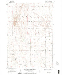
 1954 Kidder SE1955 Print · USGSSouth Dakota’s prairie landscape was still transitioning in the mid-1950s as old frontier boundaries met modern conservation efforts. Genealogists and historians can trace the Old Fort Sisseton Military Reservation Boundary or locate School No 1 (Abandoned) and the White Lake State Game Refuge.3 unique versions available
 - 1956 Map of Havana, 1957 Print
 1956 Havana1957 Print · USGSHavana and the surrounding farm country are captured here in the mid-1950s, bridging the borderlands between North Dakota and South Dakota. Researchers can trace the Great Northern rail line and locate rural landmarks like School No 4 and Trondhjem Cem.
 - 1956 Map of Britton West, 1957 Print
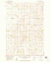
 1956 Britton West1957 Print · USGSMarshall County's agricultural and rail heartland is captured here in the mid-1950s. Genealogists and rail historians can trace the paths of the Great Northern and Milwaukee Road through Britton and find School No 1.2 unique versions available
 - 1956 Map of Newark NW, 1957 Print
 1956 Newark NW1957 Print · USGSThe North Dakota and South Dakota borderlands remained a quiet agricultural frontier in the mid-fifties, dominated by isolated farmsteads and township grids. Genealogists can trace the shift in rural education through sites like School No 1 and several others marked School No 4 (Abandoned) or School No 2 (Abandoned).2 unique versions available
 - 1958 Map of Milbank
 1958 Milbank1958 Print · USGSThe northern Great Plains in the late fifties show a landscape of glacial lakes and reservation lands shaped by the Great Northern railroad. Genealogists and local historians can trace the grid of settlements from Britton to Milbank and locate landmarks like Enemy Swim Lake and the Sisseton Indian Reservation.
 - 1958 Map of Spain
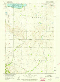
 1958 Spain1958 Print · USGSMarshall County agricultural life is captured here in the late fifties, centered on the small siding of Spain. Local historians can trace early township lines like Lowell and Hickman or locate rural landmarks including School No 1 and Crow Creek.
 - 1958 Map of Britton 4 NW, 1959 Print
 1958 Britton 4 NW1959 Print · USGSMarshall County's rural landscape is captured here in the late fifties, showing the intersection of three townships. Genealogists and local historians can locate early landmarks like School No 1, School No 2, and the shores of Hickman Lake.3 unique versions available
 - 1958 Map of Hillhead, 1959 Print
 1958 Hillhead1959 Print · USGSThe glacial hills of Marshall County come alive in this late 1950s survey of the prairie pothole region. Genealogists and local historians can trace the Old Fort Sisseton Military Reservation Boundary and locate rural landmarks like Trondhjem Ch and Hillhead.
 - 1958 Map of Veblen, 1959 Print
 1958 Veblen1959 Print · USGSMarshall County in the late fifties shows the town of Veblen at the foot of the Coteau Des Prairies. Family historians can trace rural roots at St Matthew Cem, Zion Ch, and the site of School No 1 (Abandoned).
 - 1958 Map of Marlow, 1959 Print
 1958 Marlow1959 Print · USGSSargent County and the South Dakota borderlands are shown in the late fifties as a landscape of prairie wetlands and reservation boundaries. Genealogists can locate family sites near Marlow, the Emmanuel Ch, and multiple locations of School No 1.2 unique versions available
 - 1958 Map of Britton 4 SW, 1959 Print
 1958 Britton 4 SW1959 Print · USGSDay and Marshall Counties in the late 1950s show a landscape of prairie potholes and decentralized rural school districts. Genealogists can trace family roots through numerous local landmarks like Jandahl Sch, Highlands Ch, and Rose Hill Cem.2 unique versions available
 - 1958 Map of Veblen NE, 1959 Print
 1958 Veblen NE1959 Print · USGSThe Dakota borderlands come alive in this late-fifties survey of a landscape shaped by glacial waters and iron rails. Genealogists can locate rural landmarks like Palestina Ch and Bergen Cem or trace the Minneapolis St Paul and Sault Ste Marie line.3 unique versions available
 - 1958 Map of Amherst, 1959 Print
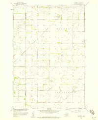 1958 Amherst1959 Print · USGSThe Marshall County prairie in the late fifties was a landscape of rail-centered trade and small township school districts. Genealogists and historians can trace local family landmarks like Amherst Cem, School No 6, and the Great Northern rail line.
 - 1958 Map of Langford, 1960 Print
 1958 Langford1960 Print · USGSThe prairie town of Langford is shown in the late 1950s at the intersection of local agriculture and the Chicago Milwaukee St Paul and Pacific rail line. Genealogists can trace rural sites like St Peter Cem, Homer Cem, and the winding Antelope Creek.2 unique versions available
 - 1958 Map of Langford SW, 1960 Print
 1958 Langford SW1960 Print · USGSNortheastern South Dakota's glacial landscape is captured in the late 1950s where Brown, Marshall, and Day Counties meet. Researchers can locate the Augustana Cem, the central Town Hall, and water features like Antelope Creek.2 unique versions available
 - 1964 Map of Claire City NW, 1966 Print
 1964 Claire City NW1966 Print · USGSCrossing the North Dakota-South Dakota border in the mid-1960s, this area shows the intersection of the Sisseton Indian Reservation and various county lines. Genealogists can locate family landmarks like Bergen Ch Cem and the Nidaros Ch among the prairie sloughs.
 - 1964 Map of Claire City SW, 1967 Print
 1964 Claire City SW1967 Print · USGSThe northern Roberts County prairie meets the Marshall County line in the mid-1960s, showing a landscape defined by glacial coulees and the SOO LINE railroad. Genealogists can locate family landmarks like Bethel Ch, Mayason Ch, and a local Cem.
 - 1970 Map of Eden, 1973 Print
 1970 Eden1973 Print · USGSThe Marshall and Day County borderlands are shown in the early 1970s, featuring the prairie wetlands around Eden and Roslyn. Researchers can trace the Old Fort Sisseton Military Reservation Boundary or locate St Michael Cem and the local Townhall.
 - 1970 Map of Whitestone Lake, 1973 Print
 1970 Whitestone Lake1973 Print · USGSThe Sisseton Indian Reservation during the 1970s shows a landscape of deep coulees and prairie lakes on the Coteau des Prairies. Researchers can trace rural cemetery sites like Spring Valley Cem and Roy Cem or locate local landmarks like St Benedict Ch.
 - 1970 Map of Britton 4 NE, 1973 Print
 1970 Britton 4 NE1973 Print · USGSThe glacial lake country of Marshall County comes into focus in the early 1970s, highlighting the historic grounds of the Fort Sisseton State Park. Researchers can trace the Old Sisseton Military Reservation Boundary and locate local landmarks like the Rose Hill Ch and Lee Lake.2 unique versions available
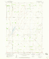
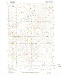
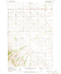
Showing maps 1-25 of 150
Top cities of Marshall County
- Britton historical maps
- Langford historical maps
- Eden historical maps
- Newark historical maps
- Lake City historical maps
Frequently asked questions
- What are the different types of historical maps available for Marshall County?
- What is the oldest map of Marshall County?
- Where can I purchase historical maps of Marshall County for my home or office?
- Where can I download high-res historical maps of Marshall County?
- Are there historical topographic maps available for Marshall County?
- Is there historical aerial imagery available for Marshall County?
- Where are historical maps of Marshall County sourced from?