1900s (20th Century) Maps of Floyd Township, South Dakota
Explore 10 historic maps of Floyd Township from the 1900s (20th Century). These maps offer a rare glimpse into what life looked like during the 1900s — showing old roads, neighborhoods, homes, and landmarks that have changed or disappeared over time.
Whether you're researching your family's past, planning a metal detecting trip, or studying how Floyd Township's landscape evolved across the 1900s, these high-resolution maps are a powerful tool for exploring the history of this region.
- Focus on a specific era: All maps on this page are from the 1900s, giving you a focused view of this time period.
- See what’s changed: Compare century-old streets, trails, and buildings to today's modern landscape using overlays and satellite layers.
- Research with precision: Use these maps for genealogy, historical research, land use analysis, or educational projects.
- View, download, or print: Maps are fully viewable online in high resolution, and can be downloaded or printed for your own records.
Start exploring Floyd Township's history through authentic maps from the 1900s. This is your window into the past.
Floyd Township, SD maps
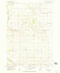
(10)- 1953 Map of Huron, 1959 Print
 1953 Huron1959 Print · USGSCentral South Dakota comes alive in the mid-1950s as a thriving rail and agricultural corridor between the Missouri and James Rivers. Trace the legacy of family farms and prairie towns like Huron, Faulkton, and Wessington Springs along the historic Chicago and North Western rail lines.3 unique versions available
 - 1953 Map of Watertown, 1968 Print
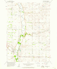
 1953 Watertown1968 Print · USGSEastern South Dakota and the Minnesota borderlands are captured here during the mid-twentieth century as the region's agricultural and rail-service centers thrived. Genealogists and local historians can trace family-named sites across the Coteau des Prairies and find landmarks in Watertown, De Smet, and Brookings.3 unique versions available
 - 1954 Map of Huron, 1977 Print
 1954 Huron1977 Print · USGSCentral South Dakota was a landscape of grain elevators and river bends during the mid-fifties. Genealogists and historians can trace the development of the James River valley through railroad towns like Redfield and the sprawling Crow Creek Indian Reservation.
 - 1957 Map of Forestburg NE, 1958 Print
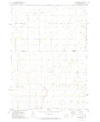
 1957 Forestburg NE1958 Print · USGSThe James River valley in the late fifties reveals a dense network of rural school districts and township landmarks. Researchers can locate the Pearl Ch, Bonny Cem, and several school sites including the Flagel Sch and Maurer Sch.
 - 1957 Map of Forestburg, 1958 Print
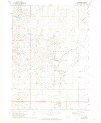
 1957 Forestburg1958 Print · USGSSanborn County at the end of the fifties reveals a landscape shaped by the winding river and the railroad. Genealogists can trace family lands across Oneida and Logan townships or locate old sites like Rubert Sch and Ruskin Park.
 - 1958 Map of Watertown
 1958 Watertown1958 Print · USGSThe eastern South Dakota prairie and the Minnesota borderlands are captured here in the late fifties, showcasing a landscape of terminal moraine lakes and burgeoning rail hubs. Genealogists and historians can trace the early paths of the Chicago and North Western railroad or locate family roots in Watertown, Clark, or the Sisseton Indian Reservation.2 unique versions available
 - 1971 Map of Artesian NW, 1973 Print
 1971 Artesian NW1973 Print · USGSSanborn and Beadle counties are captured here in the early 1970s, showcasing a rural prairie landscape defined by isolated farmsteads and township boundaries. Genealogists can locate family sites near Immanuel Ch Cem or St Anthonys Cem along the Pearl Creek drainage.
 - 1971 Map of Artesian, 1973 Print
 1971 Artesian1973 Print · USGSArtesian and the surrounding Sanborn County townships are shown here in the early seventies, centered on the Milwaukee Road railroad. Genealogists and researchers can locate St Anthonys Cem, the local Townhall, and the winding path of Redstone Creek.
 - 1985 Map of De Smet, 1986 Print
 1985 De Smet1986 Print · USGSEastern South Dakota in the mid-eighties shows a landscape of prairie rail towns and sprawling glacial lakes. Researchers can trace the routes of the Chicago and North Western through De Smet or locate communal sites like Pearl Creek Colony and Cloverleaf Colony.3 unique versions available
 - 1985 Map of Huron, 1986 Print
 1985 Huron1986 Print · USGSThe James River valley and the city of Huron come into focus during the mid-eighties as centers of rail and prairie commerce. Genealogists and historians can trace communal sites like Riverside Colony and established rail towns from Wolsey to Woonsocket.2 unique versions available
End of results
Showing maps 1-10 of 10
Top cities near Floyd Township
- Huron historical maps
- Woonsocket historical maps
- Iroquois historical maps
- Artesian historical maps
- Cavour historical maps
Frequently asked questions
- What are the different types of historical maps available for Floyd Township?
- What is the oldest map of Floyd Township?
- Where can I purchase historical maps of Floyd Township for my home or office?
- Where can I download high-res historical maps of Floyd Township?
- Are there historical topographic maps available for Floyd Township?
- Is there historical aerial imagery available for Floyd Township?
- Where are historical maps of Floyd Township sourced from?