2000-2009 Maps of Blount County, Tennessee
Explore 7 historic maps of Blount County from 2000-2009. These maps offer a rare glimpse into what life looked like during the 2000s — showing old roads, neighborhoods, homes, and landmarks that have changed or disappeared over time.
Whether you're researching your family's past, planning a metal detecting trip, or studying how Blount County's landscape evolved across the 2000s, these high-resolution maps are a powerful tool for exploring the history of this region.
- Focus on a specific era: All maps on this page are from the 2000s, giving you a focused view of this time period.
- See what’s changed: Compare century-old streets, trails, and buildings to today's modern landscape using overlays and satellite layers.
- Research with precision: Use these maps for genealogy, historical research, land use analysis, or educational projects.
- View, download, or print: Maps are fully viewable online in high resolution, and can be downloaded or printed for your own records.
Start exploring Blount County's history through authentic maps from the 2000s. This is your window into the past.
Blount County, TN maps
(7)- 2000 Map of Thunderhead Mtn, 2001 Print
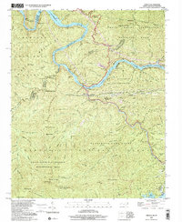
 2000 Thunderhead Mtn2001 Print · USGSThe Tennessee-North Carolina border at the start of the 2000s remains a wild corridor of high-elevation gaps and remote ridges. Hikers and historians can trace the Appalachian Trail over Thunderhead Mtn and locate landmarks like Indian Flats Falls and Big Chestnut Bald.
 - 2000 Map of Cades Cove, 2001 Print
 2000 Cades Cove2001 Print · USGSCades Cove at the turn of the millennium remains a significant site for tracing Appalachian homesteading and early mountain life. Researchers can locate family landmarks like the Henry Whitehead Cabin, Carter Shields Place, and several Cem sites preserved within the park.
 - 2000 Map of Tapoco, 2001 Print
 2000 Tapoco2001 Print · USGSThe North Carolina-Tennessee borderlands appear here just as the new millennium began, dominated by the dams and wilderness of the Great Smoky Mountains. Trace the routes of hydroelectric development at Che Oah Dam or find local landmarks like Bethel Ch and Beers Sch.
 - 2000 Map of Calderwood, 2001 Print
 2000 Calderwood2001 Print · USGSThe Tennessee and North Carolina borderlands come into focus at the turn of the millennium, showing where the wilderness of the Smokies meets the dammed Little Tennessee River. Researchers can trace historic routes like the Cooper Road Trail or locate the Happy Valley Ch and the industrial Quarry near Calderwood.
 - 2003 Map of Calderwood, 2004 Print
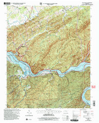
 2003 Calderwood2004 Print · USGSThe Great Smoky Mountains and the Little Tennessee River valley are captured here just after the turn of the millennium. Researchers can trace the shoreline of Chilhowee Lake, locate the community of Calderwood, and find remote landmarks like Abrams Falls and Parson Bald.
 - 2003 Map of Tallassee, 2004 Print
 2003 Tallassee2004 Print · USGSThe river valley between Blount and Monroe counties transitioned into a landscape of major reservoirs and national forest by the early 2000s. Researchers can locate family landmarks like Scona Lodge Ferry, Happy Top Ch, and Mc Murray Cem.
 - 2003 Map of Vonore, 2004 Print
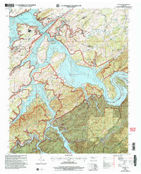 2003 Vonore2004 Print · USGSEastern Tennessee at the start of the millennium centers on the vast waters of Tellico Lake and the confluence of major rivers. Researchers can trace historical sites like Fort Loudoun State Historic Area alongside local landmarks like Toqua Cem and Vonore.
End of results
Showing maps 1-7 of 7
Top cities of Blount County
- Maryville historical maps
- Alcoa historical maps
- Louisville historical maps
- Friendsville historical maps
- Rockford historical maps
- Townsend historical maps
Frequently asked questions
- What are the different types of historical maps available for Blount County?
- What is the oldest map of Blount County?
- Where can I purchase historical maps of Blount County for my home or office?
- Where can I download high-res historical maps of Blount County?
- Are there historical topographic maps available for Blount County?
- Is there historical aerial imagery available for Blount County?
- Where are historical maps of Blount County sourced from?