Old Maps of Blount County, Tennessee for Hiking & Exploration
Hike through history with 187 historic maps of Blount County. Explore old trails, ghost towns, and forgotten backroads — perfect for outdoor adventurers and local explorers.
- Rediscover forgotten places: Map out old mining camps, roads, and footpaths that no longer exist on modern maps.
- Layer with modern tools: Combine with LiDAR or satellite views to plan hikes through historical terrain.
- Made for exploration: Popular among hikers, overlanders, and local history lovers.
Use these maps to find adventure and explore the hidden past of Blount County.
Blount County, TN maps
(187)- 1886 Map of Knoxville
 1886 Knoxville1886 Print · USGSEast Tennessee in the late nineteenth century was a landscape of river ferries and mountain coves centered around the growing hub of Knoxville. Genealogists can locate family landmarks like Spencer Cabin, Montvale Springs, and the old Brabsons Ferry river crossing.
 - 1892 Map of Knoxville
 1892 Knoxville1892 Print · USGSEastern Tennessee in the late nineteenth century shows a landscape of river-valley commerce transitioning into the Great Smokies. Genealogists can trace early homesteads near Sevierville or locate landmarks like Porter Academy and Boyd Ferry.
 - 1894 Map of Knoxville
 1894 Knoxville1894 Print · USGSThe Tennessee valley meets the high Smokies in the 1890s, revealing a landscape of river ferries, mountain coves, and emerging rail towns. Genealogists and historians can trace early crossings at Boyd Ferry, established schools like Porter Academy, and the early footprints of Gatlinburg and Pigeon Forge.
 - 1895 Map of Loudon
 1895 Loudon1895 Print · USGSEastern Tennessee is mapped here during a decade of rail expansion and river-based commerce. Genealogists and historians can trace family-named river crossings and early industry at Huff Ferry, Hiwassee College, and Brick Mill.6 unique versions available
 - 1895 Map of Knoxville
 1895 Knoxville1895 Print · USGSThe Tennessee and French Broad Rivers converge in this late-nineteenth-century survey of East Tennessee’s rising landscape. Trace the early rail lines and mountain crossings that shaped life for families in Sevierville, Gatlinburg, and Maryville.2 unique versions available
 - 1901 Map of Knoxville
 1901 Knoxville1901 Print · USGSThe East Tennessee borderlands meet the high Smokies at the turn of the century. Genealogists can trace early homesteads and crossroads near Sevierville and Maryville, or find landmarks like Cade Cove and Gatlinburg before they became tourist hubs.5 unique versions available
 - 1935 Map of Binfield
 1935 Binfield1935 Print · USGSBlount County in the mid-1930s is a landscape of rural schoolhouses and family-named ridges organized around the Louisville and Nashville Railroad. Researchers can trace the early layout of Brick Mill, locate the Carpenter Camp Ground, or find family roots at Seceded Cem.2 unique versions available
 - 1935 Map of Knoxville
 1935 Knoxville1935 Print · USGSKnoxville and its southern Blount County neighbors appear here in the mid-1930s as the TVA era begins. Researchers can trace family roots through Mt Olive Cem, locate the old Eastern State Hospital, or study the early layout of Sequoyah Hills.
 - 1935 Map of Walden Creek
 1935 Walden Creek1935 Print · USGSMid-1930s Sevier County comes alive in this survey of the Chilhowee foothills and Walden Creek valley. Genealogists and historians can trace the foundations of local communities through landmarks like the Harrison-Chilhowee Institute, Cusick, and the DuPont Cem.
 - 1935 Map of Meadow
 1935 Meadow1935 Print · USGSThe Little Tennessee River riverfront was still defined by historic crossings in the mid-1930s before modern bridges changed the landscape. You can trace early family landholdings and community sites like Morganton Ferry, Unitia Sch, and Greenback.
 - 1935 Map of Maryville
 1935 Maryville1935 Print · USGSBlount County in the mid-1930s reveals a unique mix of industrial expansion and traditional rural life. Researchers can trace the early footprint of Alcoa and Maryville College, or locate family landmarks like Beech Grove Ch and Bungalow Town.
 - 1935 Map of Wildwood
 1935 Wildwood1935 Print · USGSBlount County at the foot of the Smokies appears as a network of creek-side farms and mountain gaps in the mid-1930s. Genealogists and local historians can locate long-standing landmarks such as Eusebia Ch, Oak View Sch, and the community of Wildwood.
 - 1935 Map of Calderwood
 1935 Calderwood1935 Print · USGSBlount County and the Little Tennessee River valley are documented here in the mid-1930s as industrial power and conservation efforts reshaped the region. Genealogists and local historians can trace family sites in Happy Valley, Strawberry Hollow, and the rural community around Redtop Ch.
 - 1935 Map of Tapoco
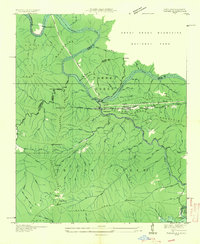 1935 Tapoco1935 Print · USGSThe border of North Carolina and Tennessee comes alive in the 1930s as massive hydroelectric projects reshape the high country. Trace the early Appalachian Trail through Deals Gap alongside industrial landmarks like Cheoah Dam and Tapoco.
 - 1935 Map of Bearden
 1935 Bearden1935 Print · USGSKnox County is captured in the mid-1930s just as the Tennessee Valley Authority began reshaping the regional landscape. Trace the old rail lines of the Southern railroad and find local landmarks like the County Prison Farm and Karns Sch.
 - 1935 Map of Blockhouse
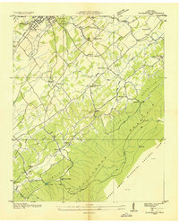 1935 Blockhouse1935 Print · USGSBlount County appears here in the mid-1930s, just as the national park was taking shape along the Chilhowee ridgeline. Genealogists can locate family landmarks like Sixmile Cem, Old Piney Ch, and the historic resort grounds at Montvale Springs.2 unique versions available
 - 1935 Map of Sevierville
 1935 Sevierville1935 Print · USGSSevier County during the mid-1930s is captured here in transition, showing the river-dependent communities along the French Broad River before modern development. Genealogists and historians can trace early school sites like Seven Islands Sch and old river crossings such as Trundle Ferry.
 - 1935 Map of Tallassee
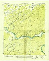 1935 Tallassee1935 Print · USGSThe Little Tennessee River valley comes to life in the mid-1930s, showing a landscape of mountain ridges and riverside settlements before major dam projects changed the river's course. Genealogists can trace family footprints at Quaker Cem, Jones Cem, and small rural centers like Wellsville or Tallassee.
 - 1935 Map of Vonore
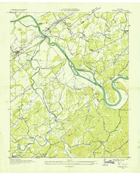 1935 Vonore1935 Print · USGSThe river valleys of eastern Tennessee are captured here in the mid-1930s, showing the early infrastructure of Monroe and Loudon counties. Genealogists can trace family landmarks like Bacon Ferry, the Fort Loudoun Monument, and Trigonia Sch.
 - 1936 Map of Louisville
 1936 Louisville1936 Print · USGSBlount County and the winding Tennessee River are captured here in the mid-thirties, showing a landscape defined by river bends and railroad stops. Genealogists can trace family roots through landmarks like Holston College, Lowe Ferry, and the settlement at Miser.
 - 1936 Map of Shooks Gap
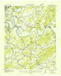 1936 Shooks Gap1936 Print · USGSEast of Knoxville in the mid-1930s, the confluence of the French Broad and Holston rivers shaped a landscape of ferry crossings and ridge-top farming. Genealogists can trace family footprints at Old Salem Cem, Whites Village, and the many rural schools like Anderson Sch.
 - 1936 Map of Knoxville
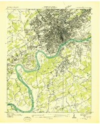 1936 Knoxville1936 Print · USGSKnoxville and its riverfront suburbs come alive in this mid-1930s survey, showing the city just as the TVA began its regional work. Genealogists and historians can locate family homes near Knoxville College, the State School for Deaf, or old cemeteries like New Gray Cem.
 - 1936 Map of Friendship
 1936 Friendship1936 Print · USGSEast Tennessee in the mid-1930s is documented here at a turning point for the river and rail landscape of Knox and Blount counties. Genealogists can trace family names at Mt Zion Ch, Martel Sch, and the riverside settlement of Louisville before the valley landscape was transformed.
 - 1936 Map of Wear Cove
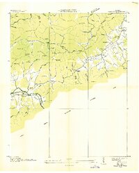 1936 Wear Cove1936 Print · USGSThe Great Smoky Mountains border these Tennessee coves during the mid-1930s, showing the early park boundary and the local rail line. Genealogists can trace family landmarks like Hatcher Cem, Coker Hill Chapel, and the isolated Carr Creek Sch.
 - 1936 Map of Concord
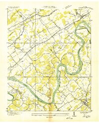 1936 Concord1936 Print · USGSThe Tennessee and Little Tennessee rivers wind through the borders of Knox, Loudon, and Blount counties in the mid-1930s. Researchers can locate early family landmarks like Long Tom Cem, Burnett Sch, and the riverside hamlet of Unitia.
Showing maps 1-25 of 187
Top cities of Blount County
- Maryville historical maps
- Alcoa historical maps
- Louisville historical maps
- Friendsville historical maps
- Rockford historical maps
- Townsend historical maps
Frequently asked questions
- What are the different types of historical maps available for Blount County?
- What is the oldest map of Blount County?
- Where can I purchase historical maps of Blount County for my home or office?
- Where can I download high-res historical maps of Blount County?
- Are there historical topographic maps available for Blount County?
- Is there historical aerial imagery available for Blount County?
- Where are historical maps of Blount County sourced from?