2000s (21st Century) Maps of Happy Valley, Tennessee
Explore 7 historic maps of Happy Valley from the 2000s (21st Century). These maps offer a rare glimpse into what life looked like during the 2000s — showing old roads, neighborhoods, homes, and landmarks that have changed or disappeared over time.
Whether you're researching your family's past, planning a metal detecting trip, or studying how Happy Valley's landscape evolved across the 2000s, these high-resolution maps are a powerful tool for exploring the history of this region.
- Focus on a specific era: All maps on this page are from the 2000s, giving you a focused view of this time period.
- See what’s changed: Compare century-old streets, trails, and buildings to today's modern landscape using overlays and satellite layers.
- Research with precision: Use these maps for genealogy, historical research, land use analysis, or educational projects.
- View, download, or print: Maps are fully viewable online in high resolution, and can be downloaded or printed for your own records.
Start exploring Happy Valley's history through authentic maps from the 2000s. This is your window into the past.
Happy Valley, TN maps
(7)- 2000 Map of Calderwood, 2001 Print
 2000 Calderwood2001 Print · USGSThe Tennessee and North Carolina borderlands come into focus at the turn of the millennium, showing where the wilderness of the Smokies meets the dammed Little Tennessee River. Researchers can trace historic routes like the Cooper Road Trail or locate the Happy Valley Ch and the industrial Quarry near Calderwood.
 - 2003 Map of Calderwood, 2004 Print
 2003 Calderwood2004 Print · USGSThe Great Smoky Mountains and the Little Tennessee River valley are captured here just after the turn of the millennium. Researchers can trace the shoreline of Chilhowee Lake, locate the community of Calderwood, and find remote landmarks like Abrams Falls and Parson Bald.
 - 2011 Map of Calderwood, 2011 Print
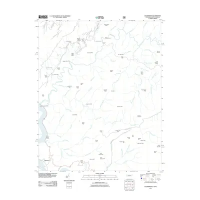 2011 Calderwood2011 Print · USGSCovers Happy Valley, including Calderwood, Abrams, and other nearby areas
 - 2013 Map of Calderwood, 2013 Print
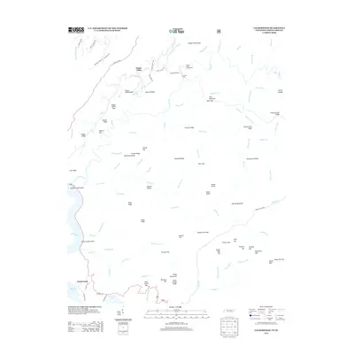 2013 Calderwood2013 Print · USGSCovers Happy Valley, including Calderwood, Abrams, and other nearby areas
 - 2016 Map of Calderwood, 2016 Print
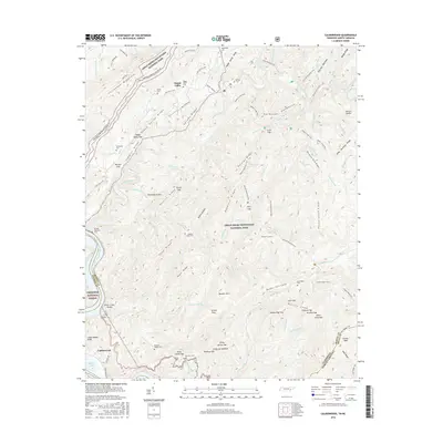 2016 Calderwood2016 Print · USGSCovers Happy Valley, including Calderwood, Abrams, and other nearby areas
 - 2019 Map of Calderwood, 2019 Print
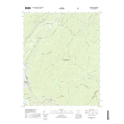 2019 Calderwood2019 Print · USGSCovers Happy Valley, including Calderwood, Abrams, and other nearby areas
 - 2022 Map of Calderwood, 2022 Print
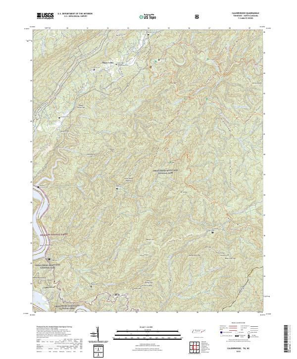 2022 Calderwood2022 Print · USGSThe borderlands of Blount County and North Carolina appear here in the early 2020s, showing a landscape defined by protected forests and family history. Genealogists can locate several remote burial sites including Ghormley Cem, Burchfield Cem, and Chilhowee Cem.
End of results
Showing maps 1-7 of 7
Top cities near Happy Valley
- Maryville historical maps
- Alcoa historical maps
- Louisville historical maps
- Greenback historical maps
- Friendsville historical maps
- Rockford historical maps
See more
Frequently asked questions
- What are the different types of historical maps available for Happy Valley?
- What is the oldest map of Happy Valley?
- Where can I purchase historical maps of Happy Valley for my home or office?
- Where can I download high-res historical maps of Happy Valley?
- Are there historical topographic maps available for Happy Valley?
- Is there historical aerial imagery available for Happy Valley?
- Where are historical maps of Happy Valley sourced from?