1900s (20th Century) Maps of Monroe County, Tennessee
Explore 86 historic maps of Monroe County from the 1900s (20th Century). These maps offer a rare glimpse into what life looked like during the 1900s — showing old roads, neighborhoods, homes, and landmarks that have changed or disappeared over time.
Whether you're researching your family's past, planning a metal detecting trip, or studying how Monroe County's landscape evolved across the 1900s, these high-resolution maps are a powerful tool for exploring the history of this region.
- Focus on a specific era: All maps on this page are from the 1900s, giving you a focused view of this time period.
- See what’s changed: Compare century-old streets, trails, and buildings to today's modern landscape using overlays and satellite layers.
- Research with precision: Use these maps for genealogy, historical research, land use analysis, or educational projects.
- View, download, or print: Maps are fully viewable online in high resolution, and can be downloaded or printed for your own records.
Start exploring Monroe County's history through authentic maps from the 1900s. This is your window into the past.
Monroe County, TN maps
(86)- 1901 Map of Knoxville
 1901 Knoxville1901 Print · USGSThe East Tennessee borderlands meet the high Smokies at the turn of the century. Genealogists can trace early homesteads and crossroads near Sevierville and Maryville, or find landmarks like Cade Cove and Gatlinburg before they became tourist hubs.5 unique versions available
 - 1914 Map of Murphy
 1914 Murphy1914 Print · USGSThe Tennessee-North Carolina borderlands come to life in this early twentieth-century survey, showcasing a landscape of mountain ridges and river-driven commerce. Researchers can trace the Louisville and Nashville Railroad to old stops like Apalachia Sta or locate the historic Prince Ferry and White Cliff Springs.3 unique versions available
 - 1927 Map of Big Junction
 1927 Big Junction1927 Print · USGSThe Tennessee-North Carolina high country comes alive in this late 1920s survey of the Unicoi Mountains. Trace old mountain routes and clearings like Whigg Cabin, Stratton Meadow, and the headwaters of the Tellico River.2 unique versions available
 - 1933 Map of Haw Knob
 1933 Haw Knob1933 Print · USGSThe Tennessee-North Carolina borderlands come alive in this early 1930s survey, showing the deep creek valleys and high peaks of the southern mountains. Researchers can find old community hubs like Tallassee Sch, Ballplay Ch, and the remote Hemlock Lookout.2 unique versions available
 - 1933 Map of Whiteoak Flats
 1933 Whiteoak Flats1933 Print · USGSThe Tennessee and North Carolina borderlands come into focus in the early 1930s, showing the high ridges and creek valleys before modern development. Genealogists and hikers can trace old routes near Pleasant Grove Church, Jeffrey, and the summits of the Unicoi Mountains.
 - 1933 Map of Bald River Falls
 1933 Bald River Falls1933 Print · USGSMonroe County, Tennessee, is shown in the mid-1930s as a high-altitude mountain landscape where early forest management and rural education intersect. Researchers can locate the Waucheesi Lookout Tower and old school sites like Blackankle Sch and Waucheesi Sch among the winding creeks.
 - 1933 Map of Rafter
 1933 Rafter1933 Print · USGSMonroe County was a landscape of remote mountain schools and country churches in the early 1930s. Genealogists can trace family footprints near Glenndale Sch, Quaker Ch, and small crossroads like Acorn and Tariffville.
 - 1934 Map of Mount Vernon
 1934 Mount Vernon1934 Print · USGSMonroe County mountain life in the mid-1930s centered on the ridges of the Cherokee National Forest and the banks of the Tellico River. Genealogists can trace early homesteads and community hubs like Belltown P O, Stakely Mill, and the Old Prospect Cem.
 - 1934 Map of Mecca
 1934 Mecca1934 Print · USGSMonroe County was a land of steep ridges and creek-side settlements in the mid-1930s. Genealogists and local historians can trace the foundations of mountain life through landmarks like White Cliff Springs, Oldman Mill, and the Rural Vale School.
 - 1934 Map of McDaniel Bald
 1934 McDaniel Bald1934 Print · USGSThe North Carolina and Tennessee borderlands appear here in the mid-1930s, showing a network of high-elevation gaps and remote mountain schools. Genealogists can locate family landmarks like Bryson Cem, Ebenezer, and schools including Owl Creek Sch and Davis Creek Sch.
 - 1934 Map of Unaka
 1934 Unaka1934 Print · USGSCherokee County at the height of the New Deal era reveals a mountain landscape defined by the winding Hiwassee River and remote forest settlements. Genealogists can locate family landmarks such as Buckberry Sch, Bethel Cem, and the depression-era CCC Camp No F 11.
 - 1934 Map of Englewood
 1934 Englewood1934 Print · USGSIn the mid-1930s, the McMinn County countryside was a network of rail-side settlements and upland farms. Genealogists can trace family footprints through numerous rural landmarks like Isbell Cem, McConkey Sch, and New Bethel Ch.
 - 1934 Map of Murphy
 1934 Murphy1934 Print · USGSWestern North Carolina during the mid-thirties reveals a mountain landscape transitioning from resource extraction to managed forest. Researchers can trace family roots at Old Friendship Cem or locate industrial sites like Culberson Mine and Regal Sta.
 - 1934 Map of Tellico Plains
 1934 Tellico Plains1934 Print · USGSMonroe County mountain life is captured here in the mid-thirties, showing the rail and river economy of the Tellico River valley. Researchers can trace old mountain schools and family sites like Atkins Sch, Murphys Mill, and Leonards Chapel.
 - 1935 Map of Niota
 1935 Niota1935 Print · USGSNiota and the surrounding McMinn County countryside are shown here in the mid-1930s as the rail and highway network began to modernize the region. Researchers can locate early rural landmarks like Murphys Store, the Flume Mill, and several country schools including Pine Grove Sch.
 - 1935 Map of Tellico
 1935 Tellico1935 Print · USGSMonroe County was a landscape of mountain ridges and remote outposts in the mid-1930s, anchored by the rail hub at Tellico Plains. Genealogists and researchers can trace family landmarks like Carpenter Cem, Oldman Mill, and the Rural Vale School.
 - 1935 Map of Meadow
 1935 Meadow1935 Print · USGSThe Little Tennessee River riverfront was still defined by historic crossings in the mid-1930s before modern bridges changed the landscape. You can trace early family landholdings and community sites like Morganton Ferry, Unitia Sch, and Greenback.
 - 1935 Map of Calderwood
 1935 Calderwood1935 Print · USGSBlount County and the Little Tennessee River valley are documented here in the mid-1930s as industrial power and conservation efforts reshaped the region. Genealogists and local historians can trace family sites in Happy Valley, Strawberry Hollow, and the rural community around Redtop Ch.
 - 1935 Map of Philadelphia
 1935 Philadelphia1935 Print · USGSEastern Tennessee valley life comes into focus as the Tennessee Valley Authority begins its work. Genealogists can trace family roots through landmarks like Snows School, Reed Spring Church, and the settlement of Adolphus.
 - 1935 Map of Tapoco
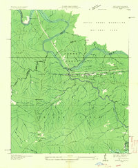 1935 Tapoco1935 Print · USGSThe border of North Carolina and Tennessee comes alive in the 1930s as massive hydroelectric projects reshape the high country. Trace the early Appalachian Trail through Deals Gap alongside industrial landmarks like Cheoah Dam and Tapoco.
 - 1935 Map of Tallassee
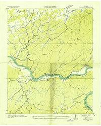 1935 Tallassee1935 Print · USGSThe Little Tennessee River valley comes to life in the mid-1930s, showing a landscape of mountain ridges and riverside settlements before major dam projects changed the river's course. Genealogists can trace family footprints at Quaker Cem, Jones Cem, and small rural centers like Wellsville or Tallassee.
 - 1935 Map of Vonore
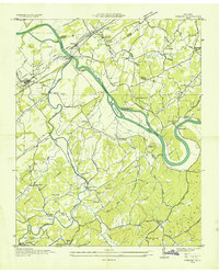 1935 Vonore1935 Print · USGSThe river valleys of eastern Tennessee are captured here in the mid-1930s, showing the early infrastructure of Monroe and Loudon counties. Genealogists can trace family landmarks like Bacon Ferry, the Fort Loudoun Monument, and Trigonia Sch.
 - 1936 Map of Madisonville
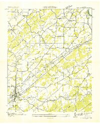 1936 Madisonville1936 Print · USGSMadisonville and the surrounding Monroe County countryside are captured here during the transformative mid-thirties era of rural electrification. Researchers can trace the grounds of Hiwassee College or locate vanished local landmarks like Hopewell Springs and Sequoyah Sch.
 - 1936 Map of Sweetwater
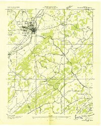 1936 Sweetwater1936 Print · USGSSweetwater and the surrounding valley are shown here in the mid-1930s as the Tennessee Valley Authority began its regional work. Researchers can locate numerous vanished rural landmarks, including Tennessee Military Institute, Christianburg, and schools like High Point Sch and Liberality Sch.
 - 1936 Map of Ducktown
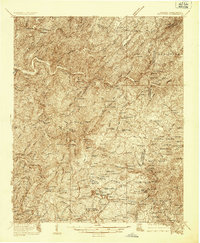 1936 Ducktown1936 Print · USGSThe Tennessee and North Carolina borderlands come to life in the mid-1930s as the Copper Basin mining boom reaches its peak. Researchers can locate vanished infrastructure like the Tennessee Copper Co RR and legendary sites including the Burra Burra Mine and Kimsey Junior College.
Showing maps 1-25 of 86
Top cities of Monroe County
Frequently asked questions
- What are the different types of historical maps available for Monroe County?
- What is the oldest map of Monroe County?
- Where can I purchase historical maps of Monroe County for my home or office?
- Where can I download high-res historical maps of Monroe County?
- Are there historical topographic maps available for Monroe County?
- Is there historical aerial imagery available for Monroe County?
- Where are historical maps of Monroe County sourced from?