Old Maps of Monroe County, Tennessee for Hiking & Exploration
Hike through history with 225 historic maps of Monroe County. Explore old trails, ghost towns, and forgotten backroads — perfect for outdoor adventurers and local explorers.
- Rediscover forgotten places: Map out old mining camps, roads, and footpaths that no longer exist on modern maps.
- Layer with modern tools: Combine with LiDAR or satellite views to plan hikes through historical terrain.
- Made for exploration: Popular among hikers, overlanders, and local history lovers.
Use these maps to find adventure and explore the hidden past of Monroe County.
Monroe County, TN maps
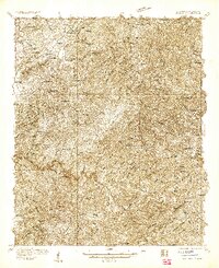
(225)- 1886 Map of Knoxville
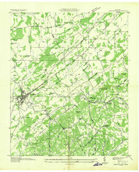
 1886 Knoxville1886 Print · USGSEast Tennessee in the late nineteenth century was a landscape of river ferries and mountain coves centered around the growing hub of Knoxville. Genealogists can locate family landmarks like Spencer Cabin, Montvale Springs, and the old Brabsons Ferry river crossing.
 - 1887 Map of Kingston
 1887 Kingston1887 Print · USGSCentral Tennessee in the late nineteenth century was a world of river landings and new rail lines. Genealogists can trace family roots through riverside sites like Sevier's Ferry or rural hubs like Bogges X Roads and Ten Mile Stand.
 - 1891 Map of Kingston
 1891 Kingston1891 Print · USGSEastern Tennessee in the 1890s reveals a river-driven economy at the edge of the Cumberland Plateau. Genealogists can trace early crossings and landings such as Mc Elwee's Ferry and Pinhook Landing, or locate vanished crossroads like Kemmers Old Stand.2 unique versions available
 - 1892 Map of Knoxville
 1892 Knoxville1892 Print · USGSEastern Tennessee in the late nineteenth century shows a landscape of river-valley commerce transitioning into the Great Smokies. Genealogists can trace early homesteads near Sevierville or locate landmarks like Porter Academy and Boyd Ferry.
 - 1893 Map of Murphy
 1893 Murphy1893 Print · USGSThe Unaka Mountains and Hiwassee River valley are captured here in the late 19th century, showing a landscape of remote mountain gaps and early industry. Researchers can find old mining sites like Isabella Mine, river crossings such as Prince Fy., and rail stops at Hiwassee Sta..5 unique versions available
 - 1893 Map of Kingston, 1905 Print
 1893 Kingston1905 Print · USGSEastern Tennessee at the end of the nineteenth century is a landscape of mountain gaps and vital river landings. Researchers can trace early river crossings like Jackson Ferry, the path of the Cincinnati Southern Railroad, and settlements like Rhea Springs and Kingston.5 unique versions available
 - 1894 Map of Knoxville
 1894 Knoxville1894 Print · USGSThe Tennessee valley meets the high Smokies in the 1890s, revealing a landscape of river ferries, mountain coves, and emerging rail towns. Genealogists and historians can trace early crossings at Boyd Ferry, established schools like Porter Academy, and the early footprints of Gatlinburg and Pigeon Forge.
 - 1895 Map of Loudon
 1895 Loudon1895 Print · USGSEastern Tennessee is mapped here during a decade of rail expansion and river-based commerce. Genealogists and historians can trace family-named river crossings and early industry at Huff Ferry, Hiwassee College, and Brick Mill.6 unique versions available
 - 1895 Map of Knoxville
 1895 Knoxville1895 Print · USGSThe Tennessee and French Broad Rivers converge in this late-nineteenth-century survey of East Tennessee’s rising landscape. Trace the early rail lines and mountain crossings that shaped life for families in Sevierville, Gatlinburg, and Maryville.2 unique versions available
 - 1901 Map of Knoxville
 1901 Knoxville1901 Print · USGSThe East Tennessee borderlands meet the high Smokies at the turn of the century. Genealogists can trace early homesteads and crossroads near Sevierville and Maryville, or find landmarks like Cade Cove and Gatlinburg before they became tourist hubs.5 unique versions available
 - 1914 Map of Murphy
 1914 Murphy1914 Print · USGSThe Tennessee-North Carolina borderlands come to life in this early twentieth-century survey, showcasing a landscape of mountain ridges and river-driven commerce. Researchers can trace the Louisville and Nashville Railroad to old stops like Apalachia Sta or locate the historic Prince Ferry and White Cliff Springs.3 unique versions available
 - 1927 Map of Big Junction
 1927 Big Junction1927 Print · USGSThe Tennessee-North Carolina high country comes alive in this late 1920s survey of the Unicoi Mountains. Trace old mountain routes and clearings like Whigg Cabin, Stratton Meadow, and the headwaters of the Tellico River.2 unique versions available
 - 1933 Map of Haw Knob
 1933 Haw Knob1933 Print · USGSThe Tennessee-North Carolina borderlands come alive in this early 1930s survey, showing the deep creek valleys and high peaks of the southern mountains. Researchers can find old community hubs like Tallassee Sch, Ballplay Ch, and the remote Hemlock Lookout.2 unique versions available
 - 1933 Map of Whiteoak Flats
 1933 Whiteoak Flats1933 Print · USGSThe Tennessee and North Carolina borderlands come into focus in the early 1930s, showing the high ridges and creek valleys before modern development. Genealogists and hikers can trace old routes near Pleasant Grove Church, Jeffrey, and the summits of the Unicoi Mountains.
 - 1933 Map of Bald River Falls
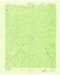
 1933 Bald River Falls1933 Print · USGSMonroe County, Tennessee, is shown in the mid-1930s as a high-altitude mountain landscape where early forest management and rural education intersect. Researchers can locate the Waucheesi Lookout Tower and old school sites like Blackankle Sch and Waucheesi Sch among the winding creeks.
 - 1933 Map of Rafter
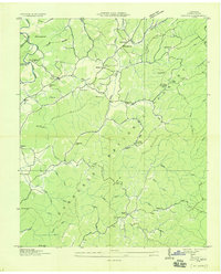 1933 Rafter1933 Print · USGSMonroe County was a landscape of remote mountain schools and country churches in the early 1930s. Genealogists can trace family footprints near Glenndale Sch, Quaker Ch, and small crossroads like Acorn and Tariffville.
 - 1934 Map of Mount Vernon
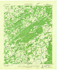 1934 Mount Vernon1934 Print · USGSMonroe County mountain life in the mid-1930s centered on the ridges of the Cherokee National Forest and the banks of the Tellico River. Genealogists can trace early homesteads and community hubs like Belltown P O, Stakely Mill, and the Old Prospect Cem.
 - 1934 Map of Mecca
 1934 Mecca1934 Print · USGSMonroe County was a land of steep ridges and creek-side settlements in the mid-1930s. Genealogists and local historians can trace the foundations of mountain life through landmarks like White Cliff Springs, Oldman Mill, and the Rural Vale School.
 - 1934 Map of McDaniel Bald
 1934 McDaniel Bald1934 Print · USGSThe North Carolina and Tennessee borderlands appear here in the mid-1930s, showing a network of high-elevation gaps and remote mountain schools. Genealogists can locate family landmarks like Bryson Cem, Ebenezer, and schools including Owl Creek Sch and Davis Creek Sch.
 - 1934 Map of Unaka
 1934 Unaka1934 Print · USGSCherokee County at the height of the New Deal era reveals a mountain landscape defined by the winding Hiwassee River and remote forest settlements. Genealogists can locate family landmarks such as Buckberry Sch, Bethel Cem, and the depression-era CCC Camp No F 11.
 - 1934 Map of Englewood
 1934 Englewood1934 Print · USGSIn the mid-1930s, the McMinn County countryside was a network of rail-side settlements and upland farms. Genealogists can trace family footprints through numerous rural landmarks like Isbell Cem, McConkey Sch, and New Bethel Ch.
 - 1934 Map of Murphy
 1934 Murphy1934 Print · USGSWestern North Carolina during the mid-thirties reveals a mountain landscape transitioning from resource extraction to managed forest. Researchers can trace family roots at Old Friendship Cem or locate industrial sites like Culberson Mine and Regal Sta.
 - 1934 Map of Tellico Plains
 1934 Tellico Plains1934 Print · USGSMonroe County mountain life is captured here in the mid-thirties, showing the rail and river economy of the Tellico River valley. Researchers can trace old mountain schools and family sites like Atkins Sch, Murphys Mill, and Leonards Chapel.
 - 1935 Map of Niota
 1935 Niota1935 Print · USGSNiota and the surrounding McMinn County countryside are shown here in the mid-1930s as the rail and highway network began to modernize the region. Researchers can locate early rural landmarks like Murphys Store, the Flume Mill, and several country schools including Pine Grove Sch.
 - 1935 Map of Tellico
 1935 Tellico1935 Print · USGSMonroe County was a landscape of mountain ridges and remote outposts in the mid-1930s, anchored by the rail hub at Tellico Plains. Genealogists and researchers can trace family landmarks like Carpenter Cem, Oldman Mill, and the Rural Vale School.
Showing maps 1-25 of 225
Top cities of Monroe County
Frequently asked questions
- What are the different types of historical maps available for Monroe County?
- What is the oldest map of Monroe County?
- Where can I purchase historical maps of Monroe County for my home or office?
- Where can I download high-res historical maps of Monroe County?
- Are there historical topographic maps available for Monroe County?
- Is there historical aerial imagery available for Monroe County?
- Where are historical maps of Monroe County sourced from?