2000s (21st Century) Maps of Monroe County, Tennessee
Explore 50 historic maps of Monroe County from the 2000s (21st Century). These maps offer a rare glimpse into what life looked like during the 2000s — showing old roads, neighborhoods, homes, and landmarks that have changed or disappeared over time.
Whether you're researching your family's past, planning a metal detecting trip, or studying how Monroe County's landscape evolved across the 2000s, these high-resolution maps are a powerful tool for exploring the history of this region.
- Focus on a specific era: All maps on this page are from the 2000s, giving you a focused view of this time period.
- See what’s changed: Compare century-old streets, trails, and buildings to today's modern landscape using overlays and satellite layers.
- Research with precision: Use these maps for genealogy, historical research, land use analysis, or educational projects.
- View, download, or print: Maps are fully viewable online in high resolution, and can be downloaded or printed for your own records.
Start exploring Monroe County's history through authentic maps from the 2000s. This is your window into the past.
Monroe County, TN maps
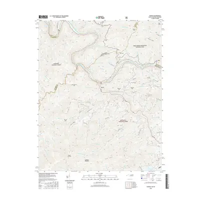
(50)- 2000 Map of Tapoco, 2001 Print
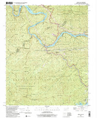 2000 Tapoco2001 Print · USGSThe North Carolina-Tennessee borderlands appear here just as the new millennium began, dominated by the dams and wilderness of the Great Smoky Mountains. Trace the routes of hydroelectric development at Che Oah Dam or find local landmarks like Bethel Ch and Beers Sch.
 - 2000 Map of Calderwood, 2001 Print
 2000 Calderwood2001 Print · USGSThe Tennessee and North Carolina borderlands come into focus at the turn of the millennium, showing where the wilderness of the Smokies meets the dammed Little Tennessee River. Researchers can trace historic routes like the Cooper Road Trail or locate the Happy Valley Ch and the industrial Quarry near Calderwood.
 - 2003 Map of Calderwood, 2004 Print
 2003 Calderwood2004 Print · USGSThe Great Smoky Mountains and the Little Tennessee River valley are captured here just after the turn of the millennium. Researchers can trace the shoreline of Chilhowee Lake, locate the community of Calderwood, and find remote landmarks like Abrams Falls and Parson Bald.
 - 2003 Map of Farner, 2004 Print
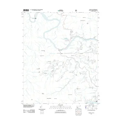
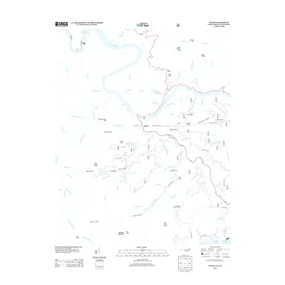
 2003 Farner2004 Print · USGSThe Tennessee and North Carolina borderlands come into focus at the dawn of the new millennium, showcasing the interaction of the river and the national forests. Researchers can trace family history through sites like River Hill Cem, Cataska Ch, and the settlement of Ironsburg.
 - 2003 Map of Bald River Falls, 2004 Print
 2003 Bald River Falls2004 Print · USGSThe high ridges of the Tennessee and North Carolina state line are captured here as they appeared in the early 2000s. Genealogists and hikers can trace remote landmarks like Miller Chapel Cem, the winding Tellico River, and the historic Warriors Passage.
 - 2003 Map of Madisonville, 2004 Print
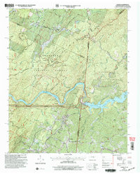
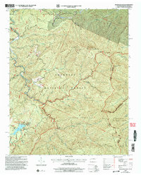
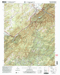
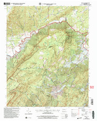
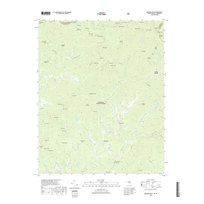
 2003 Madisonville2004 Print · USGSMadisonville and the Monroe County foothills are captured in the early 2000s, reflecting a rural landscape defined by historic schools and family homesteads. Researchers can trace the grounds of Hiwassee College, locate the Old Lutheran Cem, and follow the banks of Bat Creek.
 - 2003 Map of Whiteoak Flats, 2004 Print
 2003 Whiteoak Flats2004 Print · USGSThe Tennessee and North Carolina borderlands in the early 2000s are defined by the meeting of the Cherokee National Forest and Nantahala National Forest. Researchers can trace the quiet landmarks of the high ridges, from the Pleasant Grove Ch to the remote peaks of Big Fodderstack.
 - 2003 Map of Mount Vernon, 2004 Print
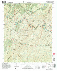
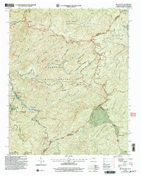
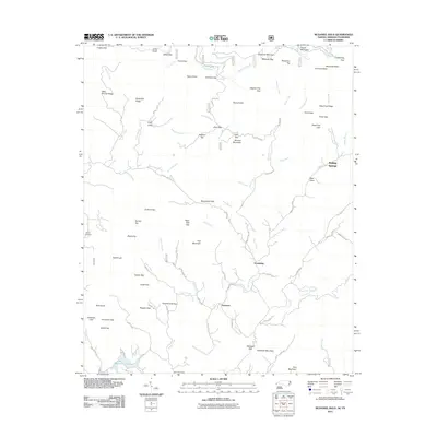
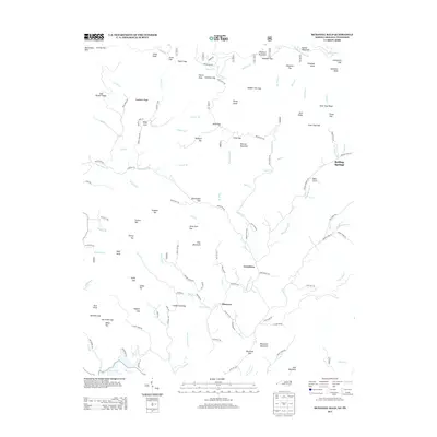
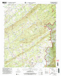 2003 Mount Vernon2004 Print · USGSMonroe County settlement at the turn of the millennium shows a landscape defined by the Tellico River and the rising ridges of the Cherokee National Forest. Genealogists and local historians can trace family roots through numerous rural landmarks like Stakely Mill, Union Hall, and Eleazar Ch.
 - 2003 Map of Rafter, 2004 Print
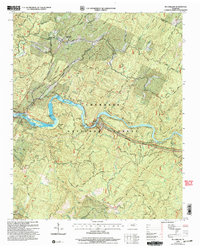
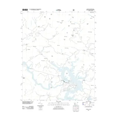
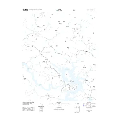
 2003 Rafter2004 Print · USGSMonroe County, Tennessee, is shown here just after the turn of the millennium, where the waters of Tellico Lake meet the rising ridges of the Cherokee National Forest. Family historians can locate several rural landmarks including Ebenezer Ballplay Church, Mt Hebron Cemetery, and Giles Cemetery.
 - 2003 Map of Mc Farland, 2004 Print
 2003 Mc Farland2004 Print · USGSThe Hiwassee River corridor in Polk County is captured here in the early 2000s, showing the intersection of mountain wilderness and industrial development. Researchers can trace the L & N RR through McFarland or locate family sites like Maggies Mill and Campground Cem.
 - 2003 Map of Tellico Plains, 2004 Print
 2003 Tellico Plains2004 Print · USGSMonroe County was transitioning into the new millennium as this survey documented the valleys and ridges surrounding Tellico Plains. Researchers can trace family roots through landmarks like Conasauga Mill, the Holder Cem, and rural congregations at Unicoi Ch.
 - 2003 Map of Big Junction, 2004 Print
 2003 Big Junction2004 Print · USGSHigh mountain ridges along the Tennessee and North Carolina border are documented here at the start of the new millennium. Researchers can trace the path of the Cherohala Skyway as it passes Green Cove Cem, the Donley Cabin, and various Ruins.
 - 2003 Map of Tallassee, 2004 Print
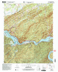 2003 Tallassee2004 Print · USGSThe river valley between Blount and Monroe counties transitioned into a landscape of major reservoirs and national forest by the early 2000s. Researchers can locate family landmarks like Scona Lodge Ferry, Happy Top Ch, and Mc Murray Cem.
 - 2003 Map of Vonore, 2004 Print
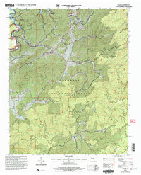
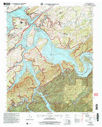 2003 Vonore2004 Print · USGSEastern Tennessee at the start of the millennium centers on the vast waters of Tellico Lake and the confluence of major rivers. Researchers can trace historical sites like Fort Loudoun State Historic Area alongside local landmarks like Toqua Cem and Vonore.
 - 2003 Map of Mecca, 2004 Print
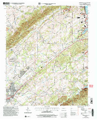
 2003 Mecca2004 Print · USGSMonroe County and the Cherokee National Forest are captured here in the early twenty-first century as the high ridges of Starr Mountain meet the valley settlements. Trace local family history at Mecca Cem or find remote landmarks like White Cliff Springs and Rural Vale Ch.
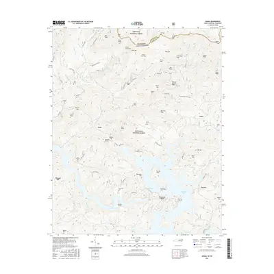
 - 2011 Map of Unaka, 2011 Print
 2011 Unaka2011 Print · USGSCovers Monroe County, including Pleasant Hill, Violet, and other nearby areas
 - 2011 Map of Tapoco, 2011 Print
 2011 Tapoco2011 Print · USGSCovers Monroe County, including Twenty Mile, Tapoco, and other nearby areas
 - 2011 Map of McDaniel Bald, 2011 Print
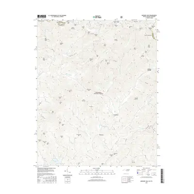
 2011 McDaniel Bald2011 Print · USGSCovers Monroe County, including Ebenezer, Grandview, and other nearby areas
 - 2013 Map of Unaka, 2013 Print
 2013 Unaka2013 Print · USGSCovers Monroe County, including Pleasant Hill, Violet, and other nearby areas
 - 2013 Map of McDaniel Bald, 2013 Print
 2013 McDaniel Bald2013 Print · USGSCovers Monroe County, including Ebenezer, Grandview, and other nearby areas
 - 2013 Map of Tapoco, 2013 Print
 2013 Tapoco2013 Print · USGSCovers Monroe County, including Twenty Mile, Tapoco, and other nearby areas
 - 2016 Map of McDaniel Bald, 2016 Print
 2016 McDaniel Bald2016 Print · USGSCovers Monroe County, including Ebenezer, Grandview, and other nearby areas
 - 2016 Map of Tapoco, 2016 Print
 2016 Tapoco2016 Print · USGSCovers Monroe County, including Twenty Mile, Tapoco, and other nearby areas
 - 2016 Map of Unaka, 2016 Print
 2016 Unaka2016 Print · USGSCovers Monroe County, including Pleasant Hill, Violet, and other nearby areas
 - 2019 Map of McDaniel Bald, 2019 Print
 2019 McDaniel Bald2019 Print · USGSCovers Monroe County, including Ebenezer, Grandview, and other nearby areas
Showing maps 1-25 of 50
Top cities of Monroe County
Frequently asked questions
- What are the different types of historical maps available for Monroe County?
- What is the oldest map of Monroe County?
- Where can I purchase historical maps of Monroe County for my home or office?
- Where can I download high-res historical maps of Monroe County?
- Are there historical topographic maps available for Monroe County?
- Is there historical aerial imagery available for Monroe County?
- Where are historical maps of Monroe County sourced from?