1950s Maps of Tipton County, Tennessee
Explore 9 historic maps of Tipton County from the 1950s. These maps offer a rare glimpse into what life looked like during the 1950s — showing old roads, neighborhoods, homes, and landmarks that have changed or disappeared over time.
Whether you're researching your family's past, planning a metal detecting trip, or studying how Tipton County's landscape evolved across the 1950s, these high-resolution maps are a powerful tool for exploring the history of this region.
- Focus on a specific era: All maps on this page are from the 1950s, giving you a focused view of this time period.
- See what’s changed: Compare century-old streets, trails, and buildings to today's modern landscape using overlays and satellite layers.
- Research with precision: Use these maps for genealogy, historical research, land use analysis, or educational projects.
- View, download, or print: Maps are fully viewable online in high resolution, and can be downloaded or printed for your own records.
Start exploring Tipton County's history through authentic maps from the 1950s. This is your window into the past.
Tipton County, TN maps
(9)- 1952 Map of Stanton
 1952 Stanton1952 Print · USGSWestern Tennessee at the start of the fifties was a landscape of rail-connected towns and crossroads communities. Genealogists can trace family roots through numerous rural landmarks like Wesley Cem, Fredonia Sch, and the community of Keeling.3 unique versions available
 - 1952 Map of Jericho
 1952 Jericho1952 Print · USGSThe Mississippi River's shifting course defines this borderland during the early 1950s, where Arkansas and Tennessee meet in a maze of chutes and islands. Researchers can trace rural lineages through numerous local sites like St Pauls Ch & Cem, Meneshea, and the Clarkedale Post Office.
 - 1952 Map of Stanton, 1958 Print
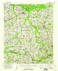 1952 Stanton1958 Print · USGSMid-century West Tennessee comes to life here as the rail-driven town of Stanton and the crossroads at Dancyville anchor a landscape of bottomlands and family farms. Trace the roots of local communities through landmarks like Yum Yum, Gailor High Sch, and the Antioch Ch.
 - 1953 Map of Memphis, 1966 Print
 1953 Memphis1966 Print · USGSEastern Arkansas and the Memphis riverfront are shown here during the mid-century period of regional growth and river management. Local historians can trace the paths of the Chicago Rock Island & Pacific RR through Forrest City or locate river landmarks like President's Island.3 unique versions available
 - 1954 Map of Mason
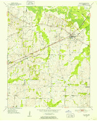
 1954 Mason1954 Print · USGSWest Tennessee in the mid-1950s shows a landscape of rail-linked towns and deep-rooted rural institutions. Genealogists and researchers can trace family connections at the Dunlap Orphanage, Home Ferry Sch, and numerous sites like St Matthews Sch & Ch.
 - 1956 Map of Evadale
 1956 Evadale1956 Print · USGSMississippi County, Arkansas, appears in the early 1950s as a productive agricultural landscape secured by an extensive system of levees and drainage ditches. Genealogists can locate family names at Pittman Cem, Louise Chapel & Cem, and the industry at Creamery Package.
 - 1956 Map of Memphis
 1956 Memphis1956 Print · USGSThe Mississippi Delta and the bluffs of West Tennessee meet in the mid-fifties, showing a landscape defined by massive river systems and rail hubs. Researchers can trace the path of Crowleys Ridge or locate vanished river landings near Centennial Island and Island No 35.
 - 1956 Map of Blytheville, 1964 Print
 1956 Blytheville1964 Print · USGSWest Tennessee and the Arkansas Delta come alive in this mid-century survey of the river-and-rail corridor connecting Memphis to Jackson. Genealogists and historians can trace the rail lines of the Louisville and Nashville RR and locate landmarks like Western State Hospital or Fort Pillow State Prison Farm.2 unique versions available
 - 1959 Map of Blytheville
 1959 Blytheville1959 Print · USGSWest Tennessee and Northeast Arkansas meet along the river in the late fifties, during a period of steady industrial and agricultural growth. Genealogists can trace the rail corridors of the Illinois Central through Jackson or explore landmarks like Shiloh National Military Park and Fort Pillow State Prison.
End of results
Showing maps 1-9 of 9
Top cities of Tipton County
- Covington historical maps
- Atoka historical maps
- Munford historical maps
- Brighton historical maps
- Mason historical maps
- Gilt Edge historical maps
See more
Frequently asked questions
- What are the different types of historical maps available for Tipton County?
- What is the oldest map of Tipton County?
- Where can I purchase historical maps of Tipton County for my home or office?
- Where can I download high-res historical maps of Tipton County?
- Are there historical topographic maps available for Tipton County?
- Is there historical aerial imagery available for Tipton County?
- Where are historical maps of Tipton County sourced from?