Old Maps of Tipton County, Tennessee for Genealogy
Trace your family roots with 143 historic maps of Tipton County. These high-res maps reveal old neighborhoods, homesites, landmarks, and streets — helping you uncover where your ancestors lived and how the area evolved over time.
- Explore historic neighborhoods: Identify where your relatives may have lived in the 1800s or 1900s.
- Compare maps over time: Trace the changes in streets, buildings, and landmarks for multi-generational research.
- Perfect for genealogy & ancestry research: Used by family historians and researchers to map out lineage and migration.
These maps are an incredible resource for exploring your personal connection to Tipton County's past.
Tipton County, TN maps
(143)- 1931 Map of Jericho
 1931 Jericho1931 Print · USGSThe Arkansas-Tennessee borderlands appear here in the early 1930s, defined by the winding Mississippi and its evolving islands. Genealogists and researchers can trace old river landings like Pecan Point, rail stops at Jericho, and the rural Mt Vernon Church.
 - 1939 Map of Jericho, 1941 Print
 1939 Jericho1941 Print · USGSThe shifting Mississippi River bottomlands come to life in this late 1930s survey of the Arkansas-Tennessee border. Researchers can trace historical river landings like Happy Valley Ldg, see the vanished tracks of the St Louis San Francisco RR, and locate rural landmarks such as Mt Olive Ch & Sch.
 - 1939 Map of Evadale, 1954 Print
 1939 Evadale1954 Print · USGSMississippi County, Arkansas, at the end of the 1930s was a landscape being reshaped by the drainage of the Sunk Lands. Local historians can trace the foundations of several communities and rural landmarks, including Little Bethlehem Ch & Cem, the company town of Wilson, and the early settlement of Dyess.
 - 1942 Map of Millington, 1944 Print
 1942 Millington1944 Print · USGSThe Tennessee-Mississippi borderlands come alive in the 1940s, showing the rural communities between the big river and the rail lines. Genealogists can locate family landmarks like St Johns Church & Cem, Rhodes Store, and Bolton.2 unique versions available
 - 1952 Map of Stanton
 1952 Stanton1952 Print · USGSWestern Tennessee at the start of the fifties was a landscape of rail-connected towns and crossroads communities. Genealogists can trace family roots through numerous rural landmarks like Wesley Cem, Fredonia Sch, and the community of Keeling.3 unique versions available
 - 1952 Map of Jericho
 1952 Jericho1952 Print · USGSThe Mississippi River's shifting course defines this borderland during the early 1950s, where Arkansas and Tennessee meet in a maze of chutes and islands. Researchers can trace rural lineages through numerous local sites like St Pauls Ch & Cem, Meneshea, and the Clarkedale Post Office.
 - 1952 Map of Stanton, 1958 Print
 1952 Stanton1958 Print · USGSMid-century West Tennessee comes to life here as the rail-driven town of Stanton and the crossroads at Dancyville anchor a landscape of bottomlands and family farms. Trace the roots of local communities through landmarks like Yum Yum, Gailor High Sch, and the Antioch Ch.
 - 1953 Map of Memphis, 1966 Print
 1953 Memphis1966 Print · USGSEastern Arkansas and the Memphis riverfront are shown here during the mid-century period of regional growth and river management. Local historians can trace the paths of the Chicago Rock Island & Pacific RR through Forrest City or locate river landmarks like President's Island.3 unique versions available
 - 1954 Map of Mason
 1954 Mason1954 Print · USGSWest Tennessee in the mid-1950s shows a landscape of rail-linked towns and deep-rooted rural institutions. Genealogists and researchers can trace family connections at the Dunlap Orphanage, Home Ferry Sch, and numerous sites like St Matthews Sch & Ch.
 - 1956 Map of Evadale
 1956 Evadale1956 Print · USGSMississippi County, Arkansas, appears in the early 1950s as a productive agricultural landscape secured by an extensive system of levees and drainage ditches. Genealogists can locate family names at Pittman Cem, Louise Chapel & Cem, and the industry at Creamery Package.
 - 1956 Map of Memphis
 1956 Memphis1956 Print · USGSThe Mississippi Delta and the bluffs of West Tennessee meet in the mid-fifties, showing a landscape defined by massive river systems and rail hubs. Researchers can trace the path of Crowleys Ridge or locate vanished river landings near Centennial Island and Island No 35.
 - 1956 Map of Blytheville, 1964 Print
 1956 Blytheville1964 Print · USGSWest Tennessee and the Arkansas Delta come alive in this mid-century survey of the river-and-rail corridor connecting Memphis to Jackson. Genealogists and historians can trace the rail lines of the Louisville and Nashville RR and locate landmarks like Western State Hospital or Fort Pillow State Prison Farm.2 unique versions available
 - 1959 Map of Blytheville
 1959 Blytheville1959 Print · USGSWest Tennessee and Northeast Arkansas meet along the river in the late fifties, during a period of steady industrial and agricultural growth. Genealogists can trace the rail corridors of the Illinois Central through Jackson or explore landmarks like Shiloh National Military Park and Fort Pillow State Prison.
 - 1960 Map of Millington, 1963 Print
 1960 Millington1963 Print · USGSMillington and its surrounding farm country are shown here in the early sixties, highlighting a landscape defined by mid-century aviation and deep-rooted rural communities. Researchers can trace the sprawling U S Naval Air Technical Training Center or locate ancestral sites like Helen Crigger Cem and Temple Ch.
 - 1961 Map of Jericho, 1963 Print
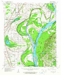 1961 Jericho1963 Print · USGSThe Mississippi River delta at the start of the 1960s reveals a world of island farming and rail-side settlements along the Arkansas-Tennessee border. Genealogists can trace family roots through numerous local landmarks, including Jericho, Clarkedale, and the St Paul School and Church.
 - 1961 Map of Rialto, 1963 Print
 1961 Rialto1963 Print · USGSWest Tennessee in the early sixties was a landscape of river-bottom farms and interconnected parish life along the Hatchie River. Researchers can trace the heritage of Covington and Ripley, alongside rural landmarks like the Fort Pillow State Prison Farm and Plumer Grove Ch & Sch.
 - 1962 Map of Rialto
 1962 Rialto1962 Print · USGSTipton and Lauderdale counties are mapped here in the early sixties, showing a landscape defined by the Hatchie River and the Illinois Central line. Genealogists can locate many local landmarks, including Rialto Ch & Sch, Canaan Cem, and the Fort Pillow State Prison Farm.
 - 1962 Map of Jericho
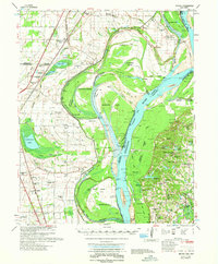 1962 Jericho1962 Print · USGSThe riverfront border of Arkansas and Tennessee is captured here in the early sixties, showing a landscape shaped by the Mississippi River. Genealogists and local historians can trace family roots through sites like Jericho, James Mill, and Lambethville, or locate rural landmarks such as Pecan Point Cem and the Shawnee Sch.
 - 1963 Map of Osceola, 1966 Print
 1963 Osceola1966 Print · USGSThe river borders of Tennessee and Arkansas meet along the bends of the Mississippi in the early sixties. Genealogists and historians can trace riverside settlements like Golddust and Randolph, or locate rural landmarks like Raven Cross Cem and St Johns Ch.
 - 1964 Map of Turnpike, 1965 Print
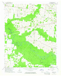 1964 Turnpike1965 Print · USGSThe Hatchie River lowlands of West Tennessee are captured here in the mid-sixties, showing a landscape defined by river bends and wetland basins. Researchers can locate vanished landmarks like New Hope School, Turnpike, and family sites such as Estes Cemetery and Walker School.2 unique versions available
 - 1965 Map of Osceola
 1965 Osceola1965 Print · USGSOsceola and the Mississippi River bottomlands are captured here in the mid-sixties, showing the complex boundary between Arkansas and Tennessee. Researchers can trace family roots through numerous rural landmarks like Golddust Ch & Sch, Grider, and Smyrna Ch.
 - 1965 Map of Brighton, 1966 Print
 1965 Brighton1966 Print · USGSWest Tennessee rural life is captured here in the mid-sixties as the Illinois Central railroad connects small communities across the Tipton and Shelby county line. Genealogists and local historians can locate many family landmarks, from the Dunlap Orphanage to the Morrison Cem and Shiloh Ch.3 unique versions available
 - 1965 Map of Arlington, 1966 Print
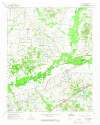 1965 Arlington1966 Print · USGSIn the mid-sixties, this section of West Tennessee centers on Arlington and its vital Louisville and Nashville Railroad corridor. Genealogists can locate family landmarks like Robinson Cem, Bethel Ch, and Barret Chapel High Sch.3 unique versions available
 - 1965 Map of Mason, 1966 Print
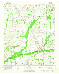 1965 Mason1966 Print · USGSThe rural Tipton and Fayette County borderlands are seen here in the mid-1960s, a landscape defined by rail lines and fertile bottomlands. Genealogists can trace family landmarks like Salem Ch, Braden-Sinai Sch, and the Louisville and Nashville rail corridor.3 unique versions available
 - 1969 Map of Mason
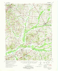 1969 Mason1969 Print · USGSWest Tennessee in the late sixties reveals a landscape of rural junctions and evolving infrastructure across Tipton, Shelby, and Fayette counties. Genealogists can trace family names at Dunlap Orphanage or local schools like Bloomington Sch and St Mathews Sch.
Showing maps 1-25 of 143
Top cities of Tipton County
- Covington historical maps
- Atoka historical maps
- Munford historical maps
- Brighton historical maps
- Mason historical maps
- Gilt Edge historical maps
See more
Frequently asked questions
- What are the different types of historical maps available for Tipton County?
- What is the oldest map of Tipton County?
- Where can I purchase historical maps of Tipton County for my home or office?
- Where can I download high-res historical maps of Tipton County?
- Are there historical topographic maps available for Tipton County?
- Is there historical aerial imagery available for Tipton County?
- Where are historical maps of Tipton County sourced from?