Old Maps of Weakley County, Tennessee for Genealogy
Trace your family roots with 118 historic maps of Weakley County. These high-res maps reveal old neighborhoods, homesites, landmarks, and streets — helping you uncover where your ancestors lived and how the area evolved over time.
- Explore historic neighborhoods: Identify where your relatives may have lived in the 1800s or 1900s.
- Compare maps over time: Trace the changes in streets, buildings, and landmarks for multi-generational research.
- Perfect for genealogy & ancestry research: Used by family historians and researchers to map out lineage and migration.
These maps are an incredible resource for exploring your personal connection to Weakley County's past.
Weakley County, TN maps
(118)- 1950 Map of Martin, 1952 Print
 1950 Martin1952 Print · USGSWeakley County at mid-century reveals a landscape shaped by higher education and intersecting rail lines. Genealogists and historians can trace family roots through numerous sites like Bible Union Ch, Freemans Chapel, and the Old McClain Cem.4 unique versions available
 - 1952 Map of Dresden, 1953 Print
 1952 Dresden1953 Print · USGSDresden and its surrounding Weakley County farmsteads are shown here during the early fifties at the height of the rail-and-river era. Researchers can locate family landmarks like Siloam Ch, Sunset Cem, and the path of the Nashville Chattanooga and St Louis Railroad.3 unique versions available
 - 1952 Map of Cuba, 1953 Print
 1952 Cuba1953 Print · USGSWestern Kentucky and Northwest Tennessee meet in the early fifties along a borderland of productive farmsteads and rural crossroads. Genealogists and local historians can trace family roots at Old Bethlehem Cem, Poyners Chapel, and the divided community of Dukedom.
 - 1952 Map of Water Valley, 1953 Print
 1952 Water Valley1953 Print · USGSIn the early 1950s, the border between Kentucky and Tennessee was a landscape of rail-driven towns and winding bayous. Genealogists and historians can trace family roots through landmarks like Camp Beauregard Cem, the settlement of Feliciana, and the Illinois Central rail line.
 - 1952 Map of Mayfield, 1957 Print
 1952 Mayfield1957 Print · USGSGraves County, Kentucky, was a bustling network of rail-side towns and rural parishes at the mid-century. Researchers can trace family history through dozens of landmarks like Rozzell Cem, follow the Illinois Central Railroad, or locate the County Farm.
 - 1952 Map of Water Valley, 1957 Print
 1952 Water Valley1957 Print · USGSWestern Kentucky and northern Tennessee are captured here in the early fifties as the Illinois Central railroad linked farming hubs and small towns. Genealogists can trace family names through dozens of landmarks like Camp Beauregard Cem, McWhort Cem, and Shiloh Sch Ch.
 - 1952 Map of Lynnville, 1973 Print
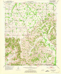 1952 Lynnville1973 Print · USGSSouthern Graves County and the Tennessee borderlands are captured in the early fifties, showing a landscape defined by small farming hamlets and family homesteads. Genealogists can trace rural lifelines through sites like Burnett Chapel, Cuba High Sch, and dozens of burial grounds like Tibbs Cem.
 - 1954 Map of Rutherford, 1955 Print
 1954 Rutherford1955 Print · USGSGibson County in the mid-1950s is a landscape of river forks and rural rail lines. Trace family history through local landmarks like China Grove Sch, Walnut Grove Ch, and the Gulf Mobile and Ohio railroad through Rutherford.3 unique versions available
 - 1954 Map of Greenfield, 1955 Print
 1954 Greenfield1955 Print · USGSMid-century West Tennessee comes to life along the rail-and-river corridor of Weakley County. Genealogists and local historians can trace family roots through numerous rural landmarks like Brocks Chapel, Highland Cem, and the small settlement of Kimery.3 unique versions available
 - 1954 Map of Bradford, 1955 Print
 1954 Bradford1955 Print · USGSGibson County is captured in the mid-fifties as a landscape of rural crossroads and rail-connected towns. Researchers can trace family history through numerous landmarks like Skullbone, Locust Grove Cem, and the Illinois Central line.3 unique versions available
 - 1956 Map of Gardner
 1956 Gardner1956 Print · USGSWeakley and Obion counties are captured here in the mid-fifties, showing a rural Tennessee landscape defined by family farmsteads and the Nashville Chattanooga and St Louis rail line. Researchers can locate numerous family-named landmarks such as Shaddtown Cem, McKinney Cem, and Alamo Ch.3 unique versions available
 - 1956 Map of Harris, 1958 Print
 1956 Harris1958 Print · USGSThe borderlands of Obion and Weakley Counties are shown in the mid-fifties, centered on the North Fork Obion River. Researchers can trace old rail lines like the Illinois Central and find family landmarks like Morris Slave Cem and Pierce Station.3 unique versions available
 - 1956 Map of Mc Connell, 1958 Print
 1956 Mc Connell1958 Print · USGSWeakley County at the end of the steam era shows a landscape defined by the Illinois Central railroad and rural community centers. Genealogists can locate family landmarks like Chestnut Glade Sch, McFall Cem, and the church at Ruthville.3 unique versions available
 - 1956 Map of Latham, 1958 Print
 1956 Latham1958 Print · USGSWeakley County's agricultural heartland is captured here in the mid-fifties, centered on the North Fork Obion River bottomlands. Researchers can trace rural community life through numerous family burial grounds like Acree Cem and local landmarks like Bible Union Sch.2 unique versions available
 - 1956 Map of Palmersville, 1958 Print
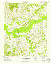 1956 Palmersville1958 Print · USGSThe rural landscape around Palmersville comes alive in this mid-century survey of Weakley County. Genealogists can trace family names through dozens of landmarks like Union Hall Ch, Palmer Cem, and the Union No 1 Sch.2 unique versions available
 - 1956 Map of Dyersburg, 1960 Print
 1956 Dyersburg1960 Print · USGSThe Four Rivers region comes alive in the mid-fifties, capturing the intricate borderlands of Tennessee, Kentucky, and Missouri. Genealogists and historians can trace the rail-and-river networks connecting Dyersburg, Caruthersville, and the shoreline of Reelfoot Lake.4 unique versions available
 - 1957 Map of Como, 1958 Print
 1957 Como1958 Print · USGSWeakley County at the end of the post-war decade is a landscape of tight-knit rural communities and family farms. Researchers can trace ancestral locations through numerous landmarks like Wesleys Chapel, Owens Cem, and the settlement of Ore Springs.3 unique versions available
 - 1966 Map of Trezevant West, 1968 Print
 1966 Trezevant West1968 Print · USGSCarroll and Weakley Counties are captured in the mid-sixties as the rural landscape remained centered on small crossroads like Christmasville and Holly Leaf. Trace the Louisville and Nashville line or locate family landmarks like Staffords Store and Republican Grove Ch.2 unique versions available
 - 1967 Map of Pillowville, 1968 Print
 1967 Pillowville1968 Print · USGSWeakley County farmland and clay mining operations define this West Tennessee landscape in the late sixties. Genealogists and local historians can trace family locations near Pillowville, Crowley Store, and several rural landmarks like Gearing Chapel and Hopewell Cem.3 unique versions available
 - 1967 Map of Trezevant East, 1969 Print
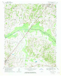 1967 Trezevant East1969 Print · USGSCarroll County in the late sixties reveals a landscape of river-bottom farms and rail-line settlements. Genealogists can trace local roots through St Johns Cem, New Zion, and family-named landmarks like Presely Lake.2 unique versions available
 - 1967 Map of Mc Kenzie, 1969 Print
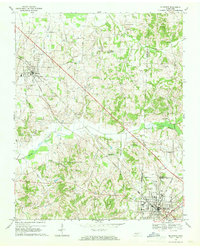 1967 Mc Kenzie1969 Print · USGSThe rural landscape around McKenzie and Gleason is captured here in the late sixties, where three counties meet along the Louisville and Nashville line. Researchers can trace the grounds of Bethel College and find local landmarks like Tumbling Creek Cem and Everett Chapel.2 unique versions available
 - 1969 Map of Water Valley, 1971 Print
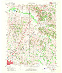 1969 Water Valley1971 Print · USGSThe Kentucky and Tennessee borderlands are captured here in the late sixties as the new parkway system began to reshape the rural landscape. Researchers can trace family history at Wesley Cem and Boaz Chapel or explore the site of Camp Beauregard near Water Valley.2 unique versions available
 - 1972 Map of Martin
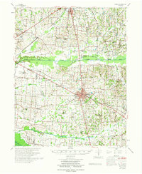 1972 Martin1972 Print · USGSWeakley and Obion Counties are captured here in the early 1970s as agricultural communities centered around the rail junction at Martin. Genealogists can trace family landmarks like Morris Slave Cem, Chestnut Glade Sch, and the Crockett Cem.
 - 1977 Map of Cuba
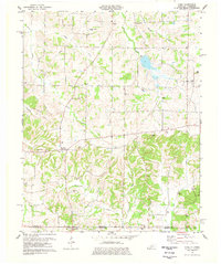 1977 Cuba1977 Print · USGSGraves County, Kentucky, and the Tennessee borderlands are captured here in the late seventies, showing a landscape defined by small farms and creek bottoms. Genealogists can trace family names through dozens of sites like Neale Cem and Adams Cem or locate community anchors such as Pilot Oak and Little Bethel Ch.
 - 1977 Map of McKenzie
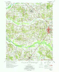 1977 McKenzie1977 Print · USGSWest Tennessee rail and river networks converge at McKenzie during the mid-seventies, showing the region's transition into the modern era. Genealogists and historians can trace family locations near Bethel College, the rural Stafford Store, or old country sites like Christmasville.
Showing maps 1-25 of 118
Top cities of Weakley County
- Martin historical maps
- Dresden historical maps
- Greenfield historical maps
- Gleason historical maps
- Sharon historical maps
Frequently asked questions
- What are the different types of historical maps available for Weakley County?
- What is the oldest map of Weakley County?
- Where can I purchase historical maps of Weakley County for my home or office?
- Where can I download high-res historical maps of Weakley County?
- Are there historical topographic maps available for Weakley County?
- Is there historical aerial imagery available for Weakley County?
- Where are historical maps of Weakley County sourced from?