2020s Maps of Williamson County, Tennessee
Explore 20 historic maps of Williamson County from the 2020s. These maps offer a rare glimpse into what life looked like during the 2020s — showing old roads, neighborhoods, homes, and landmarks that have changed or disappeared over time.
Whether you're researching your family's past, planning a metal detecting trip, or studying how Williamson County's landscape evolved across the 2020s, these high-resolution maps are a powerful tool for exploring the history of this region.
- Focus on a specific era: All maps on this page are from the 2020s, giving you a focused view of this time period.
- See what’s changed: Compare century-old streets, trails, and buildings to today's modern landscape using overlays and satellite layers.
- Research with precision: Use these maps for genealogy, historical research, land use analysis, or educational projects.
- View, download, or print: Maps are fully viewable online in high resolution, and can be downloaded or printed for your own records.
Start exploring Williamson County's history through authentic maps from the 2020s. This is your window into the past.
Williamson County, TN maps
(20)- 2022 Map of Kingston Springs, 2022 Print
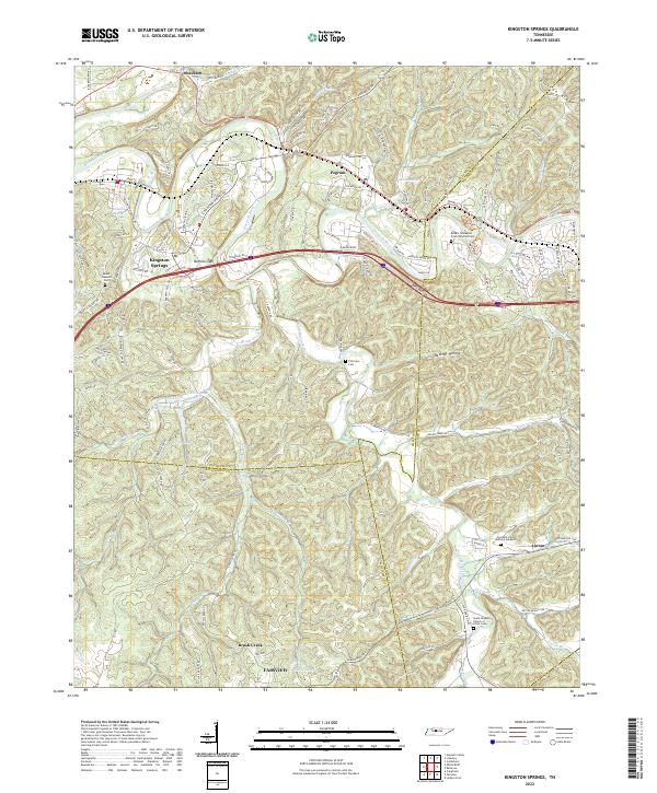 2022 Kingston Springs2022 Print · USGSThe Harpeth River valley and its surrounding hollows are captured here as they appeared in the early 2020s. Researchers can locate family landmarks like Thornton Cem, trace old routes like Old Harding Pike, or explore the settlement patterns of Kingston Springs and Linton.
 - 2022 Map of Antioch, 2022 Print
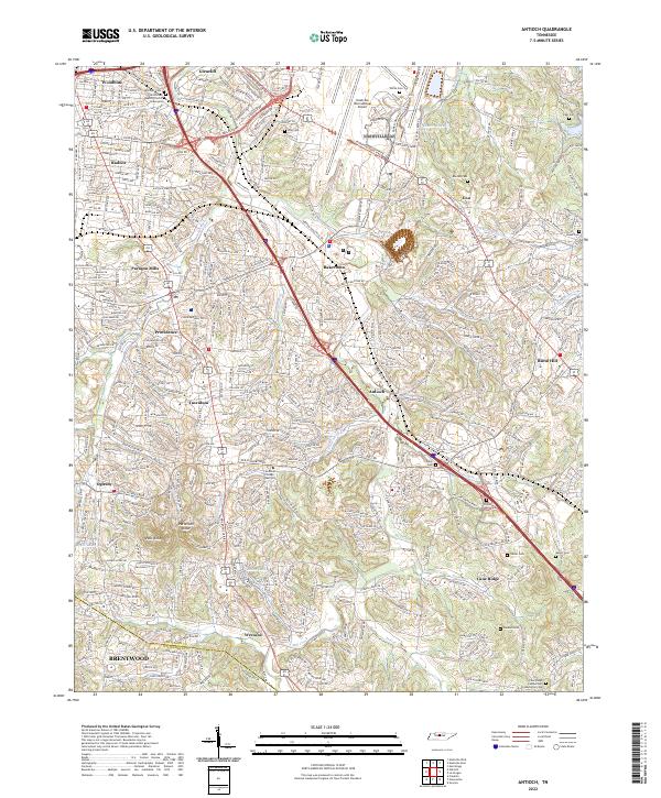 2022 Antioch2022 Print · USGSSoutheast of Nashville in the early twenty-first century, this area shows a dense mix of historical crossroads and modern suburban sprawl. Genealogists can trace family names at Whitsett Cem or Sanders Cem and locate landmarks like Mill Creek Baptist Church.
 - 2022 Map of Bellevue, 2022 Print
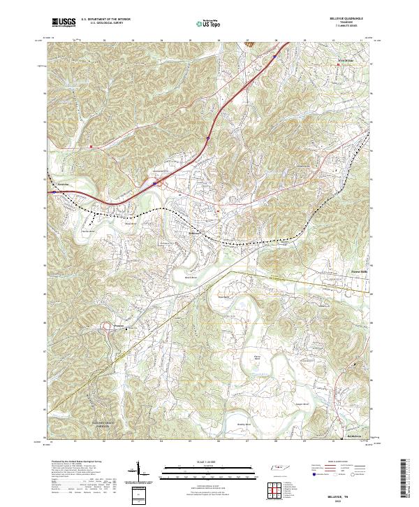 2022 Bellevue2022 Print · USGSThe Harpeth River valley and the southwestern suburbs of Nashville are captured in this modern survey. Researchers can trace historical transit routes and family-named landmarks like Pasquo Cem, the Natchez Trace Parkway, and Vaughns Gap.
 - 2022 Map of Bethesda, 2022 Print
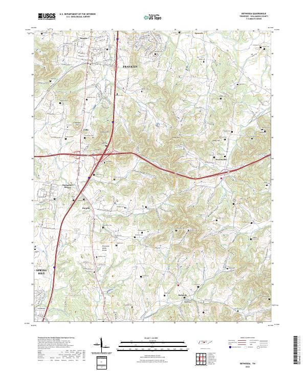 2022 Bethesda2022 Print · USGSThe rolling hills of Williamson County south of Franklin are home to historic crossroads and numerous family burial sites. Genealogists and historians can trace the landscape around Thompson's Station and Bethesda, locating sites like the Bethesda Methodist Church Cem and Gosey Hill.
 - 2022 Map of Chapel Hill, 2022 Print
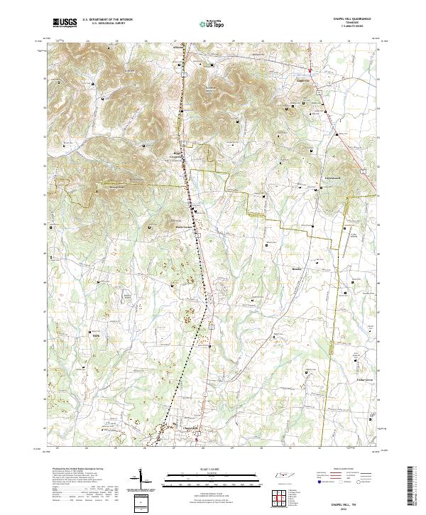 2022 Chapel Hill2022 Print · USGSMarshall County and its neighboring borderlands appear here in the 2020s, showcasing a landscape defined by the Tennessee Valley Divide and rural settlement hubs. Genealogists and local historians can trace family roots through numerous sites like Ogilvie Cemetery Rd, Riggs Crossroads, and Giles Cem.
 - 2022 Map of Franklin, 2022 Print
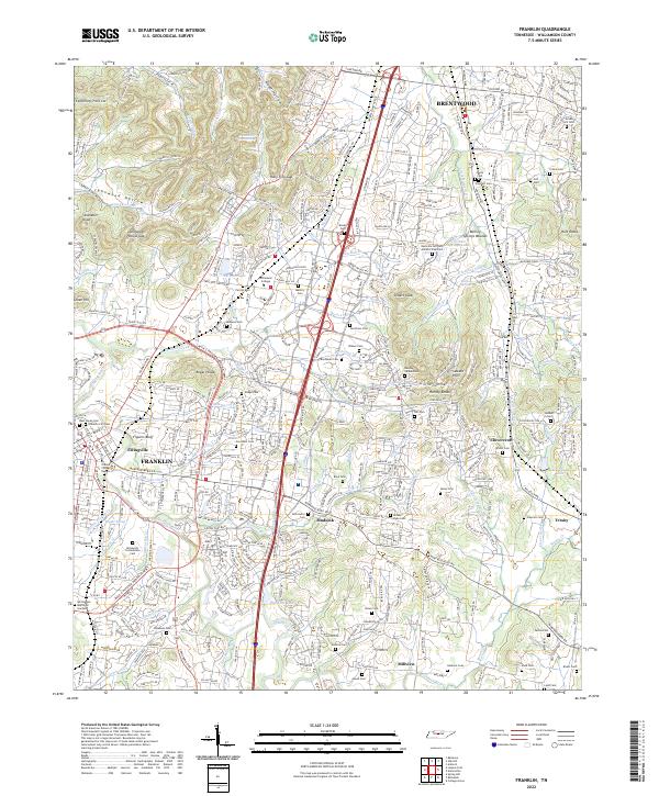 2022 Franklin2022 Print · USGSWilliamson County at the start of the 2020s shows the suburban growth of Brentwood and Franklin. Researchers can locate dozens of family-named burial sites, from Primm Cem to the McGavock Confederate Cem, and trace landmarks like Boiling Springs Mounds.
 - 2022 Map of Rockvale, 2022 Print
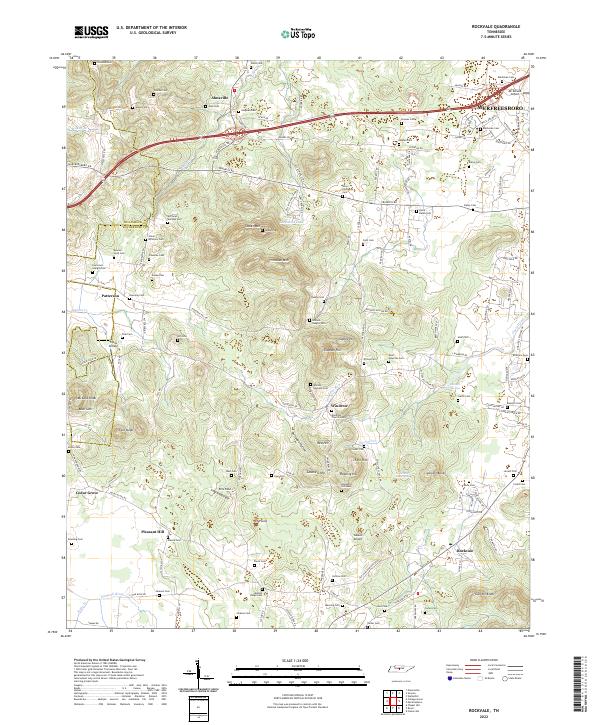 2022 Rockvale2022 Print · USGSRutherford County at the start of the 2020s shows a landscape where growing suburbs meet historic family farmsteads and springs. Researchers can trace dozens of ancestral burial sites like McClaren - Marable Cem and unique landmarks such as Snail Shell Cave Spring.
 - 2022 Map of Rally Hill, 2022 Print
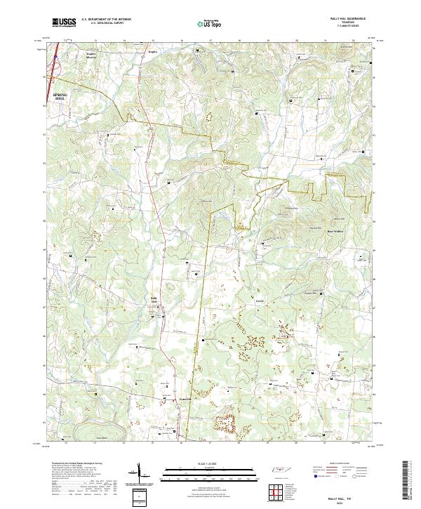 2022 Rally Hill2022 Print · USGSThe Tennessee countryside south of Spring Hill is captured here during its modern development while still preserving dozens of family landmarks. Genealogists can trace family burial sites like Moses Family Cem and Smithson Cem or locate old community centers at Rally Hill and Pottsville.
 - 2022 Map of Nolensville, 2022 Print
 2022 Nolensville2022 Print · USGSNolensville and its surrounding ridges come into focus in this contemporary study of the Williamson County landscape. Researchers can locate dozens of family-named burial sites such as Jane Hamer Cem and McCanless Cem, alongside landmarks like McMahan Knob.
 - 2022 Map of Carters Creek, 2022 Print
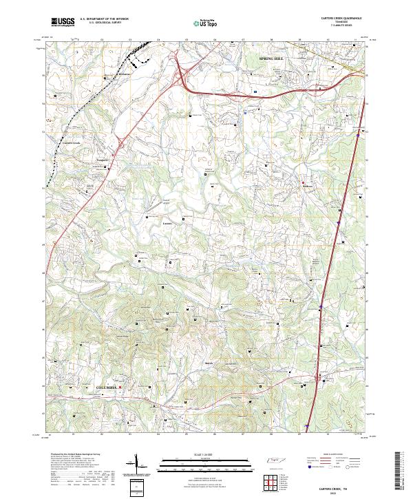 2022 Carters Creek2022 Print · USGSThe northern edge of Maury County comes into focus in this contemporary survey of the lands between Spring Hill and COLUMBIA. Genealogists can trace family names across Old Brick Church Cem, Aiken Ridge, and the University of Tennessee Experimental Farm Lake.
 - 2022 Map of White Bluff, 2022 Print
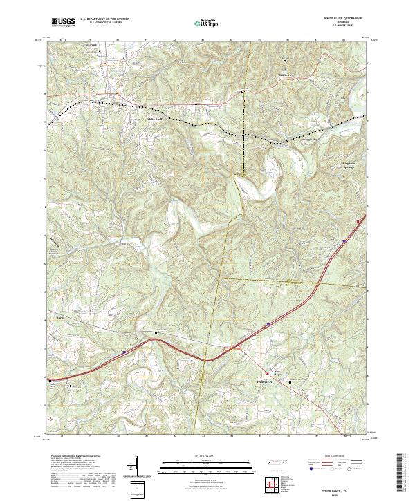 2022 White Bluff2022 Print · USGSThe rural hills of Dickson and Cheatham counties are documented here in the early twenty-first century, showing the established communities of White Bluff and Bell Town. Genealogists can trace local legacies through family landmarks like the Pinkerton Cem, Carothers Cem, and Martin Garton Cem.
 - 2022 Map of Oak Hill, 2022 Print
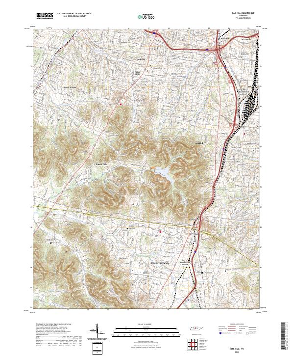 2022 Oak Hill2022 Print · USGSThe southern suburbs of Nashville and the city of Brentwood are shown here in the 2020s as modern development meets legacy landmarks. Researchers can trace historic sites like the Midway Plantation Slave Cem, Johnson Chapel Cem, and Lipscomb University.
 - 2022 Map of Theta, 2022 Print
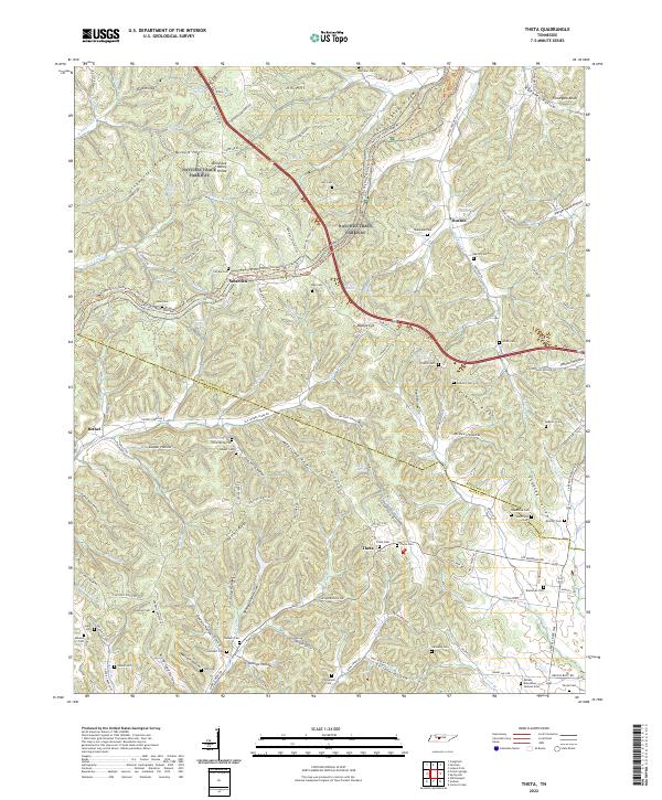 2022 Theta2022 Print · USGSThe Williamson and Maury county line comes alive in this study of Tennessee's ridge-and-hollow country. Genealogists can locate family landmarks like Theta Cem, Cave Spring Cem, and the small settlements of Smarden and Boston.
 - 2022 Map of Craigfield, 2022 Print
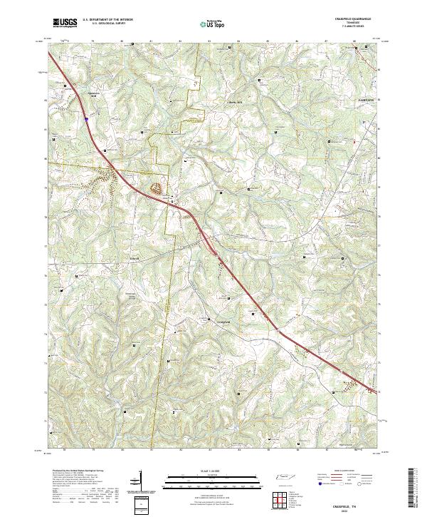 2022 Craigfield2022 Print · USGSMid-state Tennessee ridge country comes into focus here during the early twenty-first century, showing the rural communities between the forks of the Turnbull and Harpeth. Genealogists can trace family burial sites like Jack Lampley Cem and Tomlinson Cem near Craigfield.
 - 2022 Map of Primm Springs, 2022 Print
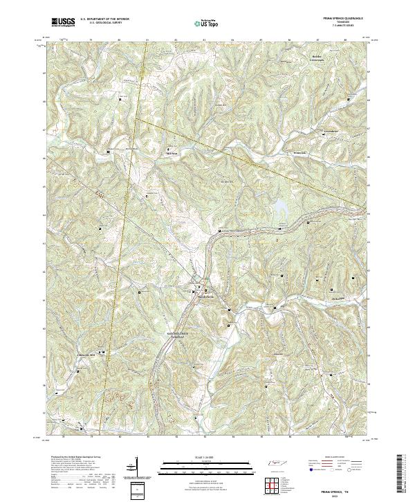 2022 Primm Springs2022 Print · USGSMaury and Williamson Counties appear in this modern survey of the Tennessee uplands along the historic Natchez Trace. Genealogists can trace family roots through dozens of pioneer burial grounds like Kinderhook Cem, Warf Cem, and Mayberry Cem.
 - 2022 Map of College Grove, 2022 Print
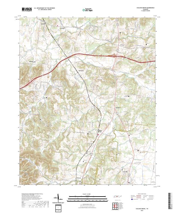 2022 College Grove2022 Print · USGSWilliamson County's rural character remains evident in the early twenty-first century as historic pike roads connect long-standing communities. Genealogists can trace family footprints across numerous sites like the Newton Cannon Cem, Pull Tight, and Locust Ridge Cem.
 - 2022 Map of Spring Hill, 2022 Print
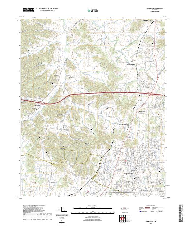 2022 Spring Hill2022 Print · USGSSpring Hill and Thompson's Station are shown during a period of modern growth in this Tennessee landscape. Researchers can trace family history through numerous burial sites like Harrison Cem and Beasley Cem, or explore the terrain of Peckerwood Hollow.
 - 2022 Map of Fairview, 2022 Print
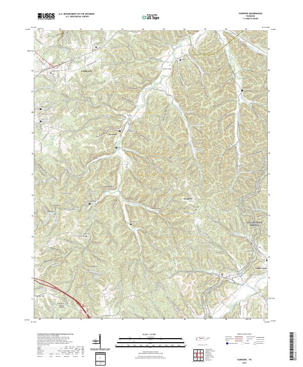 2022 Fairview2022 Print · USGSThe hills of Williamson and Davidson counties appear in sharp detail during this modern era of development. Genealogists can locate family burial grounds like Pewitt Cem and King Cem while tracing the winding path of the South Harpeth River.
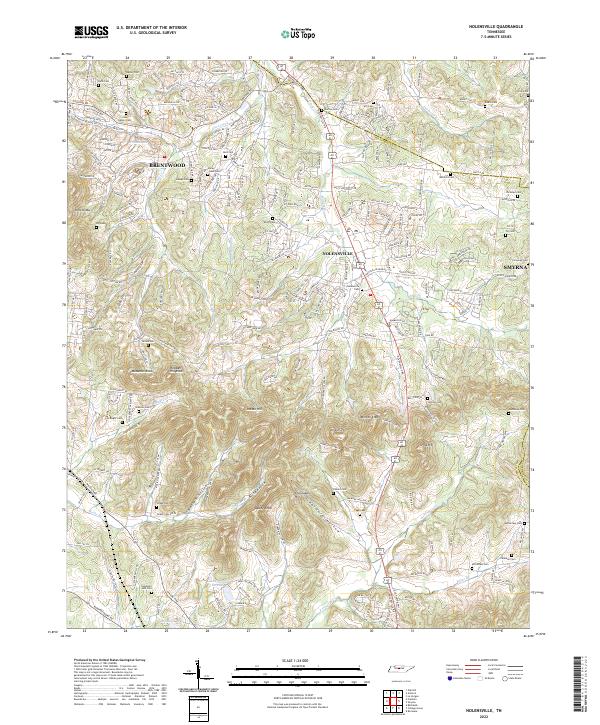
 - 2022 Map of Smyrna, 2022 Print
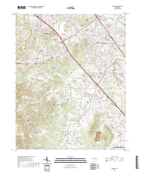 2022 Smyrna2022 Print · USGSRutherford County in the early twenty-first century shows a fascinating blend of rapid development and preserved family history. Genealogists can trace ancestral sites like the Sam Davis Cem, Hill-Roulhac Cem, and the community of Rocky Fork.
 - 2022 Map of Leipers Fork, 2022 Print
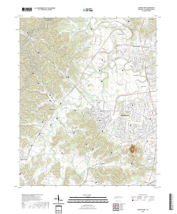 2022 Leipers Fork2022 Print · USGSThe rolling hills of Williamson County west of Franklin appear here in the early twenty-first century, preserving a dense network of family heritage. Genealogists can locate numerous pioneer burial sites including the Ashlin Moore Family Cem, Boxley Cem, and Short-Poynor Cem.
End of results
Showing maps 1-20 of 20
Top cities of Williamson County
- Franklin historical maps
- Brentwood historical maps
- Nolensville historical maps
- Fairview historical maps
- Thompson's Station historical maps
Frequently asked questions
- What are the different types of historical maps available for Williamson County?
- What is the oldest map of Williamson County?
- Where can I purchase historical maps of Williamson County for my home or office?
- Where can I download high-res historical maps of Williamson County?
- Are there historical topographic maps available for Williamson County?
- Is there historical aerial imagery available for Williamson County?
- Where are historical maps of Williamson County sourced from?