1980s Maps of Armstrong County, Texas
Explore 15 historic maps of Armstrong County from the 1980s. These maps offer a rare glimpse into what life looked like during the 1980s — showing old roads, neighborhoods, homes, and landmarks that have changed or disappeared over time.
Whether you're researching your family's past, planning a metal detecting trip, or studying how Armstrong County's landscape evolved across the 1980s, these high-resolution maps are a powerful tool for exploring the history of this region.
- Focus on a specific era: All maps on this page are from the 1980s, giving you a focused view of this time period.
- See what’s changed: Compare century-old streets, trails, and buildings to today's modern landscape using overlays and satellite layers.
- Research with precision: Use these maps for genealogy, historical research, land use analysis, or educational projects.
- View, download, or print: Maps are fully viewable online in high resolution, and can be downloaded or printed for your own records.
Start exploring Armstrong County's history through authentic maps from the 1980s. This is your window into the past.
Armstrong County, TX maps
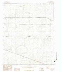
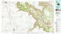
(15)- 1983 Map of Ashtola, 1984 Print
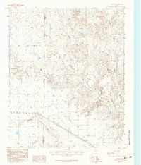 1983 Ashtola1984 Print · USGSDonley and Armstrong counties meet in this Panhandle landscape during the early 1980s. Genealogists and local historians can trace the rural community of Ashtola and map the watercourses of Salt Fork Red River and Mc Cullum Creek.
 - 1983 Map of Lark, 1984 Print
 1983 Lark1984 Print · USGSThe Texas Panhandle meets the breaking canyonlands of the Salt Fork Red River in the early 1980s. Local researchers can trace the old path of 66 through the settlement of Lark, alongside local Grain Bins and a rural Cem.
 - 1983 Map of Claude, 1984 Print
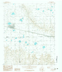
 1983 Claude1984 Print · USGSThe Texas Panhandle plains meet the winding breaks of the Red River watershed in the early 1980s. Local researchers can trace the growth of Claude, the small settlement of Malden, and the rugged course of Mulberry Creek through the local ranchlands.
 - 1983 Map of Claude SW, 1984 Print
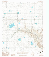
 1983 Claude SW1984 Print · USGSArmstrong County is shown in the early eighties as a landscape of intermittent waters and high plains topography. Researchers can trace the course of Mulberry Creek and the position of Badgley Lake in this precise provisional survey.
 - 1983 Map of Claude NE, 1984 Print
 1983 Claude NE1984 Print · USGSThe Texas Panhandle's open plains meet the winding cuts of the Salt Fork Red River in the early 1980s. Local researchers can trace the Carson Co boundary as it crosses industrial sites like a Gravel Pit and an extensive Underground Pipeline.
 - 1983 Map of Conway, 1984 Print
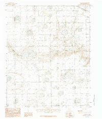
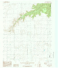
 1983 Conway1984 Print · USGSThe High Plains of the Texas Panhandle are captured here in the early eighties, centered on the historic crossroads at Conway. Researchers can trace the path of McClellan Creek and the jurisdictional divide between Carson Co and Armstrong Co.
 - 1983 Map of Groom, 1984 Print
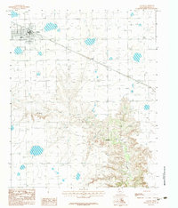
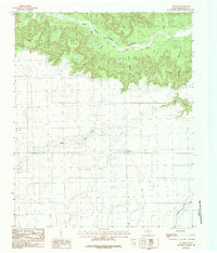
 1983 Groom1984 Print · USGSThe Texas Panhandle plains meet the rolling breaks of the Caprock in the early 1980s during a period of major highway expansion. Genealogists and local historians can trace the early layout of Groom, the small settlement of Boydston, and a rural Landing Strip.
 - 1983 Map of Goodnight, 1984 Print
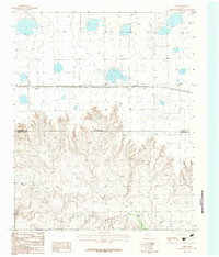
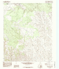
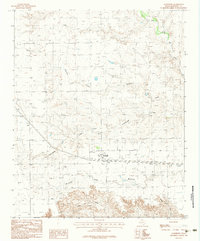 1983 Goodnight1984 Print · USGSArmstrong County ranching country is captured here in the early eighties, centered on the settlement of Goodnight. Researchers can trace the drainage of the Salt Fork Red River and locate local landmarks like the small Cem and Mc Cullum Creek.
 - 1984 Map of Pony Flats
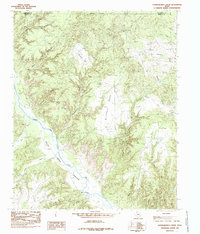
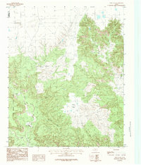 1984 Pony Flats1984 Print · USGSThe High Plains meet the canyon floor in Armstrong and Randall counties during the 1980s. Trace the winding Prairie Dog Town Fork Red River as it carves through Palo Duro Canyon State Park past Mc Farland Canyon and Pony Flats.
 - 1984 Map of Wesley Point
 1984 Wesley Point1984 Print · USGSThe High Plains of the Texas Panhandle meet the sharp breaks of the Palo Duro system in the early 1980s. Researchers can trace the drainage of South Cita Canyon and locate landmarks like Wesley Point and Happy Draw among the cattle country wells.
 - 1984 Map of Wayside
 1984 Wayside1984 Print · USGSThe High Plains of Armstrong County meet the breaks of the Red River in the mid-eighties. Researchers can trace the rural infrastructure of the era, from the Wayside settlement and its Landing Strip to landmarks like Indian Trail Point and the Historical Monument.
 - 1985 Map of Willow Arroyo
 1985 Willow Arroyo1985 Print · USGSBriscoe County ranching lands in the mid-1980s show a landscape of deep arroyos and cattle corrals where Armstrong and Donley counties meet. Trace the rugged drainage of Willow Arroyo and Stinkhole Divide to locate old water sources like Lone Tree Creek.
 - 1985 Map of Hardscrabble Creek
 1985 Hardscrabble Creek1985 Print · USGSThe High Plains of the Texas Panhandle meet the deep cuts of the Caprock during the mid-eighties. Researchers can trace the braided path of the Prairie Dog Town Fork Red River and find family-named landmarks like Mitchell Park and Hardscrabble Creek.
 - 1985 Map of Tulia
 1985 Tulia1985 Print · USGSThe Texas Panhandle in the mid-1980s displays a stark landscape where industrial agriculture meets the deep breaks of Palo Duro Canyon. Genealogists and researchers can trace rural life near Tulia or find old community centers like Vigo Park, Wayside, and Cleta.2 unique versions available
 - 1986 Map of Amarillo
 1986 Amarillo1986 Print · USGSAmarillo and the surrounding Texas Panhandle are captured here in the mid-eighties as a hub of energy, agriculture, and transport. Researchers can trace the sprawling Pantex Plant, the rail-side growth of Panhandle, and the deep cuts of Palo Duro Canyon.2 unique versions available
End of results
Showing maps 1-15 of 15
Top cities of Armstrong County
Frequently asked questions
- What are the different types of historical maps available for Armstrong County?
- What is the oldest map of Armstrong County?
- Where can I purchase historical maps of Armstrong County for my home or office?
- Where can I download high-res historical maps of Armstrong County?
- Are there historical topographic maps available for Armstrong County?
- Is there historical aerial imagery available for Armstrong County?
- Where are historical maps of Armstrong County sourced from?