Old Maps of Armstrong County, Texas for Genealogy
Trace your family roots with 186 historic maps of Armstrong County. These high-res maps reveal old neighborhoods, homesites, landmarks, and streets — helping you uncover where your ancestors lived and how the area evolved over time.
- Explore historic neighborhoods: Identify where your relatives may have lived in the 1800s or 1900s.
- Compare maps over time: Trace the changes in streets, buildings, and landmarks for multi-generational research.
- Perfect for genealogy & ancestry research: Used by family historians and researchers to map out lineage and migration.
These maps are an incredible resource for exploring your personal connection to Armstrong County's past.
Armstrong County, TX maps
(186)- 1954 Map of Amarillo, 1966 Print
 1954 Amarillo1966 Print · USGSThe Texas Panhandle in the mid-1960s shows a landscape of rising industrial power and deep-rooted ranching tradition. Local historians can trace the paths of the Panhandle and Santa Fe railroad or locate sites like the Pantex Ordnance Plant and Mobeetie.2 unique versions available
 - 1954 Map of Plainview, 1966 Print
 1954 Plainview1966 Print · USGSThe Texas Panhandle and the rugged Caprock Escarpment appear in detail as the region's agricultural and rail networks reached their mid-century peak. Trace family roots and old land patterns through the canyons and plains near Plainview, Palo Duro State Park, and Childress.3 unique versions available
 - 1956 Map of Fortress Cliff, 1957 Print
 1956 Fortress Cliff1957 Print · USGSPalo Duro Canyon’s geological landmarks and early park infrastructure are captured here in the mid-fifties. Researchers can trace historic landmarks like Lighthouse Peak, the Historical Battle Site Marker, and the route of the Miniature Railroad.4 unique versions available
 - 1956 Map of Washburn, 1957 Print
 1956 Washburn1957 Print · USGSThe Texas Panhandle comes alive in the mid-1950s at the vital rail crossing of Washburn, where two major lines met the legendary Route 66. Genealogists and rail historians can trace the local Washburn Cem and the busy junction of the Fort Worth and Denver and the Rock Island railroads.3 unique versions available
 - 1956 Map of Thomas Ranch, 1957 Print
 1956 Thomas Ranch1957 Print · USGSThe Texas Panhandle ranching landscape is captured here in the mid-1950s, highlighting the dramatic drop into Palo Duro Canyon. Genealogists and researchers can trace family-named sites like Thomas Ranch, Sorelle Ranch, and Owens Ranch.3 unique versions available
 - 1958 Map of Amarillo
 1958 Amarillo1958 Print · USGSThe Texas Panhandle in the mid-1950s reveals a landscape of expanding military installations and oil-rich rail towns. Local historians can trace the development of Amarillo Air Force Base or locate smaller settlements like Magic City and New Mobeetie.
 - 1958 Map of Plainview
 1958 Plainview1958 Print · USGSThe High Plains and Caprock Escarpment meet in the late fifties, showcasing the ranching and rail networks of the Texas Panhandle. Trace family roots and vanished stops along the Panhandle and Santa Fe railroad through Plainview, Silverton, and Matador.
 - 1960 Map of Fairview, 1961 Print
 1960 Fairview1961 Print · USGSArmstrong and Randall counties are shown here in the early 1960s, a period of established High Plains ranching. Researchers can trace historic property boundaries and family-named homesteads such as Willow Valley Farm, Butterfield, and the small community of Fairview.3 unique versions available
 - 1960 Map of Claude, 1961 Print
 1960 Claude1961 Print · USGSThe Texas Panhandle cattle country around the 1960s is defined here by the confluence of major railroads and the rugged breaks of the Red River. Trace the path of the Burlington line into Claude or locate landmarks like Conway and Mulberry Creek.2 unique versions available
 - 1960 Map of Groom, 1961 Print
 1960 Groom1961 Print · USGSThe Texas Panhandle plains meet the breaks of the Red River in the 1960s, where ranching culture and rail lines converge. Genealogists and historians can locate family landmarks like the Goodnight Cem and trace cattle operations at Thornberry Ranch or SJ Ranch.
 - 1960 Map of Wayside, 1962 Print
 1960 Wayside1962 Print · USGSThe Texas Panhandle in the early sixties reveals the dramatic vertical landscape of Palo Duro Canyon. Researchers can trace the 1874 Mackenzie Battleground, family ranch sites like Harrell Ranch, and the isolated community of Wayside.2 unique versions available
 - 1960 Map of Indian Peak, 1963 Print
 1960 Indian Peak1963 Print · USGSBriscoe County ranching and the deep cuts of the Panhandle canyons are recorded here in the early sixties. Researchers can find old cattle camps and family holdings including Woodburn Ranch, Indian Peak, and the Stinkhole Divide.
 - 1963 Map of Blue Hole Springs, 1966 Print
 1963 Blue Hole Springs1966 Print · USGSArmstrong County in the early sixties remains a remote landscape of canyons and cattle ranching. Map collectors and genealogists can trace the paths of old JEEP TRAILs leading to family landmarks like the Plains Corral and Blue Hole Springs.
 - 1963 Map of Luttrell Springs, 1966 Print
 1963 Luttrell Springs1966 Print · USGSArmstrong County in the early sixties shows a landscape of deep canyons and seasonal waterways before extensive modern development. Researchers can trace the rugged topography of Horseshoe Canyon and locate points like Luttrell Springs and Ransom.
 - 1963 Map of Buffalo Arroyo, 1966 Print
 1963 Buffalo Arroyo1966 Print · USGSDonley County and the Armstrong line appear in the early sixties as a rugged landscape of Panhandle breaks and creek beds. Trace the winding course of Mulberry Creek or locate local landmarks like the Fort Worth and Denver railroad and Buffalo Arroyo.
 - 1963 Map of Luttrell Springs NE, 1966 Print
 1963 Luttrell Springs NE1966 Print · USGSArmstrong County in the early 1960s was a landscape of small family settlements and rural school districts. Researchers can find old sites like Mt Pleasant Sch, the Cem, and rural homesites like Salt and Reed along Mulberry Creek.
 - 1963 Map of Paloduro, 1966 Print
 1963 Paloduro1966 Print · USGSArmstrong County ranch land and canyon breaks are captured in the early sixties as the landscape transition from high plains to the Red River valley. Trace the remote network of Jeep Trails through Wagon Wheel Gap and find landmarks like Mitchell Peak and Paloduro.2 unique versions available
 - 1963 Map of Tate Arroyo, 1966 Print
 1963 Tate Arroyo1966 Print · USGSDonley and Armstrong counties in the early 1960s reveal a landscape of expansive cattle ranges and intricate canyon drainages. Researchers can trace historic fence lines and cattle-country landmarks like Payne Flat, Tate Arroyo, and the broad bed of Mulberry Creek.
 - 1963 Map of Pleasant Creek, 1966 Print
 1963 Pleasant Creek1966 Print · USGSArmstrong County ranchlands meet the dramatic drop-off of the Caprock in the early sixties. Researchers can trace the rugged descent of Happy Road past Happy Point or locate various Well sites and water tanks across the Palo Duro Canyon floor.
 - 1963 Map of Gip Creek, 1966 Print
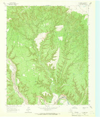 1963 Gip Creek1966 Print · USGSArmstrong County ranchlands meet the dramatic escarpments of the Panhandle in the early sixties. Researchers can trace the winding Prairie Dog Town Fork Red River through Palo Duro Canyon and locate remote ranch features like a Water tank.
 - 1965 Map of Big Betty Reservoir, 1967 Print
 1965 Big Betty Reservoir1967 Print · USGSThe Palo Duro Canyon system is revealed in its mid-century ranching prime, where the Briscoe and Armstrong county lines meet. Researchers can trace the legacy of cattle country through features like Campbell Creek Camp, Cyclone Pens, and Big Betty Reservoir.
 - 1965 Map of Vigo Park, 1967 Print
 1965 Vigo Park1967 Print · USGSBriscoe County and the surrounding Texas Panhandle ranch lands are captured here in the mid-sixties. Researchers can trace family landholdings and rural landmarks like Vigo Park, the San Jacinto Sch, and the McMurtry Farm.
 - 1969 Map of Jackson Hill, 1971 Print
 1969 Jackson Hill1971 Print · USGSThe Texas Panhandle in the late sixties remains a landscape of isolated ranching outposts and high plains terrain. Researchers can trace local lineage at Vigo Park Cem or locate the settlement of Ackley and the prominent rise of Jackson Hill.
 - 1969 Map of Tule Lake NW, 1971 Print
 1969 Tule Lake NW1971 Print · USGSThe Texas Panhandle's agricultural landscape comes alive in this late-1960s survey of the plains. Researchers can trace rural property lines and water sources along Happy Draw and locate specific sites like the Storage Bins near the county lines.
 - 1976 Map of Indian Peak NW, 1978 Print
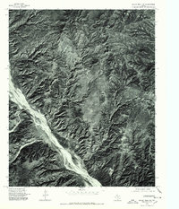 1976 Indian Peak NW1978 Print · USGSIn the mid-1970s, the canyons of Briscoe County remained a landscape defined by natural erosion and the path of the Prairie Dog Town Fork Red River. Researchers can study the unpaved terrain and plateau features like Mitchell Park as they appeared decades ago.
Showing maps 1-25 of 186
Top cities of Armstrong County
Frequently asked questions
- What are the different types of historical maps available for Armstrong County?
- What is the oldest map of Armstrong County?
- Where can I purchase historical maps of Armstrong County for my home or office?
- Where can I download high-res historical maps of Armstrong County?
- Are there historical topographic maps available for Armstrong County?
- Is there historical aerial imagery available for Armstrong County?
- Where are historical maps of Armstrong County sourced from?