1950s Maps of Atascosa County, Texas
Explore 13 historic maps of Atascosa County from the 1950s. These maps offer a rare glimpse into what life looked like during the 1950s — showing old roads, neighborhoods, homes, and landmarks that have changed or disappeared over time.
Whether you're researching your family's past, planning a metal detecting trip, or studying how Atascosa County's landscape evolved across the 1950s, these high-resolution maps are a powerful tool for exploring the history of this region.
- Focus on a specific era: All maps on this page are from the 1950s, giving you a focused view of this time period.
- See what’s changed: Compare century-old streets, trails, and buildings to today's modern landscape using overlays and satellite layers.
- Research with precision: Use these maps for genealogy, historical research, land use analysis, or educational projects.
- View, download, or print: Maps are fully viewable online in high resolution, and can be downloaded or printed for your own records.
Start exploring Atascosa County's history through authentic maps from the 1950s. This is your window into the past.
Atascosa County, TX maps
(13)- 1953 Map of Crystal City
 1953 Crystal City1953 Print · USGSSouth Texas in the early fifties was a landscape of expanding oil fields and vital rail connections. Genealogists and researchers can trace family lands along the Nueces River or locate heritage sites in Asherton, Big Wells, and Batesville.
 - 1954 Map of San Antonio, 1964 Print
 1954 San Antonio1964 Print · USGSSan Antonio and the Texas Hill Country are captured here in the mid-fifties, showing a landscape defined by massive military air bases and the rising Canyon Reservoir. Trace family ties through historic rail towns like D'Hanis and Castroville or explore the Cold War footprint of Lackland AFB and Randolph AFB.3 unique versions available
 - 1955 Map of Crystal City, 1976 Print
 1955 Crystal City1976 Print · USGSSouth Texas ranching and oil country come into focus in the mid-fifties as the rail lines and rivers connect growing hubs. Researchers can trace the development of energy fields like Washburn Oil Field or locate historic settlements from Asherton to Three Rivers.
 - 1956 Map of Suniland
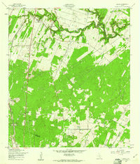
 1956 Suniland1956 Print · USGSLive Oak County ranching culture and rural infrastructure are captured here in the mid-fifties, just as the region’s landscape was maturing. Genealogists can trace family legacies through properties like the Poe Ranch and find defunct community hubs like North School and the Whitsett Pump Station.
 - 1956 Map of Pleasanton
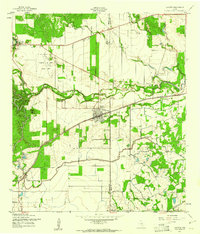
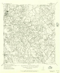 1956 Pleasanton1956 Print · USGSPleasanton and the surrounding Atascosa County ranches appear here as they were mapped between the world wars. Genealogists and local historians can trace family properties like the Coughran Ranch and find rural landmarks like Hickcock School and the Temple church.
 - 1956 Map of Jourdanton
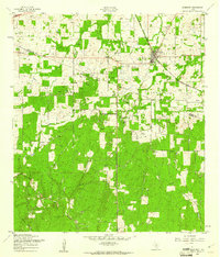
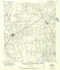 1956 Jourdanton1956 Print · USGSMid-century Atascosa County was a hub of South Texas ranching and rail activity as shown in this 1950s record. Genealogists and historians can locate family-named landmarks like Owdens Ranch, trace the San Antonio Southern rail line, or find the site of the Tobery School.
 - 1956 Map of Hindes
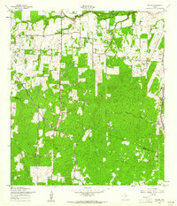
 1956 Hindes1956 Print · USGSSouth Texas ranching country comes alive in this mid-century survey of the Frio and La Salle county lines. Family history researchers can trace local landmarks like the Arnold School, Schoerp & Spettel Ranch, and rail stops at Prince Siding and Zella Siding.
 - 1956 Map of Franklin Settlement
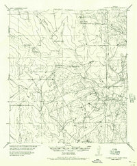 1956 Franklin Settlement1956 Print · USGSSouth Texas ranching life is well-documented in this mid-century survey of the Atascosa and McMullen county line. Genealogists can locate family holdings like Burmeister Ranch, Kenny Ranch, and the Franklin Settlement (Cross).
 - 1957 Map of San Antonio
 1957 San Antonio1957 Print · USGSSan Antonio and the Texas Hill Country are shown here during the mid-fifties, capturing the region's expanding post-war military and transportation footprint. Genealogists and local historians can trace the early residential boundaries of Alamo Heights or locate rural landmarks like St Hedwig and Medina Lake.
 - 1958 Map of Losoya, 1961 Print
 1958 Losoya1961 Print · USGSBexar County south of San Antonio was a landscape of river-valley settlements and rural education during the late 1950s. Genealogists and local historians can locate Our Lady of Mt Carmel Ch, the community of Losoya, and the Thelma Sch along the Missouri Pacific line.3 unique versions available
 - 1958 Map of La Coste, 1961 Print
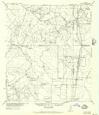
 1958 La Coste1961 Print · USGSMedina County during the late fifties shows a rural landscape shaped by the Medina River and the expanding irrigation systems of South Texas. Researchers can find long-standing landmarks like Our Lady of Grace Sch and the Castroville Air Force Auxiliary Field.3 unique versions available
 - 1958 Map of Somerset, 1961 Print
 1958 Somerset1961 Print · USGSThe oil-rich landscape south of San Antonio comes alive in the late fifties as the Somerset Oil Field reaches its peak. Genealogists and historians can trace the foundations of local life at Old Rock Ch, the Bexar Cem, and along the Missouri Pacific tracks.3 unique versions available
 - 1958 Map of Thelma, 1961 Print
 1958 Thelma1961 Print · USGSBexar County south of San Antonio is shown here in the late fifties as a landscape of rural settlements and oil extraction. Trace family roots and local history near Thelma, Oak Island, and the Thelma Tabernacle along the Missouri Pacific line.2 unique versions available
End of results
Showing maps 1-13 of 13
Top cities of Atascosa County
- Pleasanton historical maps
- Jourdanton historical maps
- Poteet historical maps
- Charlotte historical maps
- Leming historical maps
- Christine historical maps
See more
Frequently asked questions
- What are the different types of historical maps available for Atascosa County?
- What is the oldest map of Atascosa County?
- Where can I purchase historical maps of Atascosa County for my home or office?
- Where can I download high-res historical maps of Atascosa County?
- Are there historical topographic maps available for Atascosa County?
- Is there historical aerial imagery available for Atascosa County?
- Where are historical maps of Atascosa County sourced from?