1960s Maps of Atascosa County, Texas
Explore 28 historic maps of Atascosa County from the 1960s. These maps offer a rare glimpse into what life looked like during the 1960s — showing old roads, neighborhoods, homes, and landmarks that have changed or disappeared over time.
Whether you're researching your family's past, planning a metal detecting trip, or studying how Atascosa County's landscape evolved across the 1960s, these high-resolution maps are a powerful tool for exploring the history of this region.
- Focus on a specific era: All maps on this page are from the 1960s, giving you a focused view of this time period.
- See what’s changed: Compare century-old streets, trails, and buildings to today's modern landscape using overlays and satellite layers.
- Research with precision: Use these maps for genealogy, historical research, land use analysis, or educational projects.
- View, download, or print: Maps are fully viewable online in high resolution, and can be downloaded or printed for your own records.
Start exploring Atascosa County's history through authentic maps from the 1960s. This is your window into the past.
Atascosa County, TX maps
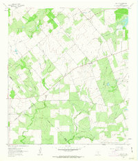
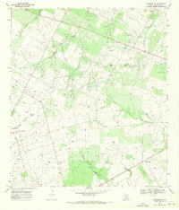
(28)- 1961 Map of Crystal City
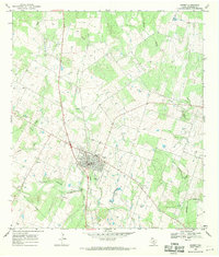
 1961 Crystal City1961 Print · USGSSouth Texas in the early sixties reveals a landscape of massive cattle ranches and emerging oil fields. Genealogists and historians can trace the Missouri Pacific rail lines through Crystal City, or locate water features like Espantosa Lake and Boynton Reservoir.
 - 1961 Map of Coy City, 1963 Print
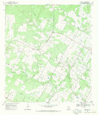
 1961 Coy City1963 Print · USGSThe Karnes County brush country is captured here in the early sixties, showing the rural crossroads of Coy City and Fashing. Researchers can trace the development of the local oil industry through a network of Pipelines and an isolated Landing Strip.
 - 1961 Map of Three Oaks, 1964 Print
 1961 Three Oaks1964 Print · USGSWilson County rural life in the early sixties revolved around small community centers like Three Oaks and Dewees. Researchers can locate family landmarks such as the Three Oaks Ch and Three Oaks Sch, or trace old industrial sites like the local Mines.2 unique versions available
 - 1961 Map of Fashing, 1964 Print
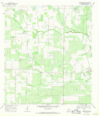
 1961 Fashing1964 Print · USGSThe South Texas brush country at the dawn of the 1960s reveals an landscape shaped by the Fashing Edwards Gas Field. Trace the development of Fashing and search for family roots at Brister Cem or Fashing Cem near Tordillo Hill.
 - 1964 Map of Saspamco SE, 1966 Print
 1964 Saspamco SE1966 Print · USGSThe rural borderlands of Wilson and Atascosa counties are captured in the mid-1960s, showing a landscape of scattered ranches and rising industry. Genealogists and local historians can locate Fairview and Stahl, alongside features like the Fairview Cem and several Oil Wells.2 unique versions available
 - 1964 Map of Leming, 1966 Print
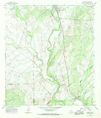
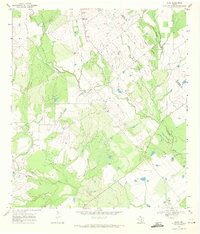
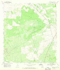
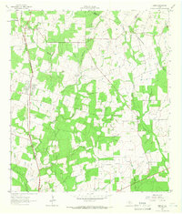 1964 Leming1966 Print · USGSAtascosa County in the mid-sixties reveals a landscape of ranching and rail-side settlements along the Missouri Pacific. Researchers can locate several historic burial sites like St Joseph Cem and family-named landmarks like Tumlinson Cem.2 unique versions available
 - 1964 Map of Lytle, 1966 Print
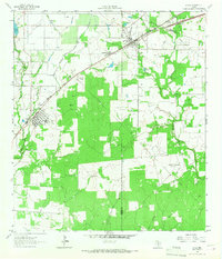 1964 Lytle1966 Print · USGSMid-century Atascosa and Medina Counties are shaped here by rail corridors and oil production. Trace the legacy of Lytle and Natalia along the Missouri Pacific near the Verna-Anacacho Oil Field.2 unique versions available
 - 1964 Map of Bigfoot, 1967 Print
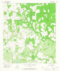 1964 Bigfoot1967 Print · USGSSouth Texas ranching and oil production define this area during the mid-sixties. Genealogists and historians can trace family-named sites like Brummett Cem and Moore Cem near the Big Foot Oil Field.
 - 1965 Map of Caballos Creek, 1966 Print
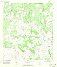
 1965 Caballos Creek1966 Print · USGSThe ranchlands of South Texas are captured here in the mid-1960s, showing a landscape defined by large cattle operations and petroleum exploration. You can trace the Old Railroad Grade or locate family sites like Peeler Ranch and the small Cem tucked away in the brush.
 - 1965 Map of Whitsett, 1968 Print
 1965 Whitsett1968 Print · USGSSouth Texas ranching and rail activity are captured here during the mid-sixties, centered on the Missouri Pacific line. Genealogists and historians can trace family-named sites like Tom Ranch and 74 Ranch or the small settlements of Campbellton and Whitsett.2 unique versions available
 - 1965 Map of Willow Hollow Tank, 1968 Print
 1965 Willow Hollow Tank1968 Print · USGSThe Live Oak County brush country during the mid-sixties reveals an active landscape of petroleum extraction and ranching. Genealogists and historians can trace the extent of the Jacob Oil Field, find the Landing Strip, and locate the Willow Hollow Tank.
 - 1965 Map of Peggy, 1969 Print
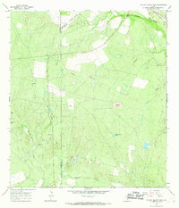
 1965 Peggy1969 Print · USGSThe South Texas brush country at the Atascosa and Live Oak county line comes into focus in the mid-1960s. Genealogists and local historians can trace small settlements like Peggy, McCoy, and Esseville or locate the rural cemetery near Salt Hollow.2 unique versions available
 - 1968 Map of Crystal City
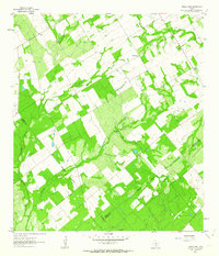
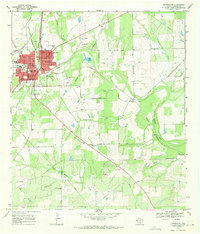
 1968 Crystal City1968 Print · USGSSouth Texas in the late sixties reveals a landscape shaped by ranching roots and the vital waters of the Nueces River. Researchers can trace the rail-driven growth of Crystal City or locate landmarks like Pilot Knob and Espantosa Lake.
 - 1968 Map of Jourdanton, 1971 Print
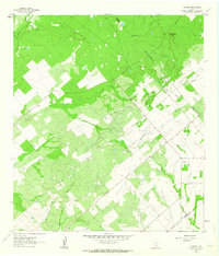
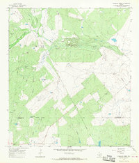
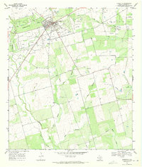
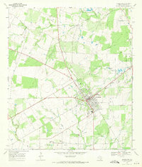 1968 Jourdanton1971 Print · USGSJourdanton in the late sixties is a thriving county seat defined by its connection to the energy industry and the natural flow of the Atascosa River. Researchers can trace the town's expansion near Mercy Hospital, locate family sites at Hilburn Cem, and map the extensive Jourdanton Oil Field.2 unique versions available
 - 1968 Map of Dobrowolski, 1971 Print
 1968 Dobrowolski1971 Print · USGSAtascosa County in the late sixties reveals a landscape shaped by the energy industry and deep family roots. Genealogists can locate named burial sites like Salazar Cem and Garcia Cem alongside the infrastructure of the BIGFOOT FIELD.
 - 1968 Map of Schattel, 1971 Print
 1968 Schattel1971 Print · USGSCrossing the Frio and Atascosa county line in the late sixties, this survey captures a South Texas landscape shaped by petroleum extraction. Researchers can locate the Miguel Cem and trace the industrial footprint of the Kyote Oil Field and Schattel.
 - 1968 Map of Charlotte, 1971 Print
 1968 Charlotte1971 Print · USGSCharlotte sits at the heart of the Atascosa County oil patch during the late sixties, where energy extraction meets South Texas ranch land. Genealogists and historians can locate specific wells in the Charlotte Oil Field or trace the course of Turkey Creek and Macho Creek.
 - 1968 Map of McCoy, 1971 Print
 1968 McCoy1971 Print · USGSThe Atascosa County brush country in the late sixties is defined here by the Atascosa River and the rural hubs of Campbellton and McCoy. Trace the Missouri Pacific rail line past Goose Lake, Big Lake, and the Campbellton Cem.3 unique versions available
 - 1968 Map of Christine West, 1971 Print
 1968 Christine West1971 Print · USGSAtascosa County in the late sixties reveals a landscape defined by the Jourdanton Oil Field and rural ranching. Researchers can trace the layout of Christine, locate family sites near La Parita, and see the network of Oil Wells and pipelines.
 - 1968 Map of Poteet, 1971 Print
 1968 Poteet1971 Print · USGSThe Atascosa River valley in the late sixties reveals a landscape of enduring family heritage and shifting infrastructure. Genealogists can locate numerous community landmarks such as Madre Dolorosa Cem, Herrera Cem, and the path of the Old Railroad Grade.2 unique versions available
 - 1968 Map of Leal, 1971 Print
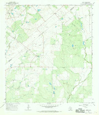
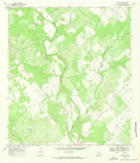
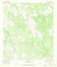
 1968 Leal1971 Print · USGSThe Atascosa River valley and the rural communities of South Texas are shown here during the late sixties. Researchers can trace the Missouri Pacific rail line and locate landmarks like the Leal Cem and the settlement of Black Hill.
 - 1968 Map of Rossville, 1971 Print
 1968 Rossville1971 Print · USGSAtascosa County in the late sixties is documented here as a landscape of small ranching communities and family homesteads. Researchers can locate numerous historic burial sites like Brite Cem and Vanness Cem, alongside the winding Atascosa River.2 unique versions available
 - 1968 Map of Pleasanton, 1971 Print
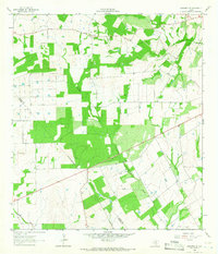
 1968 Pleasanton1971 Print · USGSAtascosa County as it appeared in the late sixties shows a mix of growing town life and active petroleum production. Family historians can locate rural landmarks like Saint Andrews Cem, the Imogene Oil Field, and the Missouri Pacific rail line.2 unique versions available
 - 1968 Map of Goldfinch, 1971 Print
 1968 Goldfinch1971 Print · USGSThe South Texas brush country at the end of the 1960s is marked here by its energy and mineral industry. Genealogists and historians can trace the West Charlotte Oil Field and the Luna Cem near Goldfinch and an Old Railroad Grade.2 unique versions available
 - 1969 Map of Christine East, 1971 Print
 1969 Christine East1971 Print · USGSAtascosa County ranchlands are documented here in the late sixties as the area transitioned away from rail dependency. Genealogists and local historians can trace family-named sites like Bautista Cem, the Old Railroad Grade, and Brown Lake.2 unique versions available
Showing maps 1-25 of 28
Top cities of Atascosa County
- Pleasanton historical maps
- Jourdanton historical maps
- Poteet historical maps
- Charlotte historical maps
- Leming historical maps
- Christine historical maps
See more
Frequently asked questions
- What are the different types of historical maps available for Atascosa County?
- What is the oldest map of Atascosa County?
- Where can I purchase historical maps of Atascosa County for my home or office?
- Where can I download high-res historical maps of Atascosa County?
- Are there historical topographic maps available for Atascosa County?
- Is there historical aerial imagery available for Atascosa County?
- Where are historical maps of Atascosa County sourced from?