Old Maps of Angleton, Texas for Metal Detecting
Plan your next treasure hunt with 13 historic maps of Angleton. Find old homesites, ghost towns, trails, and gathering spots that may be lost to time — perfect for identifying promising metal detecting locations.
- Locate forgotten sites: Uncover places like long-lost settlements, abandoned rail lines, or gathering spots.
- Plan better hunts: Use map overlays combined with LiDAR or satellite views to narrow in on historically rich areas.
- Made for detectorists: Thousands of hobbyists use these maps to discover relics, coins, and hidden history.
Use these historic maps to boost your research and find new opportunities beneath the surface of Angleton.
Angleton, TX maps
(13)- 1943 Map of Rosharon
 1943 Rosharon1943 Print · USGSBrazoria County agricultural and institutional life comes into focus during the early 1940s, centered on the rail corridor through Rosharon. Local researchers can trace old burial sites at Pilgrim Cem and Daughters Cem or locate the sprawling Ramsey State Farm.2 unique versions available
 - 1943 Map of Angleton, 1958 Print
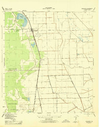
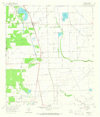
 1943 Angleton1958 Print · USGSAngleton and the surrounding Brazoria County prairies are shown here during the early 1940s, when the regional economy centered on the railroad and riverside farming. Researchers can trace historic family landmarks such as Bearle Chapel, Revelation Cem, and the Texas Agricultural Experimental Station.
 - 1943 Map of Snipe, 1959 Print
 1943 Snipe1959 Print · USGSCoastal Brazoria County was undergoing a mid-century transformation as suburban development met traditional river bottomlands. Researchers can trace the early street grid of Lake Jackson, the sprawling Retrieve State Farm, and local landmarks like Trueona Ch and Wharton Cem.2 unique versions available
 - 1950 Map of Houston, 1953 Print
 1950 Houston1953 Print · USGSCoastal Texas in the early fifties reveals a landscape of massive civil engineering and industrial transit. Genealogists and researchers can trace the growth of the Houston suburbs and the maritime infrastructure of Galveston Bay, including the Gulf Freeway and the Texas City Dike.
 - 1956 Map of Houston, 1963 Print
 1956 Houston1963 Print · USGSSoutheast Texas in the mid-fifties is captured here as a powerhouse of oil and maritime trade. Genealogists and historians can trace the foundations of Houston and its ports, alongside landmarks like the Rice Institute and the Spindletop Oil Field.2 unique versions available
 - 1963 Map of Angleton, 1966 Print
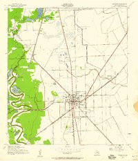
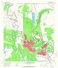
 1963 Angleton1966 Print · USGSBrazoria County undergoes significant development in the early sixties as the oil industry and regional rail lines reshape the prairie. Researchers can trace family history at Burrel Chapel Cem or locate the former Texas Agricultural Experimental Station and Bailes Airfield.3 unique versions available
 - 1963 Map of Rosharon, 1966 Print
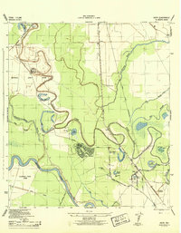
 1963 Rosharon1966 Print · USGSBrazoria County in the early 1960s was a landscape where old Texas plantations and newer oil fields converged along the Missouri Pacific railroad. Genealogists can trace family roots at Daughters Cem and Pilgrim Cem, or locate the historic Chenango Plantation.2 unique versions available
 - 1963 Map of Lake Jackson, 1966 Print
 1963 Lake Jackson1966 Print · USGSIn the early 1960s, the Brazos River bottomlands saw the rapid growth of Lake Jackson and Clute amidst established correctional units. Researchers can trace local development through Lake Jackson, Lake Jackson Farms, and neighborhood landmarks like St Michaels Ch.4 unique versions available
 - 1975 Map of Houston, 1977 Print
 1975 Houston1977 Print · USGSThe Texas Gulf Coast in the mid-seventies shows a sprawling Houston metropolis linked to the sea by the massive Houston Ship Channel. Researchers can trace the mid-century industrial landscape from the Astrodome to the Lyndon B. Johnson Space Center.2 unique versions available
 - 1984 Map of Angleton
 1984 Angleton1984 Print · USGSThe Texas Gulf Coast in the mid-eighties shows a landscape of salt domes and bayous at the height of its oil-and-river economy. Researchers can trace land use through the Damon Mound Oil Field and the sprawling State Department of Corrections (Retrieve Unit).2 unique versions available
 - 2022 Map of Angleton, 2022 Print
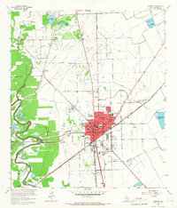
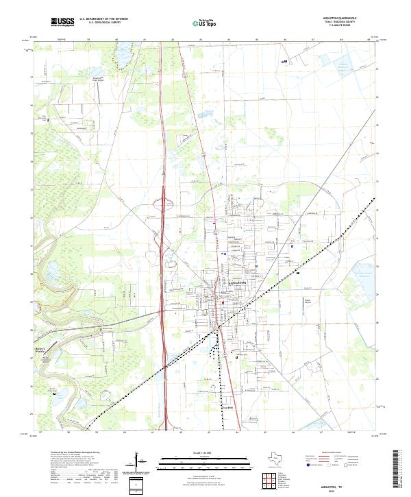 2022 Angleton2022 Print · USGSAngleton and the surrounding Brazoria County coastal plain are captured here in the early twenty-first century. Genealogists and local researchers can trace the proximity of the Brazoria County Courthouse to established neighborhoods and nearby Bailey's Prairie.
 - 2022 Map of Rosharon, 2022 Print
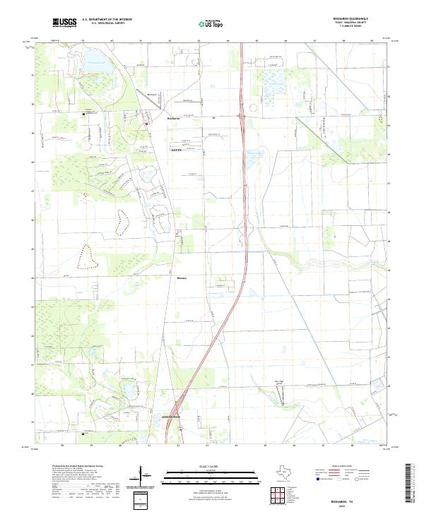 2022 Rosharon2022 Print · USGSBrazoria County's coastal prairie comes into focus in this recent survey of the lands between the growing outskirts of Alvin and Angleton. Genealogists and local historians can trace family locations near Rosharon or locate resting places at Pilgrims Knights-and- Daughters Cem and Providence Cem.
 - 2022 Map of Lake Jackson, 2022 Print
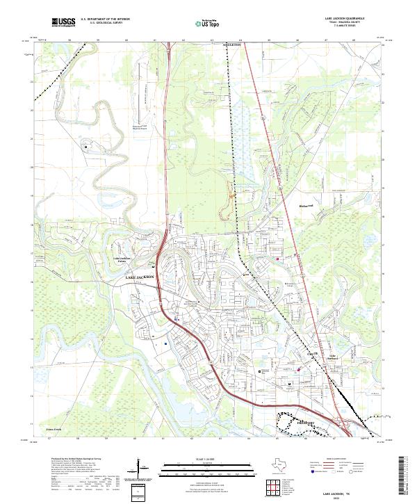 2022 Lake Jackson2022 Print · USGSCoastal Brazoria County in the early twenty-first century reveals a landscape defined by the winding Brazos River and the expanding suburbs of LAKE JACKSON. Researchers can trace local history through sites like Mount Zion Cem or follow the development of Brazosport College and the Texas Gulf Coast Regional Airport.
End of results
Showing maps 1-13 of 13
Top cities near Angleton
- Lake Jackson historical maps
- Alvin historical maps
- Iowa Colony historical maps
- Freeport historical maps
- Clute historical maps
- West Columbia historical maps
See more
Top neighborhoods of Angleton
Frequently asked questions
- What are the different types of historical maps available for Angleton?
- What is the oldest map of Angleton?
- Where can I purchase historical maps of Angleton for my home or office?
- Where can I download high-res historical maps of Angleton?
- Are there historical topographic maps available for Angleton?
- Is there historical aerial imagery available for Angleton?
- Where are historical maps of Angleton sourced from?