Old Maps of Burleson County, Texas for Metal Detecting
Plan your next treasure hunt with 131 historic maps of Burleson County. Find old homesites, ghost towns, trails, and gathering spots that may be lost to time — perfect for identifying promising metal detecting locations.
- Locate forgotten sites: Uncover places like long-lost settlements, abandoned rail lines, or gathering spots.
- Plan better hunts: Use map overlays combined with LiDAR or satellite views to narrow in on historically rich areas.
- Made for detectorists: Thousands of hobbyists use these maps to discover relics, coins, and hidden history.
Use these historic maps to boost your research and find new opportunities beneath the surface of Burleson County.
Burleson County, TX maps
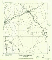
(131)- 1914 Map of Gay Hill
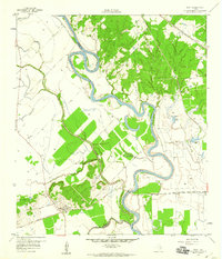
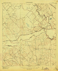 1914 Gay Hill1914 Print · USGSThe Brazos River valley in the early twentieth century shows a thriving rail-and-farm economy across three counties. Genealogists can trace family landmarks and rural school sites like Wiedes Store, Old Gay Hill, and the Allseeing Eye School.2 unique versions available
 - 1919 Map of Dime Box, 1956 Print
 1919 Dime Box1956 Print · USGSLee County and the surrounding Texas Brazos Valley are shown here just after the Great War, during a period of shifting settlements. Genealogists can trace early homesteads and community hubs near Old Dime Box, Loebau, and Shady Grove School.
 - 1954 Map of Austin, 1964 Print
 1954 Austin1964 Print · USGSCentral Texas is captured during a period of steady growth as the capital city and its neighboring farm towns began to modernize. Researchers can trace historic rail corridors like the Southern Pacific RR or locate landmarks such as Bergstrom Air Force Base and Pilot Knob.4 unique versions available
 - 1956 Map of Bryan
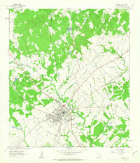
 1956 Bryan1956 Print · USGSBrazos County is shown in the era of early college expansion and steam rail, centered on the growing campus of Texas A&M College. Genealogists and historians can trace defunct post offices and rural school sites like Benchley P.O., Woodville School, and the settlement of Boonville.
 - 1956 Map of Caldwell
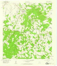
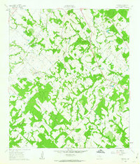
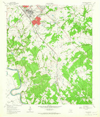
 1956 Caldwell1956 Print · USGSThe Brazos Valley at the end of the Great War era shows a landscape defined by cotton gins and river crossings. Trace family roots and vanished landmarks like Moseley's Ferry, Stone City, and the Skrabonek Gin near Caldwell.
 - 1956 Map of Milano
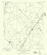
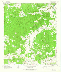
 1956 Milano1956 Print · USGSRailroad junctions and rural post offices define this Milam County landscape during the early twentieth century. Genealogists and historians can locate family-named landmarks like Septimus) Olson or trace the early paths of the San Antonio and Aransas Pass Railway.
 - 1956 Map of Somerville
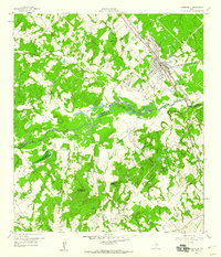
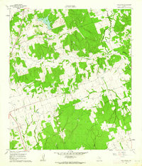
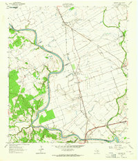
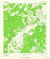
 1956 Somerville1956 Print · USGSThe rail junctions of Burleson County come into focus in this post-World War I era survey of the Brazos River valley hinterlands. Genealogists can locate family-named landmarks and rural hubs like Frenstat, Charlesville School, and Lyons P.O.
 - 1959 Map of Flag Pond, 1960 Print
 1959 Flag Pond1960 Print · USGSThe tri-county borderlands of Burleson, Lee, and Washington counties are captured here in the late fifties. Genealogists can trace rural communities through landmarks like Flat Prairie Cem, Post Oak Sch, and St Mary Ch.
 - 1959 Map of Gay Hill, 1960 Print
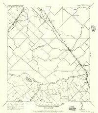
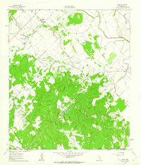
 1959 Gay Hill1960 Print · USGSWashington and Burleson Counties were shaped by the railroad and the oil patch during the late fifties. Genealogists and historians can trace the foundations of local life at Old Gay Hill Ch, the Clay Creek Oil Field, and the Gulf Colorado and Santa Fe rail line.3 unique versions available
 - 1959 Map of Clay, 1960 Print
 1959 Clay1960 Print · USGSNear the convergence of the Brazos and Yegua, this late-fifties survey reveals a landscape of winding river bends and vital rail junctions. Historians can trace the legacy of local settlements through Betts Ferry Cem, the rail lines of the Missouri Pacific, and the namesake Clay Pit.3 unique versions available
 - 1959 Map of Somerville, 1960 Print
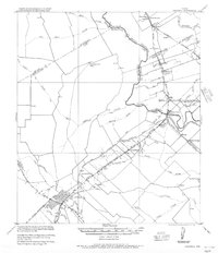
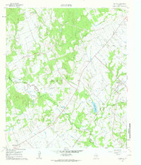
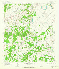
 1959 Somerville1960 Print · USGSSomerville was a bustling railway junction in the late fifties where the Burleson and Washington county lines meet along the river. Researchers can locate family sites like Schoppe Cem, Sweet Home, and the old Somerville Substa rail yard.
 - 1959 Map of Dime Box, 1960 Print
 1959 Dime Box1960 Print · USGSTexas ranching and rail history intersect in Lee County during the late fifties, where the original town sites are clearly delineated. Researchers can trace the path of El Camino Real and locate family landmarks like Sweet Home High Sch and Sandy Point Cem.4 unique versions available
 - 1959 Map of Independence, 1960 Print
 1959 Independence1960 Print · USGSTexas history remains etched into the landscape around Independence in the late fifties, from the original Baylor University State Park to the Gov Sam Houston Home. Trace family roots through rural landmarks like Sandy Hill, Union Hill Ch, and the Summers Cem.3 unique versions available
 - 1960 Map of Lyons, 1962 Print
 1960 Lyons1962 Print · USGSThe community of Lyons is captured here in the early 1960s, centered on the Gulf Colorado and Santa Fe railroad. Local researchers can trace family landmarks like the Lawrence Cem and Lone Oak Ch along the banks of Davidson Creek.2 unique versions available
 - 1960 Map of Snook, 1962 Print
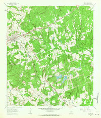
 1960 Snook1962 Print · USGSBurleson County in the early 1960s was a landscape of remote settlements and rail-dependent agriculture centered on the Snook community. Genealogists and local researchers can trace historic sites like Money Chapel, the Snook Cem, and the Gulf Colorado and Santa Fe railroad line.2 unique versions available
 - 1960 Map of Tanglewood, 1962 Print
 1960 Tanglewood1962 Print · USGSLee County as it appeared in the early 1960s was a landscape defined by the Southern Pacific rail line and rural church communities. Genealogists can locate family burial sites at Mt Zion Cem or German Cem and trace the paths of East Yegua Creek and its many branches.3 unique versions available
 - 1960 Map of Frenstat, 1963 Print
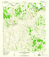
 1960 Frenstat1963 Print · USGSBurleson County, Texas, was a patchwork of small agricultural settlements and wooded creeks in the early sixties. Researchers can trace the rail corridors of the Southern Pacific and locate family sites near Frenstat and the Beaird Cem.2 unique versions available
 - 1960 Map of Deanville, 1963 Print
 1960 Deanville1963 Print · USGSBurleson and Lee counties in the early sixties reveal a landscape of rural schoolhouses and family cemeteries along the railroad. Genealogists can locate Sulphur Spring School, San Antonio Prairie Cemetery, and the original site of Old Dime Box.3 unique versions available
 - 1961 Map of Caldwell, 1963 Print
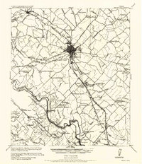
 1961 Caldwell1963 Print · USGSCaldwell was a bustling rail hub in the early sixties where major Texas lines crossed amidst a landscape of rural schools and Czech-influenced settlements. Researchers can locate the Hus Sch, the New Tabor Cem, and trace the path of the Old Railroad Grade.2 unique versions available
 - 1961 Map of Mumford, 1964 Print
 1961 Mumford1964 Print · USGSThe Brazos River valley in the early sixties is a landscape of rural junctions and historic outposts at the meeting point of four counties. Researchers can locate the Fort Tenoxtitlan (Site), the rail sidings at Mudville, and local landmarks like Smith Sch.3 unique versions available
 - 1961 Map of Wellborn, 1965 Print
 1961 Wellborn1965 Print · USGSBrazos County during the early 1960s showcases the growing footprint of Texas A & M University alongside traditional rail-side settlements. Genealogists and historians can trace rural life through landmarks like Salem Ch, the College Station Cem, and old stops along the Missouri Pacific railroad.4 unique versions available
 - 1962 Map of Goodwill, 1963 Print
 1962 Goodwill1963 Print · USGSThe rural borderlands of Burleson and Milam counties are captured here in the early 1960s, centered on the community of Hix. Genealogists and local historians can trace the foundations of this area through St Mathews Ch, the Hix Cem, and family-named hollows like Bailey Hollow.2 unique versions available
 - 1962 Map of Chriesman, 1964 Print
 1962 Chriesman1964 Print · USGSSettled along the tracks in Burleson County during the early sixties, this area shows a landscape shaped by rail and creek. Genealogists can trace family landmarks like Chriesman Cem, Liberty Ch, and the old Shiloh Sch.3 unique versions available
 - 1962 Map of Tunis, 1964 Print
 1962 Tunis1964 Print · USGSBurleson County in the early sixties reveals a landscape of river-bottom farms and small rail-stop communities. Genealogists and historians can trace family roots through sites like Salem Cem, the New Jerusalem Ch, and the settlement of Cooks Point.2 unique versions available
 - 1962 Map of Milano, 1964 Print
 1962 Milano1964 Print · USGSRailroad history and rural community life converge in early 1960s Texas at the busy junction of the Missouri Pacific and Santa Fe lines. Local researchers can trace family roots through landmarks like Sand Grove Ch, Hurt Cem, and the settlement at Elevation.2 unique versions available
Showing maps 1-25 of 131
Top cities of Burleson County
Frequently asked questions
- What are the different types of historical maps available for Burleson County?
- What is the oldest map of Burleson County?
- Where can I purchase historical maps of Burleson County for my home or office?
- Where can I download high-res historical maps of Burleson County?
- Are there historical topographic maps available for Burleson County?
- Is there historical aerial imagery available for Burleson County?
- Where are historical maps of Burleson County sourced from?