1950s Maps of Burleson County, Texas
Explore 11 historic maps of Burleson County from the 1950s. These maps offer a rare glimpse into what life looked like during the 1950s — showing old roads, neighborhoods, homes, and landmarks that have changed or disappeared over time.
Whether you're researching your family's past, planning a metal detecting trip, or studying how Burleson County's landscape evolved across the 1950s, these high-resolution maps are a powerful tool for exploring the history of this region.
- Focus on a specific era: All maps on this page are from the 1950s, giving you a focused view of this time period.
- See what’s changed: Compare century-old streets, trails, and buildings to today's modern landscape using overlays and satellite layers.
- Research with precision: Use these maps for genealogy, historical research, land use analysis, or educational projects.
- View, download, or print: Maps are fully viewable online in high resolution, and can be downloaded or printed for your own records.
Start exploring Burleson County's history through authentic maps from the 1950s. This is your window into the past.
Burleson County, TX maps
(11)- 1954 Map of Austin, 1964 Print
 1954 Austin1964 Print · USGSCentral Texas is captured during a period of steady growth as the capital city and its neighboring farm towns began to modernize. Researchers can trace historic rail corridors like the Southern Pacific RR or locate landmarks such as Bergstrom Air Force Base and Pilot Knob.4 unique versions available
 - 1956 Map of Bryan
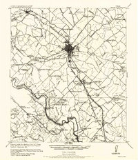 1956 Bryan1956 Print · USGSBrazos County is shown in the era of early college expansion and steam rail, centered on the growing campus of Texas A&M College. Genealogists and historians can trace defunct post offices and rural school sites like Benchley P.O., Woodville School, and the settlement of Boonville.
 - 1956 Map of Caldwell
 1956 Caldwell1956 Print · USGSThe Brazos Valley at the end of the Great War era shows a landscape defined by cotton gins and river crossings. Trace family roots and vanished landmarks like Moseley's Ferry, Stone City, and the Skrabonek Gin near Caldwell.
 - 1956 Map of Milano
 1956 Milano1956 Print · USGSRailroad junctions and rural post offices define this Milam County landscape during the early twentieth century. Genealogists and historians can locate family-named landmarks like Septimus) Olson or trace the early paths of the San Antonio and Aransas Pass Railway.
 - 1956 Map of Somerville
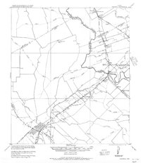
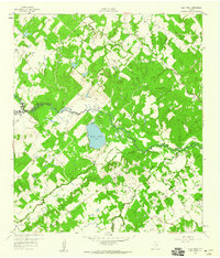
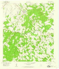
 1956 Somerville1956 Print · USGSThe rail junctions of Burleson County come into focus in this post-World War I era survey of the Brazos River valley hinterlands. Genealogists can locate family-named landmarks and rural hubs like Frenstat, Charlesville School, and Lyons P.O.
 - 1959 Map of Flag Pond, 1960 Print
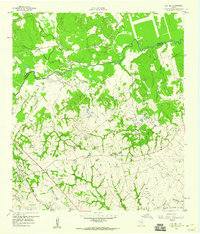
 1959 Flag Pond1960 Print · USGSThe tri-county borderlands of Burleson, Lee, and Washington counties are captured here in the late fifties. Genealogists can trace rural communities through landmarks like Flat Prairie Cem, Post Oak Sch, and St Mary Ch.
 - 1959 Map of Gay Hill, 1960 Print
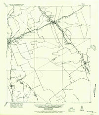
 1959 Gay Hill1960 Print · USGSWashington and Burleson Counties were shaped by the railroad and the oil patch during the late fifties. Genealogists and historians can trace the foundations of local life at Old Gay Hill Ch, the Clay Creek Oil Field, and the Gulf Colorado and Santa Fe rail line.3 unique versions available
 - 1959 Map of Clay, 1960 Print
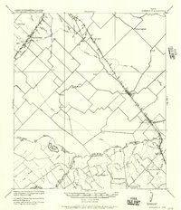
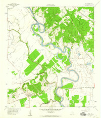 1959 Clay1960 Print · USGSNear the convergence of the Brazos and Yegua, this late-fifties survey reveals a landscape of winding river bends and vital rail junctions. Historians can trace the legacy of local settlements through Betts Ferry Cem, the rail lines of the Missouri Pacific, and the namesake Clay Pit.3 unique versions available
 - 1959 Map of Somerville, 1960 Print
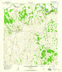
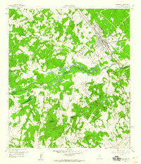 1959 Somerville1960 Print · USGSSomerville was a bustling railway junction in the late fifties where the Burleson and Washington county lines meet along the river. Researchers can locate family sites like Schoppe Cem, Sweet Home, and the old Somerville Substa rail yard.
 - 1959 Map of Dime Box, 1960 Print
 1959 Dime Box1960 Print · USGSTexas ranching and rail history intersect in Lee County during the late fifties, where the original town sites are clearly delineated. Researchers can trace the path of El Camino Real and locate family landmarks like Sweet Home High Sch and Sandy Point Cem.4 unique versions available
 - 1959 Map of Independence, 1960 Print
 1959 Independence1960 Print · USGSTexas history remains etched into the landscape around Independence in the late fifties, from the original Baylor University State Park to the Gov Sam Houston Home. Trace family roots through rural landmarks like Sandy Hill, Union Hill Ch, and the Summers Cem.3 unique versions available
End of results
Showing maps 1-11 of 11
Top cities of Burleson County
Frequently asked questions
- What are the different types of historical maps available for Burleson County?
- What is the oldest map of Burleson County?
- Where can I purchase historical maps of Burleson County for my home or office?
- Where can I download high-res historical maps of Burleson County?
- Are there historical topographic maps available for Burleson County?
- Is there historical aerial imagery available for Burleson County?
- Where are historical maps of Burleson County sourced from?