Old Maps of Port Lavaca, Texas for Metal Detecting
Plan your next treasure hunt with 16 historic maps of Port Lavaca. Find old homesites, ghost towns, trails, and gathering spots that may be lost to time — perfect for identifying promising metal detecting locations.
- Locate forgotten sites: Uncover places like long-lost settlements, abandoned rail lines, or gathering spots.
- Plan better hunts: Use map overlays combined with LiDAR or satellite views to narrow in on historically rich areas.
- Made for detectorists: Thousands of hobbyists use these maps to discover relics, coins, and hidden history.
Use these historic maps to boost your research and find new opportunities beneath the surface of Port Lavaca.
Port Lavaca, TX maps
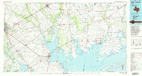
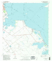
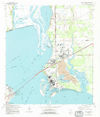
(16)- 1952 Map of Port Lavaca East, 1953 Print
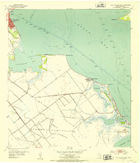 1952 Port Lavaca East1953 Print · USGSThe Texas Gulf Coast comes into focus in the early fifties, showing the working waterfronts and small beach communities of Calhoun County. Genealogists and historians can locate the Indianola Cem, the old Wilkins Sch, and landmarks like Magnolia Beach.4 unique versions available
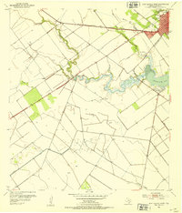
 - 1952 Map of Point Comfort, 1953 Print
 1952 Point Comfort1953 Print · USGSExperience the Texas coast in the early fifties as the industrial footprint at Point Comfort expanded alongside the Lavaca River. Local researchers can trace the oil wells of Lake Field and maritime landmarks like Gallinipper Reef.4 unique versions available
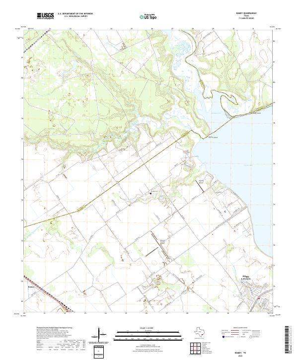
 - 1952 Map of Kamey, 1953 Print
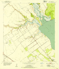 1952 Kamey1953 Print · USGSAlong the edges of Lavaca Bay in the early fifties, the coastal prairie was a landscape of tide-water marshes and rising energy infrastructure. Researchers can trace the Southern Pacific rail line to Kamey or locate Sixmile Sch and dozens of flowing wells.3 unique versions available
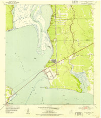
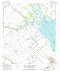
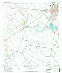
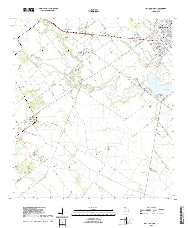
 - 1952 Map of Port Lavaca West, 1953 Print
 1952 Port Lavaca West1953 Print · USGSCoastal Texas at mid-century shows the intersection of industry and the gulf at Port Lavaca and Chocolate Bay. Researchers can locate family landmarks like Branch Cem, trace the Southern Pacific rail line, or find the old Tanner Airport.2 unique versions available
 - 1953 Map of Beeville
 1953 Beeville1953 Print · USGSThe Texas Coastal Bend in the early fifties shows a landscape of growing regional hubs and vital maritime corridors. Trace the rail-and-river economy through Goliad, locate the Matagorda Lighthouse, and explore the sprawling Aransas National Wildlife Refuge.
 - 1956 Map of Beeville
 1956 Beeville1956 Print · USGSCoastal Texas and the brush country interior are shown in the mid-fifties, from the coastal bays to the inland oil fields. Trace the old rail lines of the Southern Pacific RR or locate the historic Matagorda Lighthouse and the Aransas National Wildlife Refuge.2 unique versions available
 - 1960 Map of Beeville
 1960 Beeville1960 Print · USGSCoastal Texas in the mid-fifties reveals a landscape of growing towns and vital military outposts like Foster AFB. Researchers can trace old rail lines including the Missouri Pacific and explore the vast Aransas National Wildlife Refuge.
 - 1984 Map of Port Lavaca
 1984 Port Lavaca1984 Print · USGSCoastal Texas in the mid-1980s reveals a landscape of industrial waterways and historic rail corridors. Genealogists and historians can trace family roots through settlements like Bloomington and La Ward or explore the transit networks of the Southern Pacific and Missouri Pacific.
 - 1995 Map of Port Lavaca East
 1995 Port Lavaca East1995 Print · USGSCoastal Calhoun County in the mid-nineties shows the enduring legacy of early Texas settlements along the Gulf. Researchers can trace the proximity of the Historical Monument to Indianola Cem and the residential growth at Alamo Beach.
 - 1995 Map of Kamey
 1995 Kamey1995 Print · USGSThe Texas coast near Port Lavaca comes alive in this mid-nineties survey of the tidal wetlands and industrial infrastructure. Researchers can trace the layout of the Oil and Gas Field, locate the Sixmile Ch, and see the early development of Port Lavaca.
 - 1995 Map of Port Lavaca West
 1995 Port Lavaca West1995 Print · USGSCoastal Texas development meets the petroleum industry in the 1990s near the shores of Chocolate Bay. Trace the growth of Port Lavaca and its local landmarks, from Colonial Gardens Cem to the regional Tanner Airport.
 - 1995 Map of Point Comfort
 1995 Point Comfort1995 Print · USGSThe industrial heart of the Texas Gulf Coast is on display in the 1990s as processing plants and shipping channels define the shoreline. Researchers can trace the massive Chemical Plant complex and locate recreational landmarks like Lighthouse Beach and Noble Point.
 - 2022 Map of Port Lavaca East, 2022 Print
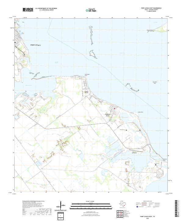 2022 Port Lavaca East2022 Print · USGSThe Calhoun County coastline comes into focus in this recent survey of the bays and beaches south of Port Lavaca. Genealogists and historians can trace coastal heritage through Zimmerman Cem, Old Town Cem, and the areas surrounding Magnolia Beach.
 - 2022 Map of Kamey, 2022 Print
 2022 Kamey2022 Print · USGSCalhoun and Victoria counties meet at the edge of the Texas coast during the early 2020s, showing the intersection of rural prairies and expansive bay waters. Researchers can trace local heritage at Six Mile Cem and locate family landmarks near Kamey or the shores of Garcitas Cove.
 - 2022 Map of Port Lavaca West, 2022 Print
 2022 Port Lavaca West2022 Print · USGSCoastal Calhoun County comes into focus in this recent survey of the Texas gulf region near the bay. Researchers can trace local heritage through numerous burial sites like Little Mary's Grave and Hatch Cem, or locate the County Courthouse in Port Lavaca.
 - 2022 Map of Point Comfort, 2022 Print
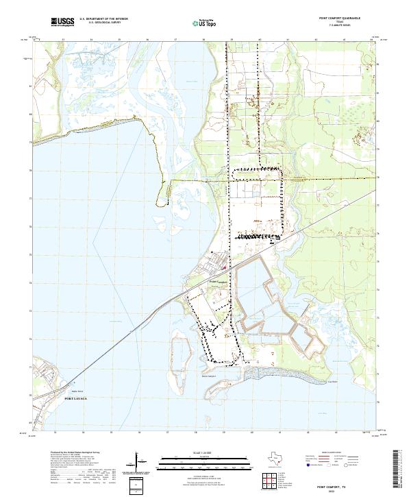 2022 Point Comfort2022 Print · USGSCoastal Calhoun County enters the 2020s as a hub of maritime industry and bay-front geography. Researchers can trace the industrial basins near Point Comfort and explore the winding inlets of Smugglers Bayou and Catfish Bayou along the bay shore.
End of results
Showing maps 1-16 of 16
Top cities near Port Lavaca
- Seadrift historical maps
- Port O'Connor historical maps
- Point Comfort historical maps
- La Ward historical maps
- Austwell historical maps
Frequently asked questions
- What are the different types of historical maps available for Port Lavaca?
- What is the oldest map of Port Lavaca?
- Where can I purchase historical maps of Port Lavaca for my home or office?
- Where can I download high-res historical maps of Port Lavaca?
- Are there historical topographic maps available for Port Lavaca?
- Is there historical aerial imagery available for Port Lavaca?
- Where are historical maps of Port Lavaca sourced from?