
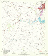
1952 Map of Port Lavaca West
USGS Topo · Published 1953About this map
The coastal settlement of Port Lavaca serves as the focal point of this 1952 topographic survey, situated where the Southern Pacific railroad meets the low-lying Texas gulf coast. The landscape is defined by the sinuous paths of Chocolate Bayou and Little Chocolate Bayou as they drain into Chocolate Bay. Human engineering is evident in the extensive systems of levee structures and an aqueduct protecting the inland areas.
Find a feature on this map
19 named features on this map. Tap any name to fly to it.
Don’t see what you’re looking for? This feature index may not catch every label — zoom into the map to look around manually.
Map Details
Editions of this 1952 Port Lavaca West Map
2 editions found
Other maps of this area

1952 · Port Lavaca East
USGS Topo · 1:24,000

1952 · Point Comfort
USGS Topo · 1:24,000

1952 · Kamey
USGS Topo · 1:24,000

1952 · Seadrift NE
USGS Topo · 1:24,000

1952 · Austwell
USGS Topo · 1:24,000

1952 · Seadrift
USGS Topo · 1:24,000

1952 · Placedo
USGS Topo · 1:24,000

1952 · Green Lake
USGS Topo · 1:24,000

1953 · Beeville
USGS Topo · 1:250,000

1956 · Beeville
USGS Topo · 1:250,000