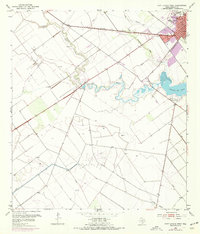
1952 Map of Port Lavaca West
USGS Topo · Published 1976About this map
The coastal plains of Calhoun County are defined by the winding course of Chocolate Bayou as it moves toward Chocolate Bay. The city of Port Lavaca occupies the northeastern corner of the map, showing mid-century infrastructure such as the County Hospital, a Courthouse, and a Drive-in Theater along the city's edge. The Southern Pacific railroad cuts a straight line through the landscape, bypassing the more rural southern stretches where Coloma Creek and the settlement of Coloma are located.
Find a feature on this map
20 named features on this map. Tap any name to fly to it.
Don’t see what you’re looking for? This feature index may not catch every label — zoom into the map to look around manually.
Map Details
Editions of this 1952 Port Lavaca West Map
2 editions found
Other maps of this area

1952 · Port Lavaca East
USGS Topo · 1:24,000

1952 · Point Comfort
USGS Topo · 1:24,000

1952 · Kamey
USGS Topo · 1:24,000

1952 · Seadrift NE
USGS Topo · 1:24,000

1952 · Austwell
USGS Topo · 1:24,000

1952 · Seadrift
USGS Topo · 1:24,000

1952 · Port Lavaca West
USGS Topo · 1:24,000

1952 · Placedo
USGS Topo · 1:24,000

1952 · Green Lake
USGS Topo · 1:24,000

1953 · Beeville
USGS Topo · 1:250,000