1940s Maps of Chambers County, Texas
Explore 16 historic maps of Chambers County from the 1940s. These maps offer a rare glimpse into what life looked like during the 1940s — showing old roads, neighborhoods, homes, and landmarks that have changed or disappeared over time.
Whether you're researching your family's past, planning a metal detecting trip, or studying how Chambers County's landscape evolved across the 1940s, these high-resolution maps are a powerful tool for exploring the history of this region.
- Focus on a specific era: All maps on this page are from the 1940s, giving you a focused view of this time period.
- See what’s changed: Compare century-old streets, trails, and buildings to today's modern landscape using overlays and satellite layers.
- Research with precision: Use these maps for genealogy, historical research, land use analysis, or educational projects.
- View, download, or print: Maps are fully viewable online in high resolution, and can be downloaded or printed for your own records.
Start exploring Chambers County's history through authentic maps from the 1940s. This is your window into the past.
Chambers County, TX maps
(16)- 1942 Map of Anahuac, 1958 Print
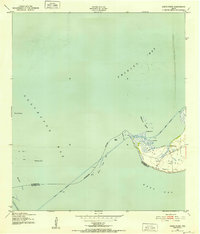
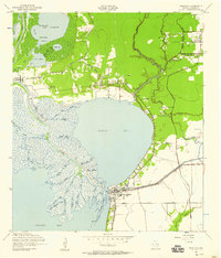 1942 Anahuac1958 Print · USGSThe mouth of the Trinity River and the shores of Turtle Bay are captured here in the early 1940s. Genealogists can trace family landmarks like Wallisville Cem and Old Fort Anahuac or locate the schools and oil wells of Wallisville and Eminence.
 - 1943 Map of West of Eagle
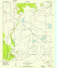
 1943 West of Eagle1943 Print · USGSCoastal Chambers County is captured here in the early 1940s along the western edge of Trinity Bay. Genealogists and local historians can trace family landmarks and early shoreline roads like Cedar Bayou Road and the Fisher Cem.
 - 1943 Map of Whites Bayou
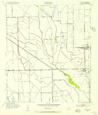
 1943 Whites Bayou1943 Print · USGSTexas coastal prairie life comes into focus during the early 1940s, showing the intersection of ranching, rice farming, and the oil industry. Genealogists and historians can trace the Hankamer Oil Field and the Abshier Cem near Hankamer.
 - 1943 Map of Texas City
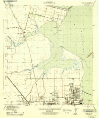 1943 Texas City1943 Print · USGSThe Galveston Bay shoreline and the industrial expansion of the Texas City area are captured in detail during the early 1940s. Genealogists and local historians can trace the early layouts of Lamarque, the waterfront at San Leon, and the rail infrastructure of the Southern Pacific.2 unique versions available
 - 1943 Map of High Island
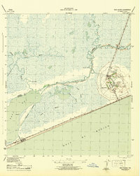 1943 High Island1943 Print · USGSCoastal Texas during the early 1940s reveals a landscape of vital waterways and isolated gulf settlements. Genealogists and researchers can trace the routes of the Santa Fe railroad and Intracoastal Waterway near High Island and Gilchrist.2 unique versions available
 - 1943 Map of Morgan Point
 1943 Morgan Point1943 Print · USGSThe coastal communities of Goose Creek, Baytown, and Pelly are shown in detail during the early 1940s as the regional maritime economy expanded. Researchers can trace the dual rail lines of the Southern Pacific and Missouri Pacific or locate local landmarks like the Hill of Rest Cem.
 - 1943 Map of Frozen Point, 1952 Print
 1943 Frozen Point1952 Print · USGSThe Texas coast near the Bolivar Peninsula is captured here during the early forties, showing a landscape defined by expansive salt marshes and new industrial waterways. Researchers can trace the development of the Intracoastal Waterway and locate early sites like Rollover and the Sun Oil Company Canal.
 - 1943 Map of Smith Point, 1952 Print
 1943 Smith Point1952 Print · USGSCoastal Chambers County is captured here during the 1940s, showing the strategic maritime convergence of three major bays. Marine researchers and genealogists can trace early industrial markers like oil wells and windmills near the Smith Point settlement and the Vingt-et-un Islands.3 unique versions available
 - 1943 Map of Clifton By The Sea, 1952 Print
 1943 Clifton By The Sea1952 Print · USGSThe western shores of Galveston Bay come alive in the 1940s, showcasing early coastal developments and maritime industry. Trace old waterfront family sites at Clifton by the Sea and San Leon, or locate historic burials at Harris Cem and Seabrook Cem.
 - 1943 Map of Lake Stephenson, 1952 Print
 1943 Lake Stephenson1952 Print · USGSChambers County coastal marshes are captured in detail in the 1940s, highlighting the remote settlements of the Texas shoreline. Genealogists and historians can locate family landmarks like the Frankland Cemetery, Smith Point School, and Lake Surprise.
 - 1943 Map of Sea Breeze, 1955 Print
 1943 Sea Breeze1955 Print · USGSCoastal Texas during the 1940s reveals a landscape shaped by oil exploration and water management. Genealogists and historians can trace industrial roots via numerous Oil Wells, the Stanolind Reservoir, and the settlement of Sea Breeze.
 - 1943 Map of Stowell, 1956 Print
 1943 Stowell1956 Print · USGSCoastal Texas prairie life during the mid-forties centered on the growing rail-side communities of Winnie and Stowell. Genealogists and historians can trace the early irrigation networks of the Lone Star Canal and locate local landmarks like School No 2 and Oil Wells.
 - 1943 Map of Cedar Bayou, 1960 Print
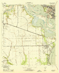
 1943 Cedar Bayou1960 Print · USGSThe Gulf Coast oil and agriculture landscape comes alive in the 1940s as industry takes root near Mont Belvieu. Genealogists and historians can trace old family sites like Fisher Cem, Shiloh Ch, and the original Cedar Bayou Sch.
 - 1944 Map of La Porte
 1944 La Porte1944 Print · USGSCoastal Harris County is captured during the mid-forties, showing the vital maritime and rail corridors near the San Jacinto River. Genealogists and researchers can trace local landmarks like the La Porte Cem, the whistle-stop at Strang, and the recreational grounds of Sylvan Beach.
 - 1945 Map of Nolte
 1945 Nolte1945 Print · USGSThe coastal prairie at the borders of Liberty, Chambers, and Jefferson Counties is captured here in the mid-1940s. Genealogists and researchers can trace early rural life through landmarks like the Pumping Station at Blair, Oak Island, and Willis Marsh.
 - 1945 Map of Sea Breeze
 1945 Sea Breeze1945 Print · USGSThe coastal prairies of Chambers County are captured here just as industrial water management began to reshape the wetlands. Genealogists and historians can trace Whites Ranch Road and the early footprints of Sea Breeze and Stanolind Reservoir.
End of results
Showing maps 1-16 of 16
Top cities of Chambers County
- Mont Belvieu historical maps
- Winnie historical maps
- Beach City historical maps
- Anahuac historical maps
- Old River-Winfree historical maps
- Cove historical maps
Frequently asked questions
- What are the different types of historical maps available for Chambers County?
- What is the oldest map of Chambers County?
- Where can I purchase historical maps of Chambers County for my home or office?
- Where can I download high-res historical maps of Chambers County?
- Are there historical topographic maps available for Chambers County?
- Is there historical aerial imagery available for Chambers County?
- Where are historical maps of Chambers County sourced from?