Old Maps of Smith Point, Texas for Hiking & Exploration
Hike through history with 13 historic maps of Smith Point. Explore old trails, ghost towns, and forgotten backroads — perfect for outdoor adventurers and local explorers.
- Rediscover forgotten places: Map out old mining camps, roads, and footpaths that no longer exist on modern maps.
- Layer with modern tools: Combine with LiDAR or satellite views to plan hikes through historical terrain.
- Made for exploration: Popular among hikers, overlanders, and local history lovers.
Use these maps to find adventure and explore the hidden past of Smith Point.
Smith Point, TX maps
(13)- 1933 Map of Smith Point
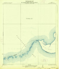 1933 Smith Point1933 Print · USGSCoastal Chambers County is captured here in the early 1930s, showing the intricate shoreline and maritime boundaries of Galveston Bay. Map collectors can trace the shifting sands and channels of Fish Bar, Possum Pass, and Red Pass.2 unique versions available
 - 1943 Map of Smith Point, 1952 Print
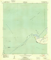 1943 Smith Point1952 Print · USGSCoastal Chambers County is captured here during the 1940s, showing the strategic maritime convergence of three major bays. Marine researchers and genealogists can trace early industrial markers like oil wells and windmills near the Smith Point settlement and the Vingt-et-un Islands.3 unique versions available
 - 1950 Map of Houston, 1953 Print
 1950 Houston1953 Print · USGSCoastal Texas in the early fifties reveals a landscape of massive civil engineering and industrial transit. Genealogists and researchers can trace the growth of the Houston suburbs and the maritime infrastructure of Galveston Bay, including the Gulf Freeway and the Texas City Dike.
 - 1956 Map of Houston, 1963 Print
 1956 Houston1963 Print · USGSSoutheast Texas in the mid-fifties is captured here as a powerhouse of oil and maritime trade. Genealogists and historians can trace the foundations of Houston and its ports, alongside landmarks like the Rice Institute and the Spindletop Oil Field.2 unique versions available
 - 1961 Map of Smith Point, 1964 Print
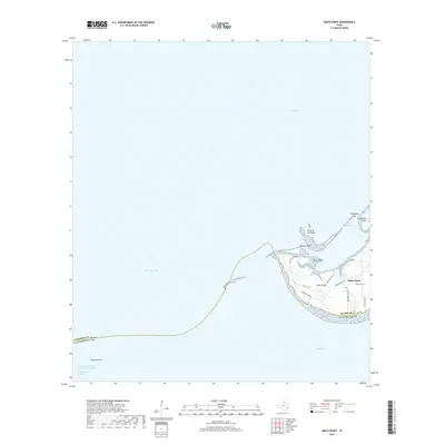
 1961 Smith Point1964 Print · USGSThe tip of Chambers County at the start of the 1960s shows a landscape transformed by the offshore energy boom. Genealogists and local historians can trace family markers at Davis Cem or locate old industrial landmarks like Morgan Pt and Red Fish Bar.2 unique versions available
 - 1975 Map of Houston, 1977 Print
 1975 Houston1977 Print · USGSThe Texas Gulf Coast in the mid-seventies shows a sprawling Houston metropolis linked to the sea by the massive Houston Ship Channel. Researchers can trace the mid-century industrial landscape from the Astrodome to the Lyndon B. Johnson Space Center.2 unique versions available
 - 1983 Map of Anahuac
 1983 Anahuac1983 Print · USGSThe Upper Texas Coast and its energy-driven landscape are detailed here in the early eighties. Genealogists and historians can trace coastal settlements like Anahuac and Winnie alongside the storied Spindletop Oil Field and the Anahuac National Wildlife Refuge.2 unique versions available
 - 1993 Map of Smith Point, 1994 Print
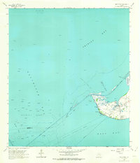
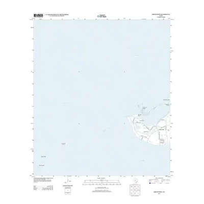
 1993 Smith Point1994 Print · USGSThe Texas Gulf Coast at the convergence of three bays is captured here in the early 1990s. Trace local history through family-named landmarks like Davis Cem or explore the vast offshore industry at Umbrella Point Oil Field and Redfish Reef.
 - 2010 Map of Smith Point, 2010 Print
 2010 Smith Point2010 Print · USGSCovers Smith Point, including Texas City, Chambers County, and other nearby areas
 - 2013 Map of Smith Point, 2013 Print
 2013 Smith Point2013 Print · USGSCovers Smith Point, including Texas City, Chambers County, and other nearby areas
 - 2016 Map of Smith Point, 2016 Print
 2016 Smith Point2016 Print · USGSCovers Smith Point, including Texas City, Chambers County, and other nearby areas
 - 2019 Map of Smith Point, 2019 Print
 2019 Smith Point2019 Print · USGSCovers Smith Point, including Texas City, Chambers County, and other nearby areas
 - 2022 Map of Smith Point, 2022 Print
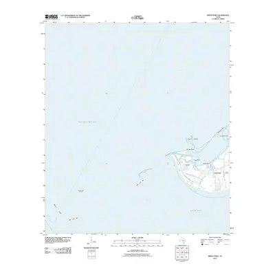
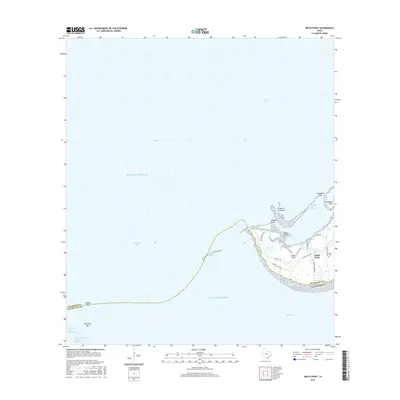
 2022 Smith Point2022 Print · USGSThe coastal community of Smith Point is surveyed here in the early 2020s where three major bays meet. Family historians and researchers can trace local roads and sites like the Davis Cem, James H. Robbins Park, and the shoreline at Trout Point.
End of results
Showing maps 1-13 of 13
Top cities near Smith Point
- Pasadena historical maps
- Baytown historical maps
- Galveston historical maps
- Texas City historical maps
- La Marque historical maps
- San Leon historical maps
See more
Frequently asked questions
- What are the different types of historical maps available for Smith Point?
- What is the oldest map of Smith Point?
- Where can I purchase historical maps of Smith Point for my home or office?
- Where can I download high-res historical maps of Smith Point?
- Are there historical topographic maps available for Smith Point?
- Is there historical aerial imagery available for Smith Point?
- Where are historical maps of Smith Point sourced from?