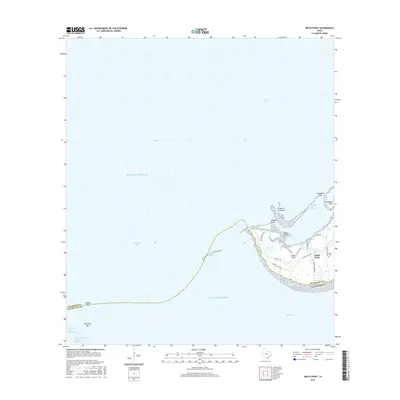
2016 Map of Smith Point
USGS Topo · Published 2016About this map
The coastal convergence of Trinity Bay, Galveston Bay, and East Bay defines this maritime landscape along the boundary of Chambers and Galveston Counties. At the heart of the peninsula lies the settlement of Smith Point, a community defined by its proximity to the water and its network of local roads such as Smith Point Rd and Hawkins Camp Rd. Historical evidence of local residency is marked at the Davis Cem, while the surrounding waters reflect the region's heavy reliance on maritime commerce through the Houston Ship Channel and the Trinity River Channel. The geography is characterized by intricate coastal features like Vingt-et-un Islands, Red Fish Bar, and Morgan Point, indicating a complex system of passes and bars that have long influenced navigation and fishing in the Gulf of Mexico.
Find a feature on this map
26 named features on this map. Tap any name to fly to it.
Don’t see what you’re looking for? This feature index may not catch every label — zoom into the map to look around manually.
Map Details
Editions of this 2016 Smith Point Map
This is the sole edition of this map. No revisions or reprints were ever made.
Other maps of this area

1916 · Morgan Point
USGS Topo · 1:24,000

1919 · Morgan Point
USGS Topo · 1:31,680

1929 · Texas City
USGS Topo · 1:24,000

1931 · Flake
USGS Topo · 1:24,000

1932 · Clifton By The Sea
USGS Topo · 1:31,680

1932 · Texas City
USGS Topo · 1:31,680

1932 · Bolivar Point
USGS Topo · 1:24,000

1933 · Whites Lake
USGS Topo · 1:31,680

1933 · Smith Point
USGS Topo · 1:31,680

1933 · Bolivar Point
USGS Topo · 1:31,680