1900s (20th Century) Maps of Duval County, Texas
Explore 61 historic maps of Duval County from the 1900s (20th Century). These maps offer a rare glimpse into what life looked like during the 1900s — showing old roads, neighborhoods, homes, and landmarks that have changed or disappeared over time.
Whether you're researching your family's past, planning a metal detecting trip, or studying how Duval County's landscape evolved across the 1900s, these high-resolution maps are a powerful tool for exploring the history of this region.
- Focus on a specific era: All maps on this page are from the 1900s, giving you a focused view of this time period.
- See what’s changed: Compare century-old streets, trails, and buildings to today's modern landscape using overlays and satellite layers.
- Research with precision: Use these maps for genealogy, historical research, land use analysis, or educational projects.
- View, download, or print: Maps are fully viewable online in high resolution, and can be downloaded or printed for your own records.
Start exploring Duval County's history through authentic maps from the 1900s. This is your window into the past.
Duval County, TX maps
(61)- 1917 Map of Ben Bolt, 1956 Print
 1917 Ben Bolt1956 Print · USGSSouth Texas ranching country comes into focus in this late-frontier era survey centered on the rail hub of Alice. Genealogists can trace family holdings like Hanson Ranch and Lopez Ranch, while finding landmarks like the Sugar Mill and regional Shipping Pens.
 - 1920 Map of Mikeska
 1920 Mikeska1920 Print · USGSSouth Texas ranching country comes to life in this post-World War I tactical survey of the Live Oak County area. Genealogists and historians can trace family landholdings from OAKVILLE to George West, locating ancestral landmarks like Simmons City, Mikeska, and the O'Connor Ranch.
 - 1920 Map of San Diego, 1957 Print
 1920 San Diego1957 Print · USGSSouth Texas ranching culture and early rail expansion are captured here at the start of the 1920s. Genealogists and historians can trace family landholdings across the Duval County Line, identifying sites like Luby Ranch, Bentonville, and the Texas Mexican Railroad corridor.
 - 1921 Map of Falfurrias
 1921 Falfurrias1921 Print · USGSBrooks and Jim Wells counties were defined by a sprawling ranching and citrus economy in the years following the Great War. Genealogists can trace family holdings and early infrastructure like Coyote Mills, the Concepcion Ruins, and the Seymour Citrus Farm.
 - 1937 Map of Loma Alta, 1956 Print
 1937 Loma Alta1956 Print · USGSSouth Texas ranching and oil development meet along the McMullen and Duval county line in the mid-1930s. Genealogists and historians can locate family holdings like Pony Jim Martin Ranch and industrial sites including Eagle Hill Settlement and Seven Sisters.
 - 1939 Map of Bruni, 1958 Print
 1939 Bruni1958 Print · USGSSouth Texas brush country was a hub of energy and ranching in the late thirties as the oil boom transformed the landscape. Genealogists and historians can trace family landholdings like Santa Cruz Ranch and the early industrial footprint of Mirando City or the Valdez Oil Field.2 unique versions available
 - 1953 Map of Crystal City
 1953 Crystal City1953 Print · USGSSouth Texas in the early fifties was a landscape of expanding oil fields and vital rail connections. Genealogists and researchers can trace family lands along the Nueces River or locate heritage sites in Asherton, Big Wells, and Batesville.
 - 1955 Map of Crystal City, 1976 Print
 1955 Crystal City1976 Print · USGSSouth Texas ranching and oil country come into focus in the mid-fifties as the rail lines and rivers connect growing hubs. Researchers can trace the development of energy fields like Washburn Oil Field or locate historic settlements from Asherton to Three Rivers.
 - 1956 Map of Benavides
 1956 Benavides1956 Print · USGSCoastal plains ranching and the arrival of the oil industry define this South Texas landscape in the early twentieth century. Genealogists can trace family heritage through numerous named homesteads like Hoffman Ranch and Stein Ranch or the tracks of the Texas Mexican R. R.
 - 1956 Map of Rosita Ranch
 1956 Rosita Ranch1956 Print · USGSSouth Texas cattle country is shown here in the early twentieth century, revealing a landscape of family-owned ranching empires and rail connections. Genealogists and historians can trace lineage and land use through labels like Rosita Ranch, the Mendieto post office, and the path of the T. M. R. R.
 - 1956 Map of Freer
 1956 Freer1956 Print · USGSDuval County is shown during a period of intense oil development and traditional ranching in the mid-1950s. Genealogists and historians can trace family properties like Cuatitas Ranch and R Mendez alongside prolific energy sites like Seven Sisters Field.
 - 1956 Map of Piedra Creek
 1956 Piedra Creek1956 Print · USGSThe ranching country of La Salle and McMullen Counties is captured here in the mid-1950s, following military surveys of the brushy plains. Researchers can locate remote family landmarks like the Dobie Ranch or trace the early Oil Field at Munson.
 - 1956 Map of Las Mujeres
 1956 Las Mujeres1956 Print · USGSRanching life on the Webb and Duval county border is captured here during the mid-twentieth century as new infrastructure began to arrive. Genealogists and historians can trace family land holdings such as Jotana Ranch, Puertacita Ranch, and the homestead of Don Adami.
 - 1956 Map of Laredo, 1960 Print
 1956 Laredo1960 Print · USGSSouth Texas in the mid-fifties reveals a landscape shaped by border commerce, military aviation, and a booming oil industry. Trace the historic Texas and Mexican RR line through Hebbronville or locate the sprawling Mirando City Oil Field and Laredo AFB.3 unique versions available
 - 1961 Map of Crystal City
 1961 Crystal City1961 Print · USGSSouth Texas in the early sixties reveals a landscape of massive cattle ranches and emerging oil fields. Genealogists and historians can trace the Missouri Pacific rail lines through Crystal City, or locate water features like Espantosa Lake and Boynton Reservoir.
 - 1963 Map of Anna Rose, 1964 Print
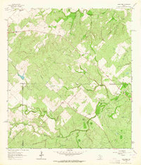 1963 Anna Rose1964 Print · USGSSouth Texas ranching and oil production are on full display in the early 1960s at the junction of Live Oak and Jim Wells counties. Trace family history and land use through landmarks like Rancho de la Parrita, Anna Rose, and the Calabaza Windmill.2 unique versions available
 - 1963 Map of San Diego, 1964 Print
 1963 San Diego1964 Print · USGSSan Diego and the surrounding brush country are captured here in the early sixties as the regional water infrastructure was expanding. Genealogists and historians can trace the Texas Mexican rail line, find the local Cem, or locate the series of Chiltipin-San Fernando Dam No 6 reservoirs.2 unique versions available
 - 1963 Map of Shaeffer Ranch, 1964 Print
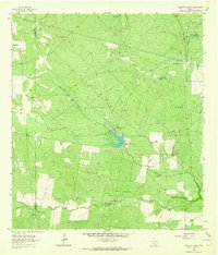 1963 Shaeffer Ranch1964 Print · USGSSouth Texas ranching country in the early sixties is captured here along the Duval and Jim Wells county line. Genealogists and historians can locate the San Jose Cem near Mendieta, old family landmarks like the Shaeffer Ranch, and dozens of named windmills and tanks.2 unique versions available
 - 1963 Map of Premont West, 1964 Print
 1963 Premont West1964 Print · USGSJim Wells County in the early 1960s was a hub of energy production and ranching at the meeting point of three counties. Genealogists and historians can trace the Southern Pacific rail corridor through Premont and La Gloria, and locate rural landmarks like the La Gloria Sch and the Drive-in Theater.
 - 1963 Map of Ben Bolt NW, 1964 Print
 1963 Ben Bolt NW1964 Print · USGSCoastal Bend brush country during the early 1960s reveals a landscape of active energy production along the Duval and Jim Wells county line. Researchers can trace the development of the Ben Bolt Oil Field and Koopman Gas Field alongside the southern edge of San Diego.
 - 1963 Map of Palito Blanco, 1964 Print
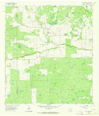 1963 Palito Blanco1964 Print · USGSJim Wells County ranching country comes into focus in the early sixties, showing a landscape of family-owned holdings and scattered brushland cemeteries. Researchers can trace local heritage through sites like Palito Blanco, San Jose Ch, and the Valadez Cem or Perez Cem.
 - 1963 Map of Seeligson Ranch, 1965 Print
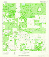 1963 Seeligson Ranch1965 Print · USGSJim Wells County rangeland meets the mid-century energy boom in the early sixties. Researchers can trace ranching legacies at Seeligson Ranch or explore petroleum history across the Premont Oil Field and East Premont Oil Field.
 - 1967 Map of Hebbronville SE, 1971 Print
 1967 Hebbronville SE1971 Print · USGSThe ranch lands of Jim Hogg County are captured here in the late sixties as the oil and gravel industries expanded across the brush country. Researchers can trace the Texas Mexican line and locate numerous family-named landmarks like Papalote Nuevo Windmill and San Tomas Windmill.2 unique versions available
 - 1967 Map of Parrilla Creek SE, 1971 Print
 1967 Parrilla Creek SE1971 Print · USGSDuval County was a center of energy production and ranching in the late sixties. Researchers can trace oil and gas development through Driscoll Camp, the local Refinery, and the settlement at Sweden.
 - 1967 Map of Realitos, 1971 Print
 1967 Realitos1971 Print · USGSSouth Texas ranching and rail transport converge at the town of Realitos during the late sixties. Genealogists and local historians can locate family-named sites like Longora Windmill and Pila Blanca Windmill along the Texas Mexican line.2 unique versions available
Showing maps 1-25 of 61
Top cities of Duval County
Frequently asked questions
- What are the different types of historical maps available for Duval County?
- What is the oldest map of Duval County?
- Where can I purchase historical maps of Duval County for my home or office?
- Where can I download high-res historical maps of Duval County?
- Are there historical topographic maps available for Duval County?
- Is there historical aerial imagery available for Duval County?
- Where are historical maps of Duval County sourced from?