Old Maps of Fort Bend County, Texas for Metal Detecting
Plan your next treasure hunt with 165 historic maps of Fort Bend County. Find old homesites, ghost towns, trails, and gathering spots that may be lost to time — perfect for identifying promising metal detecting locations.
- Locate forgotten sites: Uncover places like long-lost settlements, abandoned rail lines, or gathering spots.
- Plan better hunts: Use map overlays combined with LiDAR or satellite views to narrow in on historically rich areas.
- Made for detectorists: Thousands of hobbyists use these maps to discover relics, coins, and hidden history.
Use these historic maps to boost your research and find new opportunities beneath the surface of Fort Bend County.
Fort Bend County, TX maps
(165)- 1915 Map of Alief
 1915 Alief1915 Print · USGSIn the years before Houston's westward sprawl, this prairie landscape was a remote network of dairy farms and rail lines. You can trace the early foundations of these communities at Alief, Traceyville Church, and along the rural paths of Westheimer Road.3 unique versions available
 - 1915 Map of Katy
 1915 Katy1915 Print · USGSKaty was a budding rail settlement on the Texas prairie during the early twentieth century. Genealogists and local historians can trace the early town site along the Missouri Kansas and Texas tracks and locate the South Mayde School.3 unique versions available
 - 1915 Map of Clodine, 1961 Print
 1915 Clodine1961 Print · USGSSoutheast Texas prairie life is captured here during the mid-teens, when rail lines dictated the growth of small settlements. Trace the early footprints of Clodine and Howell or locate the defunct route of the Texas Western R R (Abandoned).
 - 1919 Map of Clodine
 1919 Clodine1919 Print · USGSThe coastal prairie of the Harris and Fort Bend county line is captured here just before the era of major flood control. Genealogists can trace early settlements like Clodine and Howell alongside the remnant Texas Western RR (Abandoned) rail bed.3 unique versions available
 - 1920 Map of Almeda
 1920 Almeda1920 Print · USGSHarris County prairie land is captured here during the First World War era, showing a landscape defined by rail and water. Genealogists and researchers can trace the early footprint of Almeda and the path of the International and Great Northern railroad.2 unique versions available
 - 1943 Map of Juliff
 1943 Juliff1943 Print · USGSBrazoria County during the early 1940s shows a landscape of prison agriculture and coastal prairie drainage systems. Researchers can locate the Darrington State Farm complex, the Prison Cem, and rural schoolhouses like Mustang Sch and School No 20.2 unique versions available
 - 1950 Map of Houston, 1953 Print
 1950 Houston1953 Print · USGSCoastal Texas in the early fifties reveals a landscape of massive civil engineering and industrial transit. Genealogists and researchers can trace the growth of the Houston suburbs and the maritime infrastructure of Galveston Bay, including the Gulf Freeway and the Texas City Dike.
 - 1953 Map of Needville, 1954 Print
 1953 Needville1954 Print · USGSFort Bend County's coastal prairie comes into sharp focus during the mid-century oil boom, showing a landscape transitioning from ranching to petroleum production. Trace family roots at Concord Cem or the Foster Sch (Aban'd), and see the early footprint of the Needville Oil Field.3 unique versions available
 - 1953 Map of Guy, 1954 Print
 1953 Guy1954 Print · USGSFort Bend County at the start of the 1950s was a landscape defined by the intersection of cattle, crops, and crude oil. Genealogists and local historians can trace family locations near the Guy Cem, the settlement of Mooredale, and the active Damon Mound Oil Field.4 unique versions available
 - 1953 Map of Lake George, 1954 Print
 1953 Lake George1954 Print · USGSFort Bend County in the early fifties is captured here as an industrializing landscape of oil and sulphur extraction. Trace the development of the Big Creek Oil Field and Sulphur Field alongside the Long Point School and the rails of the Santa Fe.3 unique versions available
 - 1953 Map of Kendleton, 1954 Print
 1953 Kendleton1954 Print · USGSFort Bend and Wharton Counties are seen here in the early 1950s, a landscape shaped by the San Bernard River and rail lines. Locate the Mexican Army Encampment site, trace the Southern Pacific tracks through Beasley, or find family roots near Wesley Chapel.2 unique versions available
 - 1953 Map of Damon, 1954 Print
 1953 Damon1954 Print · USGSBrazoria County oil production and coastal prairie life are in full view during the early fifties. Genealogists and industrial historians can trace the Nash Dome Oil Field, locate the Woodrow School, and find family landmarks near Damon Mound.3 unique versions available
 - 1953 Map of Hungerford, 1954 Print
 1953 Hungerford1954 Print · USGSWharton and Fort Bend Counties appear in the early fifties as a landscape of coastal prairies and emerging energy production. Researchers can trace rural life through the many landmarks like Hungerford School, Faith Tabernacle, and the Hungerford Oil Field.2 unique versions available
 - 1953 Map of Boling, 1955 Print
 1953 Boling1955 Print · USGSWharton County industry and rural life intersect in the early fifties as the sulphur industry reshapes the coastal plain. Trace the layout of the company town at Newgulf or locate family roots at Shiloh Cem and Routt Point Church.3 unique versions available
 - 1953 Map of Otey, 1955 Print
 1953 Otey1955 Print · USGSCoastal Texas ranching and the oil industry converge along the Brazos River in the early fifties. Researchers can trace the massive Ramsey State Prison Farm complex, the Orozimbo Historical Marker, and small outposts like Guenther Station.4 unique versions available
 - 1953 Map of Thompsons, 1955 Print
 1953 Thompsons1955 Print · USGSThe Brazos River valley in the early fifties shows a landscape transformed by petroleum at Humble Camp and Thompsons Ridge Field. Trace family roots near Thompsons and locate the Sacred Heart Church or the Darrington State Prison Farm.3 unique versions available
 - 1953 Map of Seguin, 1965 Print
 1953 Seguin1965 Print · USGSSouth Texas in the early fifties shows a thriving river-and-rail economy across the Guadalupe and Colorado basins. Genealogists and historians can trace rail routes like the Southern Pacific through Seguin, locate oil wells, or find the Gary AAF near San Marcos.4 unique versions available
 - 1955 Map of Almeda, 1957 Print
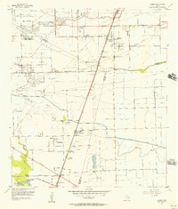 1955 Almeda1957 Print · USGSIn the mid-fifties, this portion of the Texas coastal plain was a mix of prison farms, oil fields, and rural settlements. Genealogists can locate family names and burial sites at Beth Jacob Cem or Arcola-Fresno Cem and trace the old Missouri Pacific rail corridor.3 unique versions available
 - 1955 Map of Sugar Land, 1957 Print
 1955 Sugar Land1957 Print · USGSFort Bend and Harris counties were transitioning from a plantation and prison-farm economy to a modern industrial corridor in the mid-1950s. Genealogists can trace family names at the Dewalt Cem or Riceville Ch, while researchers can map the early footprints of Sharpstown and Andrau Airpark.
 - 1955 Map of Brookshire, 1957 Print
 1955 Brookshire1957 Print · USGSThe growing railroad towns of Waller and Harris Counties are shown in the mid-fifties as the local energy economy takes hold. Genealogists and historians can locate family landmarks like Curry Chapel, Magnolia Cem, and the old Salt Mine at Hockley Mound.
 - 1955 Map of Richmond, 1958 Print
 1955 Richmond1958 Print · USGSFort Bend County during the mid-fifties is captured here as a landscape of meandering rivers and burgeoning rail hubs. Genealogists can trace family names through rural sites like Little Prayer Cem or follow the Old Spanish Trail through Rosenberg.
 - 1956 Map of Wallis
 1956 Wallis1956 Print · USGSThe Brazos and San Bernard rivers dominate this coastal prairie landscape during the early twentieth century. Trace family roots and vanished rail stops through Wallis, Chesterville, and Lissie along the Gulf Colorado and Santa Fe Railway.
 - 1956 Map of Houston, 1963 Print
 1956 Houston1963 Print · USGSSoutheast Texas in the mid-fifties is captured here as a powerhouse of oil and maritime trade. Genealogists and historians can trace the foundations of Houston and its ports, alongside landmarks like the Rice Institute and the Spindletop Oil Field.2 unique versions available
 - 1958 Map of Seguin
 1958 Seguin1958 Print · USGSSouth Texas in the late fifties was a network of river-valley settlements and active oilfields tied together by major rail lines. Genealogists and historians can trace family-named sites across Rabb Prairie, locate the Behring Store, or follow the Southern Pacific through Schulenburg.
 - 1960 Map of Wallis, 1961 Print
 1960 Wallis1961 Print · USGSThe Brazos River bottomlands in the early sixties reveal a landscape shaped by rail junctions and small farming communities. Genealogists can trace family roots through sites like Hartville Cem, Mount Olive Ch, and the intersection of two major railroads in Wallis.3 unique versions available
Showing maps 1-25 of 165
Top cities of Fort Bend County
- Sugar Land historical maps
- Missouri City historical maps
- Rosenberg historical maps
- Fresno historical maps
- Stafford historical maps
- Richmond historical maps
See more
Frequently asked questions
- What are the different types of historical maps available for Fort Bend County?
- What is the oldest map of Fort Bend County?
- Where can I purchase historical maps of Fort Bend County for my home or office?
- Where can I download high-res historical maps of Fort Bend County?
- Are there historical topographic maps available for Fort Bend County?
- Is there historical aerial imagery available for Fort Bend County?
- Where are historical maps of Fort Bend County sourced from?