Old Maps of Glasscock County, Texas for Metal Detecting
Plan your next treasure hunt with 131 historic maps of Glasscock County. Find old homesites, ghost towns, trails, and gathering spots that may be lost to time — perfect for identifying promising metal detecting locations.
- Locate forgotten sites: Uncover places like long-lost settlements, abandoned rail lines, or gathering spots.
- Plan better hunts: Use map overlays combined with LiDAR or satellite views to narrow in on historically rich areas.
- Made for detectorists: Thousands of hobbyists use these maps to discover relics, coins, and hidden history.
Use these historic maps to boost your research and find new opportunities beneath the surface of Glasscock County.
Glasscock County, TX maps
(131)- 1941 Map of Morita
 1941 Morita1941 Print · USGSRanching life and rail transport define this Howard County landscape just before the war. Trace early schools and family holdings like Sandwell Sch, Morita, and Quinn Ranch along the route of the Texas and Pacific railroad.
 - 1941 Map of Big Spring South, 1949 Print
 1941 Big Spring South1949 Print · USGSHoward County ranching and early oil development are captured here in the late thirties. Genealogists can trace family holdings like W T Roberts Ranch and find rural landmarks such as Chalk Sch or the remote Hollis siding.2 unique versions available
 - 1942 Map of Big Spring South
 1942 Big Spring South1942 Print · USGSThe West Texas ranchlands south of Big Spring come alive in this late Depression-era survey. Genealogists and historians can locate family landmarks like the Wasson Ranch, Panther Draw Sch, and the early oil-era settlement of Forsan.
 - 1949 Map of Morita
 1949 Morita1949 Print · USGSHoward and Martin Counties in the late 1930s show a landscape of sprawling family ranches and essential rail stops. Genealogists can locate named homesteads like McDowell Ranch and Cross Ranch, or trace the rural students of Sandwell Sch.
 - 1954 Map of Big Spring, 1965 Print
 1954 Big Spring1965 Print · USGSWest Texas in the mid-1950s shows a landscape of growing oil towns and vital rail links along the Texas and Pacific RR. Researchers can trace the development of Big Spring, find smaller settlements like Knott and Lomax, or locate landmarks such as Boyds Chapel and Signal Mountain.4 unique versions available
 - 1954 Map of San Angelo, 1967 Print
 1954 San Angelo1967 Print · USGSThe Concho Valley and eastern Permian Basin transition from ranching to a burgeoning oil economy during the mid-twentieth century. Trace the expansion of San Angelo near Goodfellow AFB and locate old crossroads like Stiles, Texon, and Barnhart along the SANTA FE railroad.2 unique versions available
 - 1958 Map of San Angelo
 1958 San Angelo1958 Print · USGSWest Texas in the late fifties centers on the growing hub of San Angelo and its vital river confluences. Genealogists and historians can trace the paths of the Santa Fe railroad to outposts like Fort Chadbourne, Big Lake, and the specialized community of Sanatorium.
 - 1958 Map of Big Spring
 1958 Big Spring1958 Print · USGSThe West Texas oil boom was in full swing during the late fifties, transforming the landscape around Howard and Mitchell counties. Genealogists and historians can trace the growth of Big Spring and Snyder alongside industrial landmarks like the Kelly-Snyder Oil Field and the Santa Fe rail lines.
 - 1963 Map of Ballinger Ranch, 1964 Print
 1963 Ballinger Ranch1964 Print · USGSGlasscock County ranching country comes into focus in the early sixties, showing a landscape defined by cattle operations and seasonal waterways. Genealogists and historians can trace family land at Ballinger Ranch and Shafer Ranch or follow the path of Polecat Creek.2 unique versions available
 - 1963 Map of Currie Reservoir, 1965 Print
 1963 Currie Reservoir1965 Print · USGSThe West Texas ranchlands along the Glasscock and Sterling County line are captured here in the early 1960s. Researchers can trace the local oil economy and family holdings through the Clyde Reynolds Oil Field, Currie Ranch, and Currie Reservoir.
 - 1963 Map of Garden City NE, 1965 Print
 1963 Garden City NE1965 Print · USGSThe Glasscock County cattle and oil country of the early sixties is preserved here, showing the remote ranchlands of the Permian Basin. Researchers can trace the industrial landscape of the Clyde Reynolds Oil Field and old ranching outposts like Lester and Hilltop Ranch.2 unique versions available
 - 1963 Map of Garden City, 1965 Print
 1963 Garden City1965 Print · USGSGarden City and the surrounding ranchlands of Glasscock County are captured here in the early 1960s. Researchers can trace family-named sites and local landmarks like the Currie Ranch, Garden City Cem, and the winding path of Lacy Creek.
 - 1964 Map of Dewey Lake NE, 1966 Print
 1964 Dewey Lake NE1966 Print · USGSGlasscock County in the mid-1960s is shown here as a landscape of ranching and early oil exploration. Researchers can trace the network of water sources like the Crows Nest Windmill and South Windmill or locate old Oil Wells.
 - 1965 Map of San Angelo
 1965 San Angelo1965 Print · USGSWest Texas in the mid-sixties reveals a landscape shaped by the petroleum industry and strategic water management. Genealogists and historians can trace the rail corridor through Texon and Big Lake, or locate military landmarks like Goodfellow AFB and Broome Air Force Auxiliary Airfield.
 - 1965 Map of Dewey Lake, 1966 Print
 1965 Dewey Lake1966 Print · USGSGlasscock County ranchland in the mid-1960s is defined by its arid draws and livestock infrastructure. Researchers can trace historical fence lines and water sources like Dewey Lake, Powell Ranch, and Mustang Draw.
 - 1965 Map of Spraberry, 1966 Print
 1965 Spraberry1966 Print · USGSMidland and Glasscock Counties were dominated by the Permian Basin's energy boom in the mid-sixties. Researchers can trace the layout of the Spraberry Oil Field and Germania Oil Field alongside the Tex-Harvey Camp and Spraberry Ch.
 - 1965 Map of Dewey Lake SE, 1966 Print
 1965 Dewey Lake SE1966 Print · USGSMid-century Glasscock County reveals a ranching landscape adapting to industrial growth through its network of water wells and energy infrastructure. Genealogists and historians can locate family-named landmarks like Morgan Windmill or trace early roadway features like the Roadside Park and Schoolhouse Windmill.
 - 1965 Map of Pecks Lake, 1966 Print
 1965 Pecks Lake1966 Print · USGSThe West Texas ranchlands along the Midland and Glasscock county line appear here during a period of expanding energy infrastructure. Researchers can locate the Pioneer Memorial Ch and trace the path of the regional Aqueduct near the Spraberry Gas Plant.
 - 1965 Map of Patterson Lake, 1967 Print
 1965 Patterson Lake1967 Print · USGSThe ranchlands of Glasscock County are captured here in the mid-1960s, showing a landscape defined by cattle ranching and oil development. Genealogists and historians can locate specific family sites like the Brunson Ranch and name-specific landmarks such as Patterson Lake and Meyers Draw.
 - 1966 Map of Lucian Wells Ranch, 1968 Print
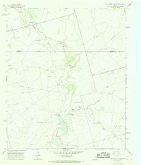 1966 Lucian Wells Ranch1968 Print · USGSRanching and early oil production define this West Texas landscape during the mid-1960s. Genealogists and historians can trace family holdings at Lucian Wells Ranch, follow Mustang Draw, and locate the curious School Bus Windmill.
 - 1966 Map of Houston Ranch, 1968 Print
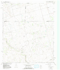 1966 Houston Ranch1968 Print · USGSThe West Texas plains at the meeting of Glasscock, Howard, and Martin counties are captured here in the mid-sixties. Researchers can trace ranching and oil history through the Old Houston Place, the Lomax settlement, and the landmark Hog Mountain.2 unique versions available
 - 1966 Map of Stanton SE, 1969 Print
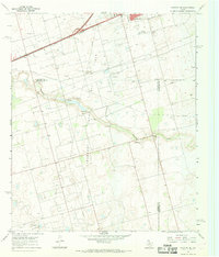 1966 Stanton SE1969 Print · USGSThe oil fields of the Permian Basin are in full development during the mid-sixties, marking the landscape with wells and pipelines. Genealogists and historians can trace the early industrial footprint of Stanton and Dix, locating landmarks like Evergreen Cem and Mustang Draw.
 - 1967 Map of Midkiff, 1970 Print
 1967 Midkiff1970 Print · USGSMidland and Upton counties are shown during a peak of mid-century industrial growth. Local historians can trace energy development through the Midkiff settlement, the Midkiff Gas Plant, and a sprawling network of Oil Wells.2 unique versions available
 - 1971 Map of Lees, 1973 Print
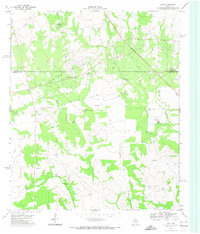 1971 Lees1973 Print · USGSGlasscock County at the start of the 1970s reveals a West Texas landscape shaped by petroleum and ranching. You can trace the community around Lees, the industrial footprint of the northern Oil Field, and rural landmarks like the North Cauble Windmill.
 - 1971 Map of Forsan, 1974 Print
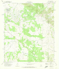 1971 Forsan1974 Print · USGSSettled along the Howard and Glasscock county lines in the early 1970s, this area shows a landscape defined by the North Concho River. Researchers can trace the local infrastructure of Forsan and Ross City, locating the High Sch and Cem.
Showing maps 1-25 of 131
Top cities of Glasscock County
Frequently asked questions
- What are the different types of historical maps available for Glasscock County?
- What is the oldest map of Glasscock County?
- Where can I purchase historical maps of Glasscock County for my home or office?
- Where can I download high-res historical maps of Glasscock County?
- Are there historical topographic maps available for Glasscock County?
- Is there historical aerial imagery available for Glasscock County?
- Where are historical maps of Glasscock County sourced from?