Old Maps of Gray County, Texas for Metal Detecting
Plan your next treasure hunt with 129 historic maps of Gray County. Find old homesites, ghost towns, trails, and gathering spots that may be lost to time — perfect for identifying promising metal detecting locations.
- Locate forgotten sites: Uncover places like long-lost settlements, abandoned rail lines, or gathering spots.
- Plan better hunts: Use map overlays combined with LiDAR or satellite views to narrow in on historically rich areas.
- Made for detectorists: Thousands of hobbyists use these maps to discover relics, coins, and hidden history.
Use these historic maps to boost your research and find new opportunities beneath the surface of Gray County.
Gray County, TX maps
(129)- 1954 Map of Amarillo, 1966 Print
 1954 Amarillo1966 Print · USGSThe Texas Panhandle in the mid-1960s shows a landscape of rising industrial power and deep-rooted ranching tradition. Local historians can trace the paths of the Panhandle and Santa Fe railroad or locate sites like the Pantex Ordnance Plant and Mobeetie.2 unique versions available
 - 1958 Map of Amarillo
 1958 Amarillo1958 Print · USGSThe Texas Panhandle in the mid-1950s reveals a landscape of expanding military installations and oil-rich rail towns. Local historians can trace the development of Amarillo Air Force Base or locate smaller settlements like Magic City and New Mobeetie.
 - 1960 Map of Groom, 1961 Print
 1960 Groom1961 Print · USGSThe Texas Panhandle plains meet the breaks of the Red River in the 1960s, where ranching culture and rail lines converge. Genealogists and historians can locate family landmarks like the Goodnight Cem and trace cattle operations at Thornberry Ranch or SJ Ranch.
 - 1962 Map of Hudgens Ranch, 1965 Print
 1962 Hudgens Ranch1965 Print · USGSThe Texas Panhandle ranching country south of Pampa is revealed in the early 1960s, showing a landscape defined by family cattle operations and creek drainages. Researchers can locate named properties like Hudgens Ranch and Word Ranch or trace the early energy infrastructure at the Pumping Sta.
 - 1962 Map of Back, 1965 Print
 1962 Back1965 Print · USGSThe Texas Panhandle energy landscape is captured here in the early sixties as industrial expansion moved across the plains. Researchers can locate remote settlements like Back and Kellerville alongside the extensive Gas and Oil Field and Heald Ch.
 - 1962 Map of Pond Creek, 1965 Print
 1962 Pond Creek1965 Print · USGSThe Texas Panhandle ranching country of the early sixties is captured here along the breaks of the North Fork Red River. Researchers can trace the path of the Fort Worth and Denver railroad and locate rural landmarks like Graham and the Huseby Ranch.2 unique versions available
 - 1962 Map of Pond Creek NW, 1965 Print
 1962 Pond Creek NW1965 Print · USGSThe Texas Panhandle's river-and-rail economy is on full display in the early 1960s along the North Fork Red River. Map collectors and historians can trace the extensive Gas and Oil Field infrastructure and the route of the Fort Worth and Denver railroad.
 - 1963 Map of Alanreed, 1967 Print
 1963 Alanreed1967 Print · USGSIn the early sixties, the Texas Panhandle community of Alanreed served as a key transit point for the CHICAGO ROCK ISLAND AND PACIFIC railroad. Local researchers can trace family landmarks like Alanreed Cem and the winding course of Whitefish Creek.2 unique versions available
 - 1963 Map of McLean, 1967 Print
 1963 McLean1967 Print · USGSMcLean and the surrounding High Plains ranch lands are captured here in the early sixties as the town grew along the Chicago Rock Island and Pacific rail line. Researchers can locate the Hillcrest Cem, trace the local Rodeo Ground, and find long-standing landmarks like the Drive-in Theater.2 unique versions available
 - 1963 Map of Pampa, 1968 Print
 1963 Pampa1968 Print · USGSMid-century Pampa and the nearby community of Mesilla Park are shown during a period of significant energy production and rail activity. Genealogists and local historians can trace neighborhood growth through dozens of named sites like Lee Jr High Sch, Fairview Cem, and Perry-Lefors Airfield.
 - 1964 Map of Jericho, 1967 Print
 1964 Jericho1967 Print · USGSThe Texas Panhandle in the early sixties reveals a landscape of cattle-guard gates and rural industry. Genealogists and historians can trace family locations near Jericho Cem, the Chicago Rock Island and Pacific line, and Boydston Cemetery.
 - 1964 Map of Rockledge, 1967 Print
 1964 Rockledge1967 Print · USGSThe Texas Panhandle in the early sixties is captured here as a landscape of ranching, energy extraction, and critical rail transport. Genealogists and historians can trace the Chicago Rock Island and Pacific rail line through Rockledge and locate family landmarks like Johnson Ranch.
 - 1965 Map of Lake Mc Connell, 1967 Print
 1965 Lake Mc Connell1967 Print · USGSGray County, Texas, was a hub of energy and transport in the mid-1960s as petroleum infrastructure reshaped the Panhandle. Researchers can trace the industrial footprint of the Carbon Black Plant, the residential layout of Kingsmill Camp, and the rail lines of the Atchison Topeka and Santa Fe.
 - 1966 Map of Grandview School, 1967 Print
 1966 Grandview School1967 Print · USGSThe high plains of the Texas Panhandle are captured here in the mid-sixties, straddling the Carson Co and Gray Co line. Local historians and researchers can locate Grandview Sch, trace the path of McClellan Creek, and identify early Oil Wells.
 - 1966 Map of Kingsmill, 1967 Print
 1966 Kingsmill1967 Print · USGSThe Texas Panhandle's energy and rail landscape is on full display in the mid-sixties, from the Kingsmill rail stop to the Oil Field operations. Trace the industrial footprint of the Chemical Plant, the Pampa Plant (Gas), and the rail-side Kingsmill Camp.
 - 1966 Map of Laketon, 1970 Print
 1966 Laketon1970 Print · USGSThe Texas Panhandle at the height of the mid-century oil boom is centered here on the railroad hamlet of Laketon. Genealogists and historians can trace the industrial footprint of the Laketon Grain Elevators and the Landing Field (Aban'd) alongside dozens of named gas wells.
 - 1966 Map of Bowers City, 1970 Print
 1966 Bowers City1970 Print · USGSGray County was a hub of energy production in the mid-1960s, defined by the convergence of rail and petroleum infrastructure. Trace the early layout of Bowers City, the Fort Worth and Denver railroad, and the expansive Gas and Oil Field.2 unique versions available
 - 1967 Map of Lefors, 1969 Print
 1967 Lefors1969 Print · USGSThe Texas Panhandle comes alive in the late sixties as the petroleum industry reshapes the valley of the North Fork Red River. Trace the sprawling Gas and Oil Field alongside the Fort Worth and Denver rail line near Lefors and Wesco.
 - 1967 Map of Hoover, 1969 Print
 1967 Hoover1969 Print · USGSGray County and the Roberts County line are captured in the late sixties as the Panhandle's rail and ranching economy thrived. Trace the tracks of the Atchison Topeka and Santa Fe through Hoover and locate the Grain Elevators at Heaton.
 - 1967 Map of Tody School, 1970 Print
 1967 Tody School1970 Print · USGSThe Texas Panhandle's rugged drainages and rail corridors are revealed here in the late sixties, where Gray and Wheeler counties meet. Genealogists and historians can locate the Tody Sch and trace the path of the Atchison Topeka and Santa Fe near Cowboy Creek.2 unique versions available
 - 1968 Map of Taylor Ranch, 1969 Print
 1968 Taylor Ranch1969 Print · USGSGray County's petroleum and ranching landscape is captured in detail during the late 1960s. Genealogists and historians can trace family-named sites like Taylor Ranch and Eldridge Cem, alongside the extensive Gas and Oil Field infrastructure.
 - 1968 Map of Deep Lake, 1970 Print
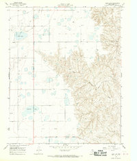 1968 Deep Lake1970 Print · USGSGray County during the late 1960s is shown as a hub of energy production where oil and gas infrastructure covers the plains. Researchers can trace the industrial footprint of the Oil Field and find landmarks like Deep Lake and Wakefield Lake.
 - 1982 Map of Pampa, 1983 Print
 1982 Pampa1983 Print · USGSThe Texas Panhandle in the early eighties shows a landscape shaped by petroleum and ranching along the Canadian River. Genealogists and local historians can trace the paths of the Atchison Topeka and Santa Fe railroad through Pampa, Mobeetie, and Heaton.
 - 1983 Map of Shamrock
 1983 Shamrock1983 Print · USGSThe Texas Panhandle in the early 1980s reveals a landscape shaped by petroleum and the rail lines of the southern plains. Genealogists and historians can trace the Chicago Rock Island and Pacific corridor through Mc Lean and Shamrock, or locate smaller centers like Magic City and Lefors.
 - 1983 Map of Groom, 1984 Print
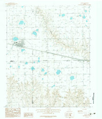 1983 Groom1984 Print · USGSThe Texas Panhandle plains meet the rolling breaks of the Caprock in the early 1980s during a period of major highway expansion. Genealogists and local historians can trace the early layout of Groom, the small settlement of Boydston, and a rural Landing Strip.
Showing maps 1-25 of 129
Top cities of Gray County
Frequently asked questions
- What are the different types of historical maps available for Gray County?
- What is the oldest map of Gray County?
- Where can I purchase historical maps of Gray County for my home or office?
- Where can I download high-res historical maps of Gray County?
- Are there historical topographic maps available for Gray County?
- Is there historical aerial imagery available for Gray County?
- Where are historical maps of Gray County sourced from?