
1966 Map of Grandview School
USGS Topo · Published 1967About this map
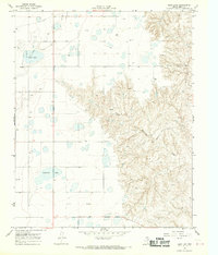
The boundary between Carson Co and Gray Co divides this landscape, where the agricultural and industrial infrastructure of the Texas Panhandle is clearly visible. The local community center is anchored at Grandview Sch in the eastern portion of the sheet. Across the terrain, the prominence of Gas Well and Oil Well markings indicates the importance of petroleum extraction to the local economy during the mid-1960s. Drainage is defined by the winding course of McClellan Creek in the southwest, while a network of service roads and a Pipeline cut across the high plains to connect various Storage Bins. This survey captures a moment when the Panhandle's traditional ranching or farming uses were being heavily overlaid by the expansion of the energy sector.
Find a feature on this map
10 named features on this map. Tap any name to fly to it.
Don’t see what you’re looking for? This feature index may not catch every label — zoom into the map to look around manually.
Map Details
Editions of this 1966 Grandview School Map
This is the sole edition of this map. No revisions or reprints were ever made.
Other maps of this area

1954 · Amarillo
USGS Topo · 1:250,000

1958 · Amarillo
USGS Topo · 1:250,000

1960 · Groom
USGS Topo · 1:62,500

1964 · Jericho
USGS Topo · 1:24,000

1965 · White Deer
USGS Topo · 1:24,000

1966 · White Deer SW
USGS Topo · 1:24,000

1966 · Kingsmill
USGS Topo · 1:24,000

1966 · Bowers City
USGS Topo · 1:24,000
1968 · Deep Lake
USGS Topo · 1:24,000
1983 · Shamrock
USGS Topo · 1:100,000