
1966 Map of White Deer SW
USGS Topo · Published 1967About this map
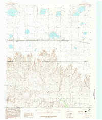
McClellan Creek meanders through the central and southern portions of this landscape, defining the sharp breaks and deep contours of the Carson County terrain. In the mid-1960s, this area was characterized by intensive energy exploration, with numerous Oil Wells and Gas Wells dotting the plains above the creek bed. The map reveals an intricate industrial infrastructure, including a prominent Pipeline and a specific Drill Hole that reflect the region's focus on mineral extraction. The density of these small-scale features against the backdrop of the rolling Texas Panhandle illustrates a period when the local economy was deeply tied to the underlying geological resources and the systematic development of fossil fuel fields.
Find a feature on this map
8 named features on this map. Tap any name to fly to it.
Don’t see what you’re looking for? This feature index may not catch every label — zoom into the map to look around manually.
Map Details
Editions of this 1966 White Deer SW Map
This is the sole edition of this map. No revisions or reprints were ever made.
Other maps of this area

1954 · Amarillo
USGS Topo · 1:250,000

1958 · Amarillo
USGS Topo · 1:250,000

1960 · Claude
USGS Topo · 1:62,500

1960 · Groom
USGS Topo · 1:62,500

1965 · White Deer
USGS Topo · 1:24,000

1966 · Grandview School
USGS Topo · 1:24,000

1966 · Panhandle East
USGS Topo · 1:24,000

1966 · Cuyler
USGS Topo · 1:24,000

1966 · Kingsmill
USGS Topo · 1:24,000
1983 · Lark
USGS Topo · 1:24,000