
1964 Map of Jericho
USGS Topo · Published 1967About this map
Jericho sits as a quiet hub on the High Plains along the Chicago Rock Island and Pacific railroad, reflecting a landscape shaped by both transit and the pursuit of natural resources. The terrain is defined by the dramatic drainage of McClellan Creek as it feeds into Lake McClellan, a sharp contrast to the surrounding flat plains marked by numerous playas. Local family and community history is preserved at the Jericho Cem and Boydston Cemetery, while the presence of scattered gas and oil wells indicates the mid-century industrial activity common to the Panhandle. The boundary between Gray and Donley County is noted as indefinite, tracing the transition through the breaks of the Red River watershed.
Find a feature on this map
12 named features on this map. Tap any name to fly to it.
Don’t see what you’re looking for? This feature index may not catch every label — zoom into the map to look around manually.
Map Details
Editions of this 1964 Jericho Map
This is the sole edition of this map. No revisions or reprints were ever made.
Other maps of this area

1954 · Amarillo
USGS Topo · 1:250,000

1958 · Amarillo
USGS Topo · 1:250,000

1960 · Groom
USGS Topo · 1:62,500

1962 · Roach Ranch
USGS Topo · 1:24,000

1962 · Griffin Ranch
USGS Topo · 1:24,000

1964 · Rockledge
USGS Topo · 1:24,000

1966 · Grandview School
USGS Topo · 1:24,000

1968 · Taylor Ranch
USGS Topo · 1:24,000
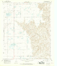
1968 · Deep Lake
USGS Topo · 1:24,000
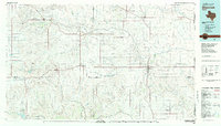
1983 · Shamrock
USGS Topo · 1:100,000