1950s Maps of Hardin County, Texas
Explore 10 historic maps of Hardin County from the 1950s. These maps offer a rare glimpse into what life looked like during the 1950s — showing old roads, neighborhoods, homes, and landmarks that have changed or disappeared over time.
Whether you're researching your family's past, planning a metal detecting trip, or studying how Hardin County's landscape evolved across the 1950s, these high-resolution maps are a powerful tool for exploring the history of this region.
- Focus on a specific era: All maps on this page are from the 1950s, giving you a focused view of this time period.
- See what’s changed: Compare century-old streets, trails, and buildings to today's modern landscape using overlays and satellite layers.
- Research with precision: Use these maps for genealogy, historical research, land use analysis, or educational projects.
- View, download, or print: Maps are fully viewable online in high resolution, and can be downloaded or printed for your own records.
Start exploring Hardin County's history through authentic maps from the 1950s. This is your window into the past.
Hardin County, TX maps
(10)- 1954 Map of Beaumont, 1964 Print
 1954 Beaumont1964 Print · USGSSoutheast Texas in the mid-fifties reveals a landscape of massive national forests, emerging reservoirs, and a booming oil economy. Genealogists and researchers can trace rural settlements like Dallardsville and Village Mills or locate early drilling sites at Sour Lake Oil Field.3 unique versions available
 - 1955 Map of Daisetta, 1956 Print
 1955 Daisetta1956 Print · USGSLiberty County was undergoing an industrial transition in the 1950s as oil fields and drainage canals reshaped the coastal prairie. Researchers can trace the development of salt dome operations near Daisetta or locate rural landmarks like Ames Cem and Sacred Heart Ch.3 unique versions available
 - 1955 Map of Saratoga, 1956 Print
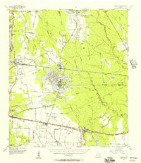
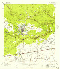
 1955 Saratoga1956 Print · USGSHardin County oil and timber industries are on full display in the mid-fifties, showing the region's dense baygalls and rail towns. Genealogists and historians can trace family sites at Mt Calvary Ch or the Saratoga Oil Field.4 unique versions available
 - 1955 Map of Silsbee, 1956 Print
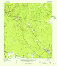
 1955 Silsbee1956 Print · USGSSoutheast Texas in the mid-fifties is captured here as a landscape of timber and oil, where the Neches River meanders through the piney woods. Genealogists and historians can trace community roots through Peaceful Rest Cem, Good Shepherd Ch, and the rail stops at Lumberton and Fletcher.3 unique versions available
 - 1955 Map of Kountze, 1956 Print
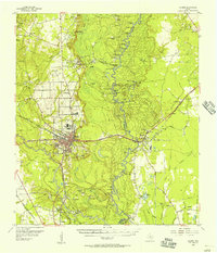
 1955 Kountze1956 Print · USGSIn the mid-1950s, the Hardin County lumber and oil landscape centered on Kountze was a network of rail-side settlements and active fields. Researchers can trace the Kirby Lumber Tram or locate family roots near Honey Island, Old Hardin, and Providence Ch.4 unique versions available
 - 1955 Map of Sour Lake, 1956 Print
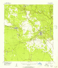
 1955 Sour Lake1956 Print · USGSCoastal Texas prairies and oil fields are captured here in the mid-1950s as petroleum production shaped the local economy. Genealogists can locate family landmarks like Pine Ridge Ch, Henderson Sch, and the Grayburg Cem along the old rail lines.2 unique versions available
 - 1957 Map of Beaumont
 1957 Beaumont1957 Print · USGSSoutheast Texas in the mid-fifties is defined by the timber-rich lands between the Trinity River and Beaumont. Trace the history of the Alabama and Coushatti Indian Reservation or locate early campus sites like Prairie View College.
 - 1958 Map of Segno, 1960 Print
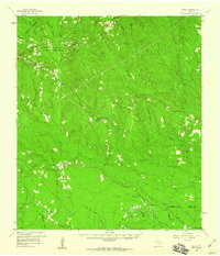 1958 Segno1960 Print · USGSDeep in the East Texas Piney Woods during the late fifties, this area shows the intersection of tribal lands and the burgeoning oil industry. Genealogists can locate family sites near Indian Village, Segno, and the Midway Cem.2 unique versions available
 - 1958 Map of Warren, 1960 Print
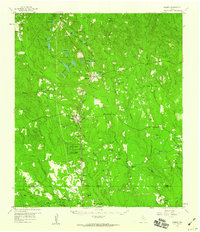 1958 Warren1960 Print · USGSSoutheast Texas timber and oil lands come to life in this late fifties survey of Tyler and Hardin counties. Genealogists and researchers can trace the Southern Pacific rail line to settlements like Warren and landmarks such as the Red Oak Sch.3 unique versions available
 - 1958 Map of Spurger, 1960 Print
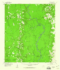 1958 Spurger1960 Print · USGSSoutheast Texas in the late fifties was a landscape of river bottomlands and emerging oil fields. Researchers can trace the legacy of timber and oil through the Old Railroad Grade and Joes Lake Oil Field, or find family roots at Withers Cem and Spring Hill Ch.2 unique versions available
End of results
Showing maps 1-10 of 10
Top cities of Hardin County
- Lumberton historical maps
- Silsbee historical maps
- Kountze historical maps
- Sour Lake historical maps
- Rose Hill Acres historical maps
Frequently asked questions
- What are the different types of historical maps available for Hardin County?
- What is the oldest map of Hardin County?
- Where can I purchase historical maps of Hardin County for my home or office?
- Where can I download high-res historical maps of Hardin County?
- Are there historical topographic maps available for Hardin County?
- Is there historical aerial imagery available for Hardin County?
- Where are historical maps of Hardin County sourced from?