2020s Maps of Harris County, Texas
Explore 46 historic maps of Harris County from the 2020s. These maps offer a rare glimpse into what life looked like during the 2020s — showing old roads, neighborhoods, homes, and landmarks that have changed or disappeared over time.
Whether you're researching your family's past, planning a metal detecting trip, or studying how Harris County's landscape evolved across the 2020s, these high-resolution maps are a powerful tool for exploring the history of this region.
- Focus on a specific era: All maps on this page are from the 2020s, giving you a focused view of this time period.
- See what’s changed: Compare century-old streets, trails, and buildings to today's modern landscape using overlays and satellite layers.
- Research with precision: Use these maps for genealogy, historical research, land use analysis, or educational projects.
- View, download, or print: Maps are fully viewable online in high resolution, and can be downloaded or printed for your own records.
Start exploring Harris County's history through authentic maps from the 2020s. This is your window into the past.
Harris County, TX maps
(46)- 2022 Map of Sheeks, 2022 Print
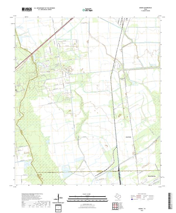 2022 Sheeks2022 Print · USGSCoastal Texas water management and county boundaries take center stage in the 2020s near the junction of Harris, Liberty, and Chambers counties. Genealogists can locate the Harvey Family Cem while researchers trace the extensive Dayton Canal and Lynchburg Canal networks.
 - 2022 Map of Bacliff, 2022 Print
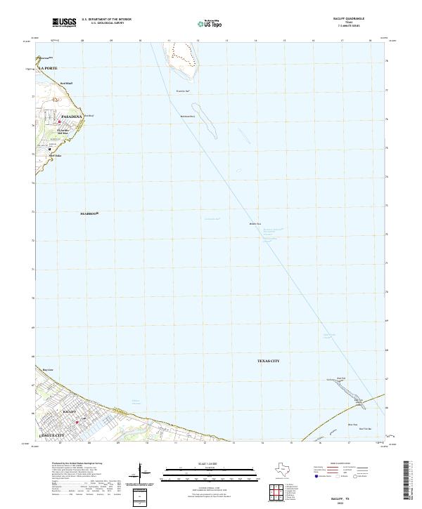 2022 Bacliff2022 Print · USGSThe Galveston Bay coastline in 2022 remains a hub of maritime commerce and residential growth. Trace the streets of Bacliff, find the Seabrook Cem, and follow the Houston Ship Channel through the bay.
 - 2022 Map of Addicks, 2022 Print
 2022 Addicks2022 Print · USGSWestern Harris County during the early twenty-first century expansion shows a dense network of suburban development surrounding the Barker Reservoir. Genealogists and local historians can trace legacy landmarks like the Bear Creek Methodist Cem, Baker Cem, and the historic settlements of Barker and Addicks.
 - 2022 Map of Hockley Mound, 2022 Print
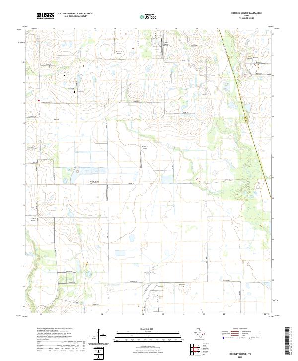 2022 Hockley Mound2022 Print · USGSThe rural prairie landscape northwest of Houston is captured here in the early twenty-first century, showing a unique density of private airstrips and family lands. Researchers can locate burial sites like Frey Cem or trace the winding paths of Live Oak Creek and Cypress Creek as they flow near Hockley Mound.
 - 2022 Map of Algoa, 2022 Print
 2022 Algoa2022 Print · USGSCoastal Texas expansion meets established local history in this study of the Alvin and Santa Fe corridor. Genealogists and researchers can map out the residential growth around Dickinson Bayou and locate landmarks like the Confederate Cem or Alvin Community College.
 - 2022 Map of Rose Hill, 2022 Print
 2022 Rose Hill2022 Print · USGSIn the northwestern outskirts of Houston during the early twenty-first century, this area balances residential growth with deep-rooted local history. Genealogists can locate numerous burial sites like Sander Cem, Zahn Cem, and Rose Hill Cem alongside the waters of Willow Cr.
 - 2022 Map of Waller NW, 2022 Print
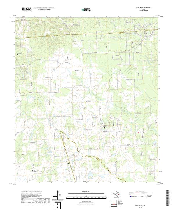 2022 Waller NW2022 Print · USGSThis rural portion of Waller and Grimes Counties shows a landscape of creek-fed prairies and historic family lands. Genealogists can locate long-standing burial sites like Fields Store Cem and Jones Cem alongside the waters of Spring Cr.
 - 2022 Map of Mont Belvieu, 2022 Print
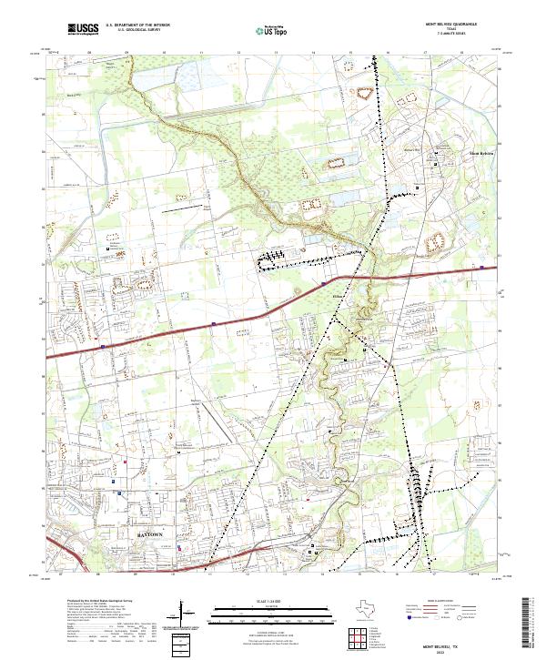 2022 Mont Belvieu2022 Print · USGSCoastal Texas industry and heritage meet along the Harris-Chambers county line in the early 2020s. Researchers can locate numerous family-named burial grounds like Amos Barber Cem and Morgan Cem or trace the winding course of Cedar Bayou.
 - 2022 Map of Morgans Point, 2022 Print
 2022 Morgans Point2022 Print · USGSCoastal Harris and Chambers counties meet at this vital maritime crossroads during the 2020s. Researchers can trace the industrial shoreline from Barbours Cut to Baytown, or locate family sites at Magnolia Cem and Morgan's Point Cem.
 - 2022 Map of Park Place, 2022 Print
 2022 Park Place2022 Print · USGSSoutheast Houston and its industrial waterfront come alive in this recent survey, showing the dense network of bayous and neighborhoods near the ship channel. Researchers can trace historic boundaries and landmarks from Harrisburg and Magnolia Park to the William P Hobby Airport and Evergreen Cem.
 - 2022 Map of La Porte, 2022 Print
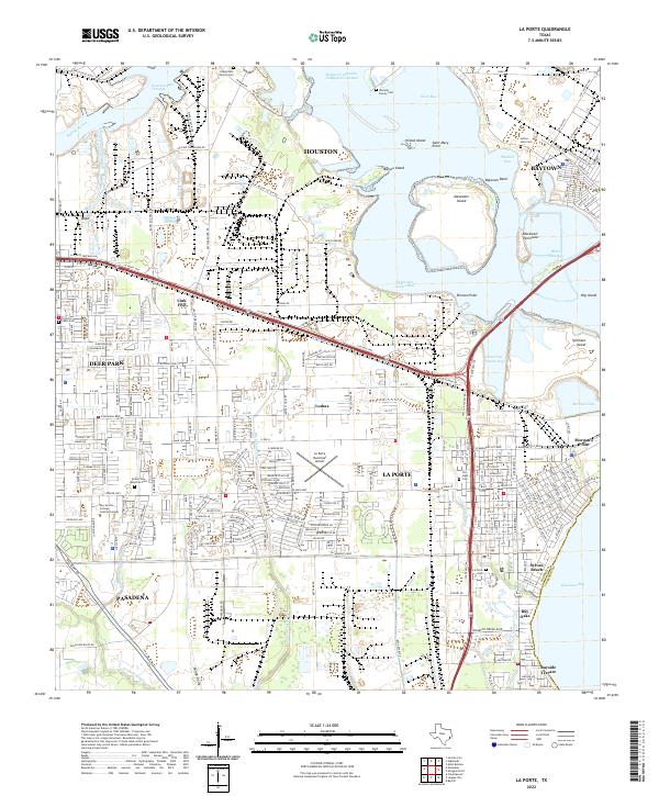 2022 La Porte2022 Print · USGSThe industrial shoreline of East Harris County is captured here in the early 2020s, showing the intersection of massive shipping channels and coastal neighborhoods. Researchers can locate small family burial sites like Habermehl Family Cem and Arthur Hale Cem alongside landmarks like Sylvan Beach.
 - 2022 Map of Missouri City, 2022 Print
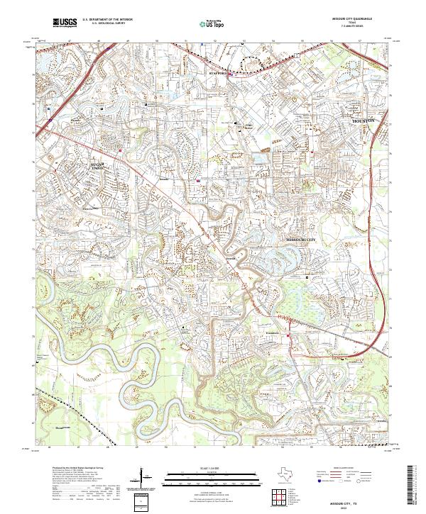 2022 Missouri City2022 Print · USGSFort Bend County's transition from river-bottom ranching to a major suburban hub is on display here in the early 2020s. Genealogists and historians can locate numerous burial sites like Cementerio San Isidro and Stafford Cem alongside old crossroads like Dewalt.
 - 2022 Map of Almeda, 2022 Print
 2022 Almeda2022 Print · USGSThe southern fringes of the Houston metro area come into focus in the 2020s, showing a landscape shaped by both bayous and beltways. Researchers can trace family history at the Almeda Cem or locate regional landmarks like the Houston/Southwest Airport.
 - 2022 Map of Jacinto City, 2022 Print
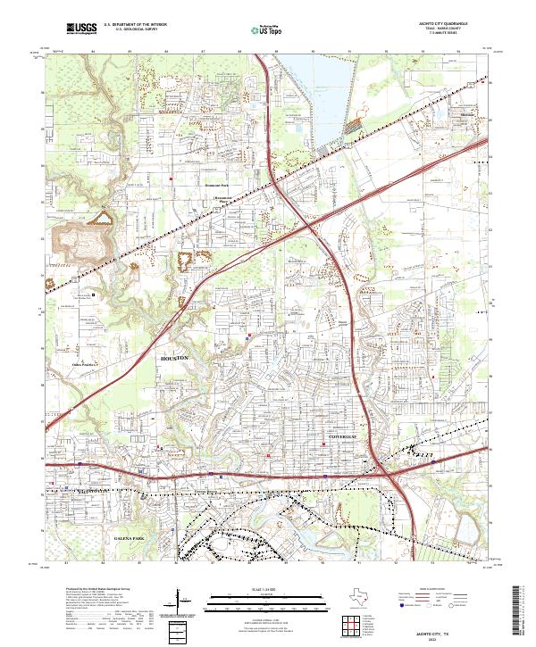 2022 Jacinto City2022 Print · USGSEast Harris County in the 2020s shows a complex landscape where deep-rooted residential neighborhoods meet the massive infrastructure of the shipping and industrial corridors. Researchers can trace local heritage at Harris County Cem Number Two, Bradshaw Cem, and the established streets of Cloverleaf.
 - 2022 Map of Alief, 2022 Print
 2022 Alief2022 Print · USGSThe western Houston suburbs of Harris and Fort Bend counties are shown in 2022 during a period of dense residential and institutional growth. Researchers can find prominent landmarks like Piney Point Village, Houston Baptist University, and the Forest Park Cem.
 - 2022 Map of Clodine, 2022 Print
 2022 Clodine2022 Print · USGSFort Bend and Harris counties meet here in a landscape of rapid suburban growth during the 2020s. Researchers can trace historic cemeteries and neighborhood landmarks like Pleasant Green Cem, Clodine, and Hodges Bend Cem.
 - 2022 Map of Bellaire, 2022 Print
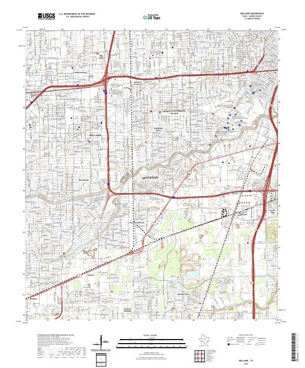 2022 Bellaire2022 Print · USGSHouston and its southwestern suburbs are shown in high resolution during the early twenty-first century. Researchers can trace the development of established neighborhoods like Bellaire and Meyerland or locate specific sites like Rice University and Pierce Junction.
 - 2022 Map of Warren Lake, 2022 Print
 2022 Warren Lake2022 Print · USGSWestern Harris County's ranching heritage meets modern expansion in this detailed 2022 survey. Genealogists and local historians can trace family-named routes like Warren Ranch Rd and landmarks including Fisher Lake and Wolf Hill.
 - 2022 Map of Pasadena, 2022 Print
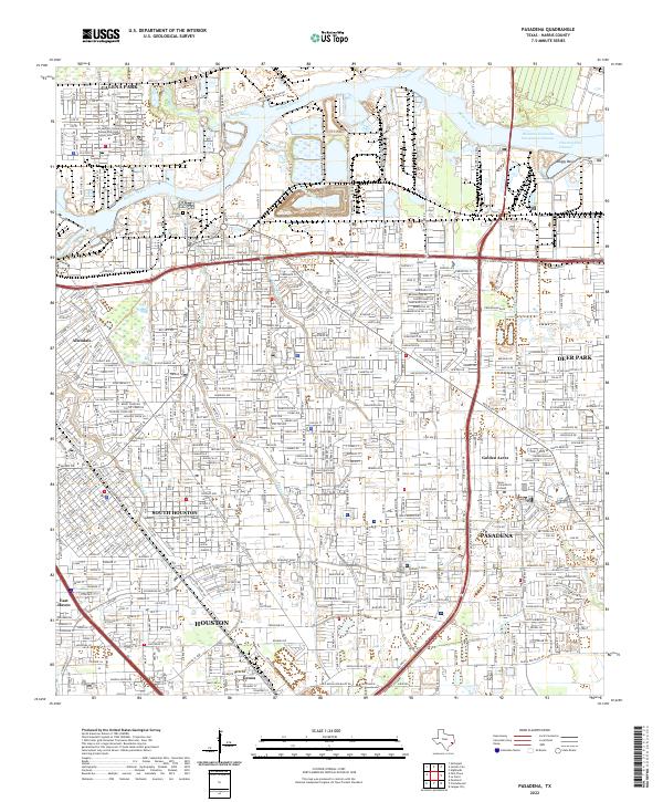 2022 Pasadena2022 Print · USGSPasadena and the industrial heart of Harris County appear here during the early 2020s. Researchers can trace the modern growth of Golden Acres and locate institutions like Texas Chiropractic College and Crown Hill.
 - 2022 Map of Settegast, 2022 Print
 2022 Settegast2022 Print · USGSHouston and its eastern industrial corridors are captured here in the early twenty-first century as modern transit networks weave through historic neighborhoods. Genealogists can trace family sites at Evergreen Negro Cem-East, Hollywood Cem, or Settegast.
 - 2022 Map of Harmaston, 2022 Print
 2022 Harmaston2022 Print · USGSHouston's northeastern expansion reaches the shores of Lake Houston during this era of rapid suburban growth. Researchers can trace the development of Atascocita and locate landmarks like the Harrington Cem and Sheldon Reservoir.
 - 2022 Map of League City, 2022 Print
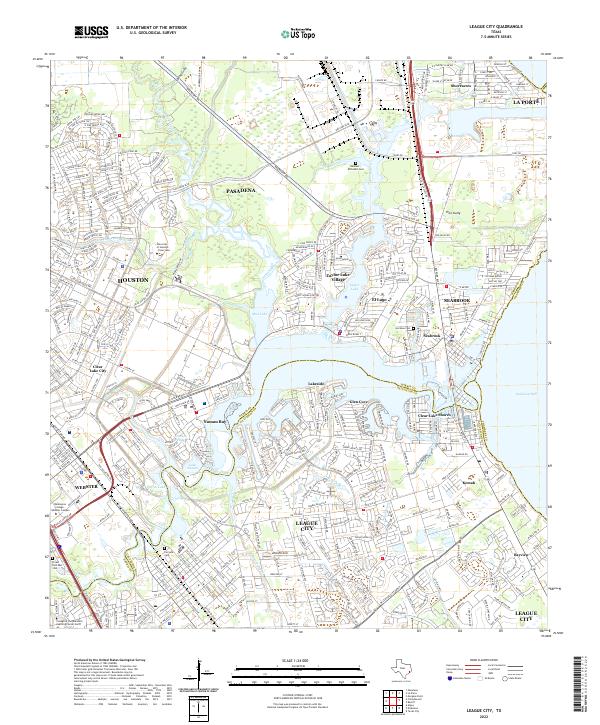 2022 League City2022 Print · USGSLeague City and the surrounding bayou country are shown in extensive detail at the start of the 2020s. Genealogists and researchers can trace local family landmarks like the Hammer-McFaddin Cem or the winding reaches of Armand Bayou and Big Island Slough.
 - 2022 Map of Katy, 2022 Print
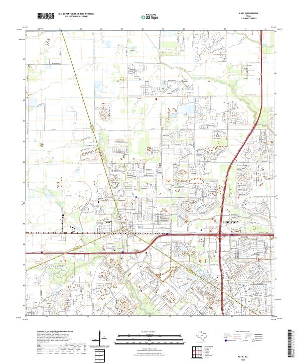 2022 Katy2022 Print · USGSKaty and the western fringes of Houston are captured here during a period of intense suburban growth and infrastructural expansion. Map collectors and local researchers can trace the modern development around the Katy Magnolia Cem and along the banks of Buffalo Bayou.
 - 2022 Map of Friendswood, 2022 Print
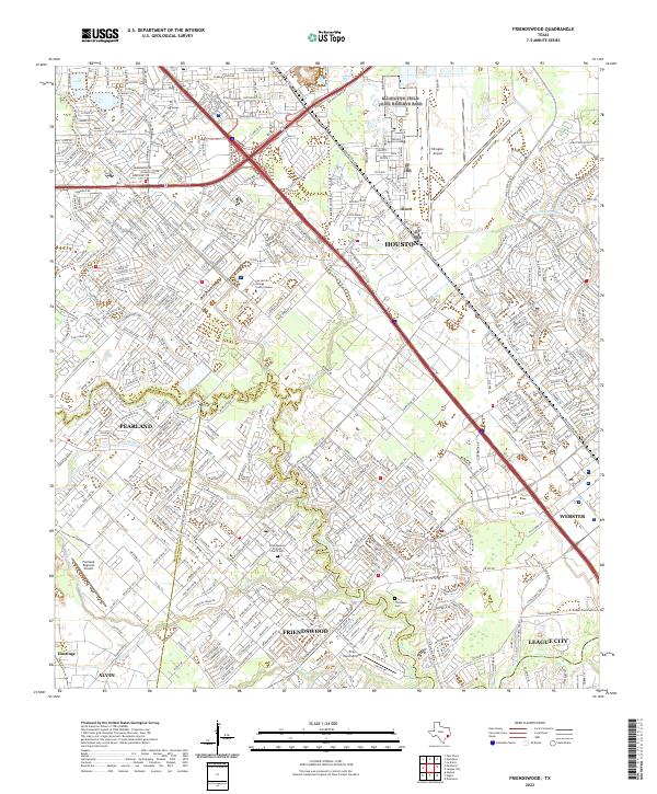 2022 Friendswood2022 Print · USGSThe Gulf Coast suburbs south of Houston were rapidly maturing by the early 2020s, dominated by modern aviation and intricate waterways. Researchers can trace local heritage at the Friendswood Friends Church Cemetery or explore the aviation footprints of Ellington Airport and Polly Ranch Airport.
 - 2022 Map of Hedwig Village, 2022 Print
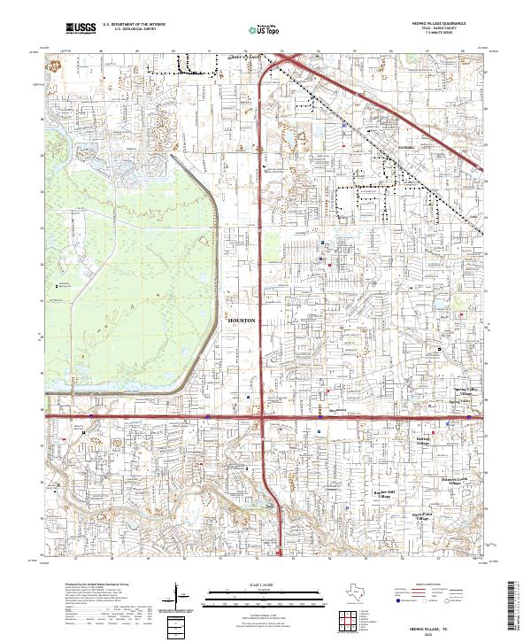 2022 Hedwig Village2022 Print · USGSThe western Houston suburbs and the critical drainage systems of the Addicks area are captured here in 2022. Trace local family history at the Beeler Family Cem or study the landscape around Buffalo Bayou and Addicks Dam.
Showing maps 1-25 of 46
Top cities of Harris County
- Houston historical maps
- Pasadena historical maps
- Cypress historical maps
- Atascocita historical maps
- Baytown historical maps
- Spring historical maps
See more
Frequently asked questions
- What are the different types of historical maps available for Harris County?
- What is the oldest map of Harris County?
- Where can I purchase historical maps of Harris County for my home or office?
- Where can I download high-res historical maps of Harris County?
- Are there historical topographic maps available for Harris County?
- Is there historical aerial imagery available for Harris County?
- Where are historical maps of Harris County sourced from?