2020s Maps of Coffee City, Texas
Explore 4 historic maps of Coffee City from the 2020s. These maps offer a rare glimpse into what life looked like during the 2020s — showing old roads, neighborhoods, homes, and landmarks that have changed or disappeared over time.
Whether you're researching your family's past, planning a metal detecting trip, or studying how Coffee City's landscape evolved across the 2020s, these high-resolution maps are a powerful tool for exploring the history of this region.
- Focus on a specific era: All maps on this page are from the 2020s, giving you a focused view of this time period.
- See what’s changed: Compare century-old streets, trails, and buildings to today's modern landscape using overlays and satellite layers.
- Research with precision: Use these maps for genealogy, historical research, land use analysis, or educational projects.
- View, download, or print: Maps are fully viewable online in high resolution, and can be downloaded or printed for your own records.
Start exploring Coffee City's history through authentic maps from the 2020s. This is your window into the past.
Coffee City, TX maps
(4)- 2022 Map of Poynor, 2022 Print
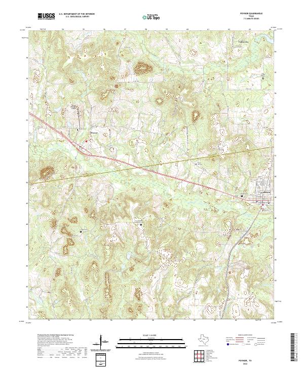 2022 Poynor2022 Print · USGSThe Henderson and Anderson County line divides this East Texas landscape in the early 2020s, showcasing the rural communities around Poynor and Frankston. Local historians can locate numerous family and community burial grounds like Foster Cemetery and landmarks such as the Pickle Plantation Airport.
 - 2022 Map of Moore Station, 2022 Print
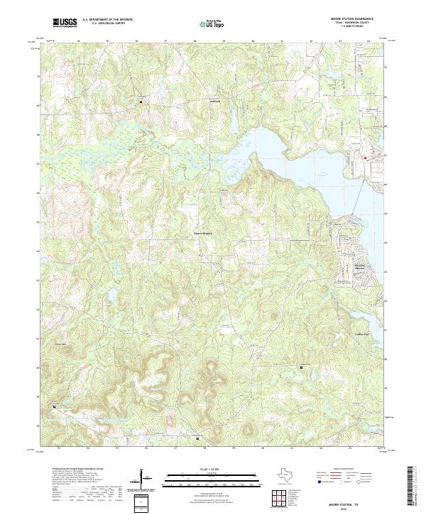 2022 Moore Station2022 Print · USGSHenderson County, Texas, is shown here during a period of lakeside growth and rural preservation. Genealogists can trace family burial sites at Bethel Cem and Myrtle Springs Cem, while researchers can study the shoreline of Lake Palestine.
 - 2022 Map of Saline Bay, 2022 Print
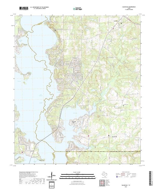 2022 Saline Bay2022 Print · USGSThe eastern shores of Lake Palestine in the early 2020s show a mix of waterfront recreation and deep-rooted Texas history. Trace family lineage at Bethlehem Cem or explore the inlets and residential growth near Coffee City and Emerald Bay.
 - 2022 Map of Berryville, 2022 Print
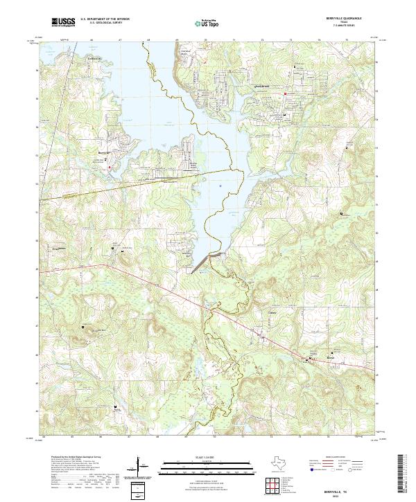 2022 Berryville2022 Print · USGSLake Palestine and its winding inlets define this East Texas landscape as it appeared in the early 2020s. Researchers can locate numerous heritage sites including Corinth Cem, Kickapoo Mtn, and the rural community of Cuney.
End of results
Showing maps 1-4 of 4
Top cities near Coffee City
- Tyler historical maps
- Jacksonville historical maps
- Athens historical maps
- Chandler historical maps
- Bullard historical maps
- Frankston historical maps
See more
Frequently asked questions
- What are the different types of historical maps available for Coffee City?
- What is the oldest map of Coffee City?
- Where can I purchase historical maps of Coffee City for my home or office?
- Where can I download high-res historical maps of Coffee City?
- Are there historical topographic maps available for Coffee City?
- Is there historical aerial imagery available for Coffee City?
- Where are historical maps of Coffee City sourced from?