2020s Maps of Hood County, Texas
Explore 16 historic maps of Hood County from the 2020s. These maps offer a rare glimpse into what life looked like during the 2020s — showing old roads, neighborhoods, homes, and landmarks that have changed or disappeared over time.
Whether you're researching your family's past, planning a metal detecting trip, or studying how Hood County's landscape evolved across the 2020s, these high-resolution maps are a powerful tool for exploring the history of this region.
- Focus on a specific era: All maps on this page are from the 2020s, giving you a focused view of this time period.
- See what’s changed: Compare century-old streets, trails, and buildings to today's modern landscape using overlays and satellite layers.
- Research with precision: Use these maps for genealogy, historical research, land use analysis, or educational projects.
- View, download, or print: Maps are fully viewable online in high resolution, and can be downloaded or printed for your own records.
Start exploring Hood County's history through authentic maps from the 2020s. This is your window into the past.
Hood County, TX maps
(16)- 2022 Map of Lipan, 2022 Print
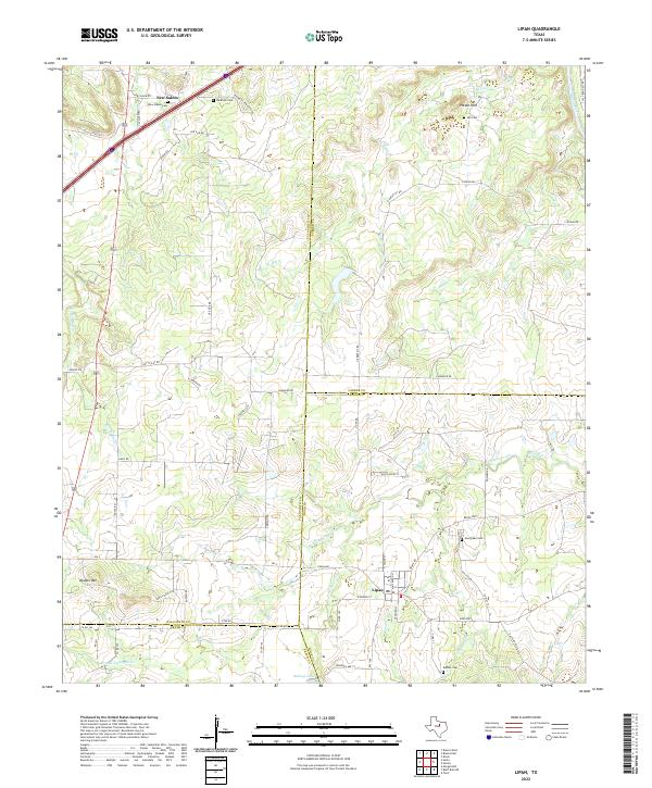 2022 Lipan2022 Print · USGSLipan and its surrounding ranch lands appear in detail at the intersection of Hood, Erath, and Palo Pinto counties in the early 2020s. Genealogists can trace family burial sites at Evergreen Cem and New Salem Cem or locate landmarks like Double Mtn.
 - 2022 Map of Bluff Dale NE, 2022 Print
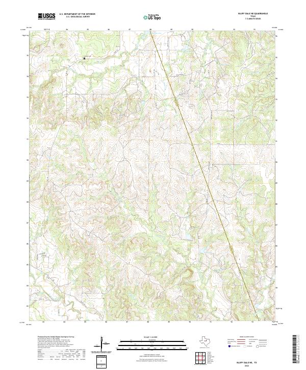 2022 Bluff Dale NE2022 Print · USGSThe rural borderlands between Erath and Hood Counties are documented here as they appeared recently. Genealogists and local historians can locate Bishop Cem and trace the headwaters of the N Paluxy River and Kickapoo Cr.
 - 2022 Map of Bluff Dale, 2022 Print
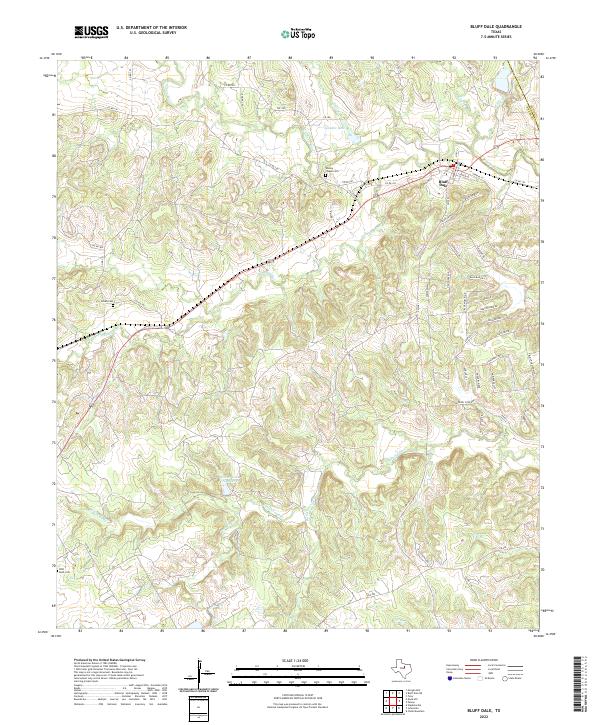 2022 Bluff Dale2022 Print · USGSBluff Dale and the Erath County countryside are captured here in the early twenty-first century as the Paluxy River forks continue to shape the landscape. Local historians can trace family burial sites at Wesley Chapel Cem or Acrea Cem and locate rural landmarks like Spindor Lake.
 - 2022 Map of Bono, 2022 Print
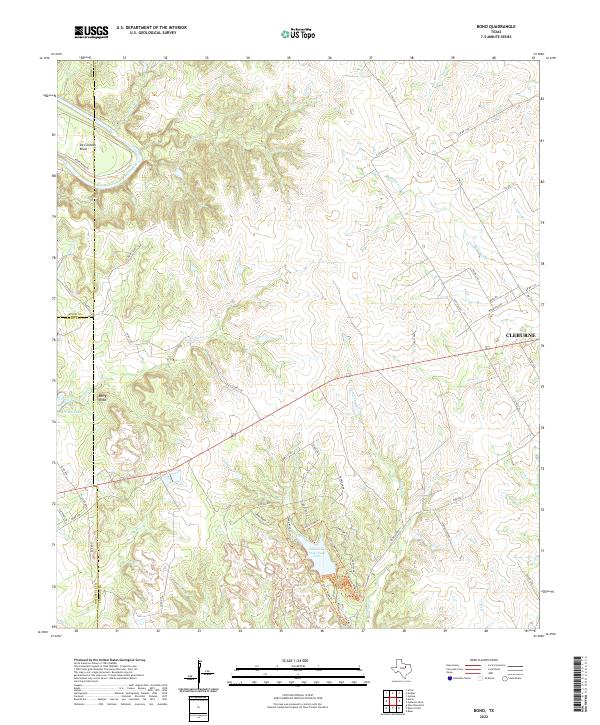 2022 Bono2022 Print · USGSThe Brazos River loop at De Cordova Bend and the wooded hills of Johnson County are captured in this contemporary survey. Outdoor enthusiasts and researchers can trace the detailed trail networks of Cleburne State Park, including the Fossil Ridge Trl and Coyote Run Nature Trl.
 - 2022 Map of Acton, 2022 Print
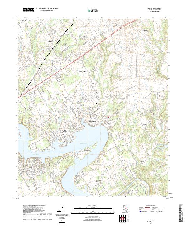 2022 Acton2022 Print · USGSThe Brazos River valley in Hood County shows a landscape transformed by water and suburban growth in the early twenty-first century. Genealogists can locate family sites at Acton Cem, W M Miller Cem, and the community of DeCordova.
 - 2022 Map of Paluxy, 2022 Print
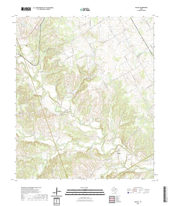 2022 Paluxy2022 Print · USGSHood County ranchlands and river valleys are captured here in the early twenty-first century as they border Somervell and Erath. Genealogists can trace several family-named landmarks including Rock Church Cem, Bull Cem, and Brooks Cem along the Paluxy River.
 - 2022 Map of Dennis, 2022 Print
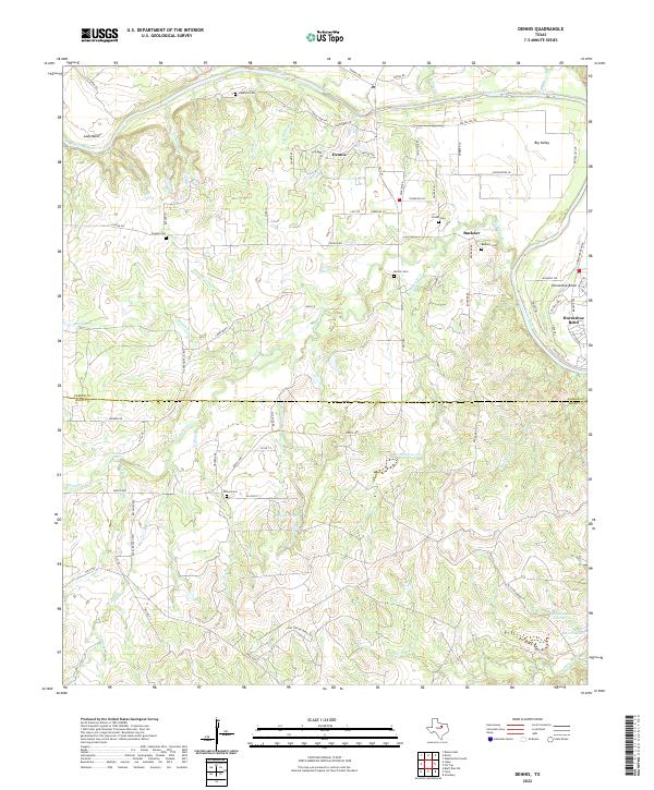 2022 Dennis2022 Print · USGSThe Brazos River meanders across the Parker and Hood county line in this contemporary landscape. Genealogists and local historians can trace family roots through several rural burial sites, including Stephens Cem, Morton Cem, and Allison Cem.
 - 2022 Map of Tin Top, 2022 Print
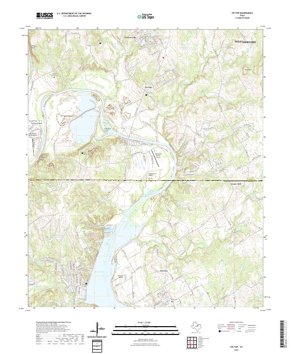 2022 Tin Top2022 Print · USGSThe Brazos River meanders through the Texas countryside between Parker and Hood Counties in the early 2020s. Researchers can locate several burial grounds like Irby Cem and Fairview Cem, alongside the industrial TXI Plant and the site of Center Mill.
 - 2022 Map of Chalk Mountain, 2022 Print
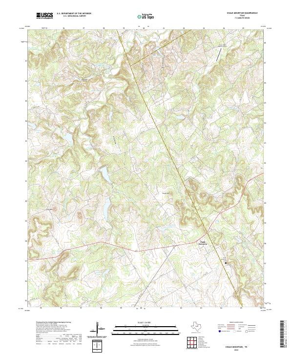 2022 Chalk Mountain2022 Print · USGSTexas ranching country at the tri-county border comes alive here during the early twenty-first century. Researchers can locate the Chalk Mountain Cem, trace the headwaters of the E Bosque River, and identify landmarks like Lone Mtn.
 - 2022 Map of Godley, 2022 Print
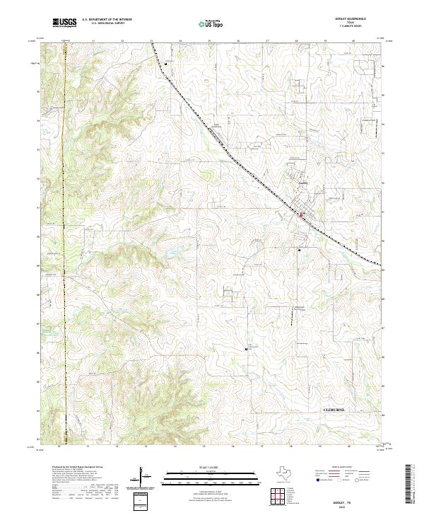 2022 Godley2022 Print · USGSGodley and the northern reaches of Johnson County are shown here in the early 2020s, a landscape defined by ranching and regional aviation. Researchers can locate Unity Cem, trace the course of the Nolan River, or explore small airfields like Aresti Aerodrome.
 - 2022 Map of Cresson, 2022 Print
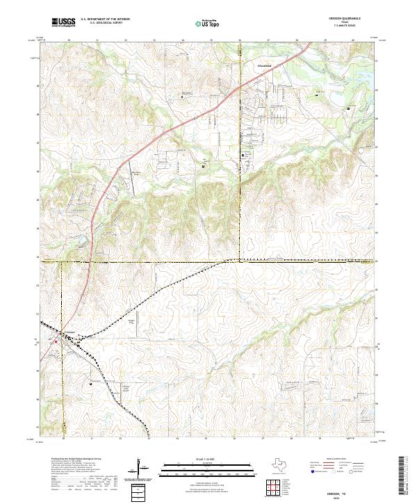 2022 Cresson2022 Print · USGSSettlement patterns at the meeting point of Hood, Johnson, and Parker counties appear here in the early twenty-first century. Researchers can trace family history at the Keyes Cemetery and Corn Cemetery or locate regional airfields like Chigger Field.
 - 2022 Map of Chapin, 2022 Print
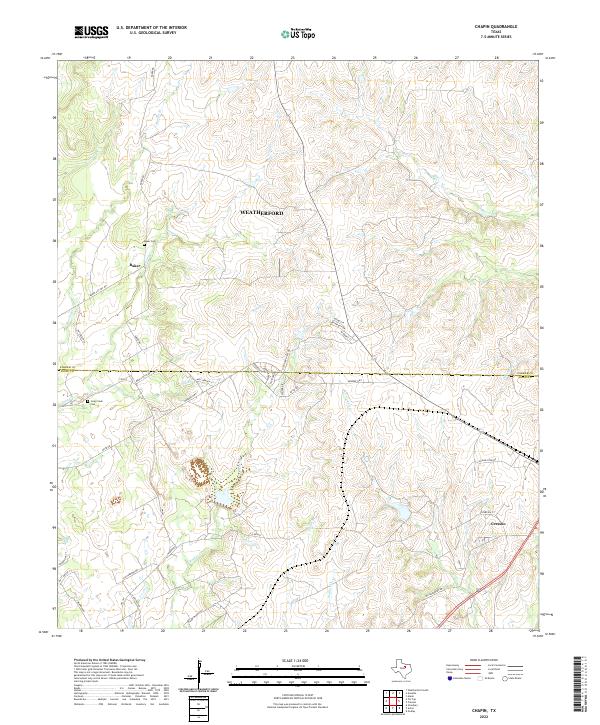 2022 Chapin2022 Print · USGSThe borderlands of Parker and Hood counties are captured here in the early twenty-first century as rural homesteads and ranches begin to meet newer residential growth. Researchers can locate family landmarks such as Baker Cem, Long Creek Cem, and the old community of Baker.
 - 2023 Map of Nemo, 2023 Print
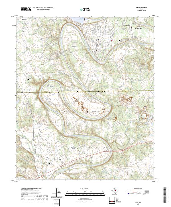 2023 Nemo2023 Print · USGSIn the early twenty-first century, the Brazos River corridor between Glen Rose and Pecan Plantation reveals a mix of suburban growth and deep-rooted Texas history. Family researchers can trace legacy sites like Fort Spunky, Kristenstad Cem, and the river bends of Abby Bend.
 - 2023 Map of Tolar, 2023 Print
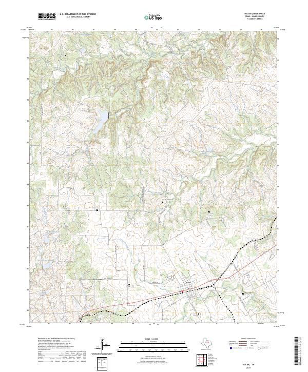 2023 Tolar2023 Print · USGSHood County’s rural character is well-preserved in this recent survey of the area around the community of Tolar. Genealogists can trace several local burial grounds including Ashbury Cem and Colony Cem, while researchers can study the drainages of Strouds Creek and Star Hollow Creek.
 - 2023 Map of Granbury, 2023 Print
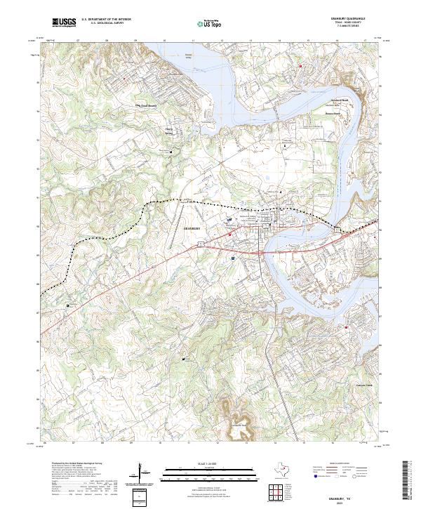 2023 Granbury2023 Print · USGSThe Brazos River valley in Hood County shows its modern character as a hub of lakeside communities and historic settlements. Trace local history through Thorp Spring, Granbury Cem, and the iconic profile of Comanche Peak.
 - 2023 Map of Hill City, 2023 Print
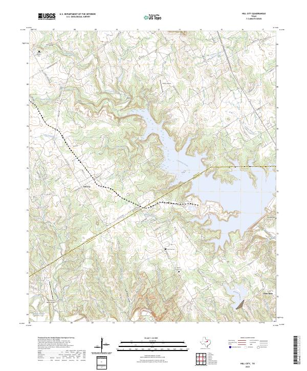 2023 Hill City2023 Print · USGSHood and Somervell Counties meet here along the meandering Comanche Creek and the Paluxy River in recent years. Researchers can trace ancestral connections at Mount Pleasant Cem or Milam Chapel Cem and locate rural landmarks like Parker Airport.
End of results
Showing maps 1-16 of 16
Top cities of Hood County
Frequently asked questions
- What are the different types of historical maps available for Hood County?
- What is the oldest map of Hood County?
- Where can I purchase historical maps of Hood County for my home or office?
- Where can I download high-res historical maps of Hood County?
- Are there historical topographic maps available for Hood County?
- Is there historical aerial imagery available for Hood County?
- Where are historical maps of Hood County sourced from?