Old Maps of Temco, Texas for Metal Detecting
Plan your next treasure hunt with 11 historic maps of Temco. Find old homesites, ghost towns, trails, and gathering spots that may be lost to time — perfect for identifying promising metal detecting locations.
- Locate forgotten sites: Uncover places like long-lost settlements, abandoned rail lines, or gathering spots.
- Plan better hunts: Use map overlays combined with LiDAR or satellite views to narrow in on historically rich areas.
- Made for detectorists: Thousands of hobbyists use these maps to discover relics, coins, and hidden history.
Use these historic maps to boost your research and find new opportunities beneath the surface of Temco.
Temco, TX maps
(11)- 1954 Map of Beaumont, 1964 Print
 1954 Beaumont1964 Print · USGSSoutheast Texas in the mid-fifties reveals a landscape of massive national forests, emerging reservoirs, and a booming oil economy. Genealogists and researchers can trace rural settlements like Dallardsville and Village Mills or locate early drilling sites at Sour Lake Oil Field.3 unique versions available
 - 1955 Map of Silsbee, 1956 Print
 1955 Silsbee1956 Print · USGSSoutheast Texas in the mid-fifties is captured here as a landscape of timber and oil, where the Neches River meanders through the piney woods. Genealogists and historians can trace community roots through Peaceful Rest Cem, Good Shepherd Ch, and the rail stops at Lumberton and Fletcher.3 unique versions available
 - 1957 Map of Beaumont
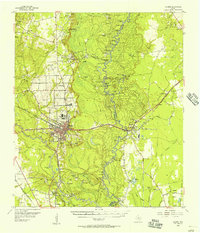
 1957 Beaumont1957 Print · USGSSoutheast Texas in the mid-fifties is defined by the timber-rich lands between the Trinity River and Beaumont. Trace the history of the Alabama and Coushatti Indian Reservation or locate early campus sites like Prairie View College.
 - 1984 Map of Beaumont
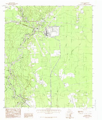
 1984 Beaumont1984 Print · USGSSoutheast Texas in the late seventies and early eighties shows a landscape of expanding reservoirs and deep timber industry. Researchers can trace the development of the Sam Houston National Forest or locate regional landmarks like Grabbs Prairie and the Wynne State Prison Farm.3 unique versions available
 - 1984 Map of Evadale, 1985 Print
 1984 Evadale1985 Print · USGSMid-1980s East Texas comes alive along the Jasper and Hardin county line as the Big Neches River winds through the Big Thicket National Preserve. Genealogists and historians can trace old transportation routes via the Old RR Grade and locate long-standing settlements like Evadale and Wiess Bluff.
 - 1986 Map of Beaumont
 1986 Beaumont1986 Print · USGSThe East Texas piney woods and coastal prairies are captured here in the mid-eighties, a period of established energy production and conservation. Researchers can trace the industrial footprint of the Oil and Gas Field near Daisetta and Batson, or locate family sites at Graveyard Hill Cem.
 - 2010 Map of Evadale, 2010 Print
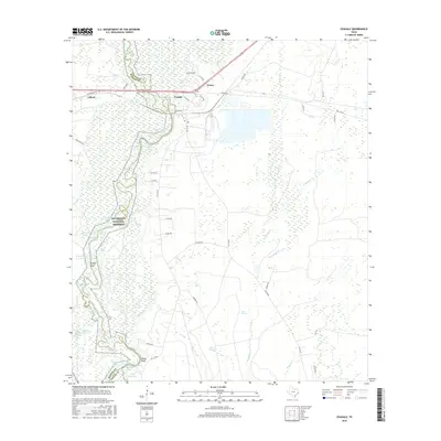
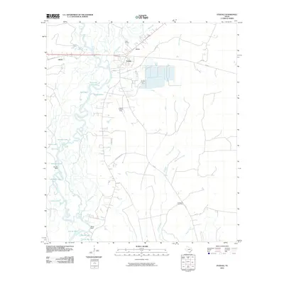 2010 Evadale2010 Print · USGSCovers Temco, including Lillard, Evadale, and other nearby areas
 - 2013 Map of Evadale, 2013 Print
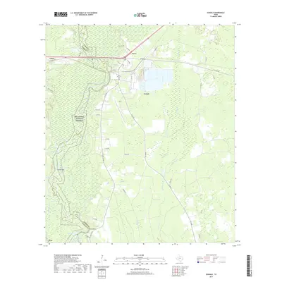
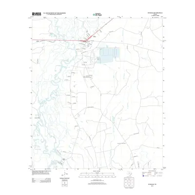 2013 Evadale2013 Print · USGSCovers Temco, including Lillard, Evadale, and other nearby areas
 - 2016 Map of Evadale, 2016 Print
 2016 Evadale2016 Print · USGSCovers Temco, including Lillard, Evadale, and other nearby areas
 - 2019 Map of Evadale, 2019 Print
 2019 Evadale2019 Print · USGSCovers Temco, including Lillard, Evadale, and other nearby areas
 - 2022 Map of Evadale, 2022 Print
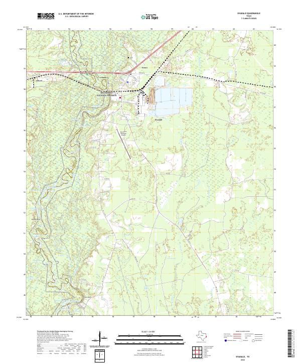 2022 Evadale2022 Print · USGSSoutheast Texas river country comes to life in this contemporary study of the Jasper and Hardin county line. Trace the winding Neches River past historical sites like Wiess Bluff, the Craig Cem, and the vast Big Thicket National Preserve.
End of results
Showing maps 1-11 of 11
Top cities near Temco
- Beaumont historical maps
- Orange historical maps
- Vidor historical maps
- Lumberton historical maps
- Silsbee historical maps
- Bevil Oaks historical maps
See more
Frequently asked questions
- What are the different types of historical maps available for Temco?
- What is the oldest map of Temco?
- Where can I purchase historical maps of Temco for my home or office?
- Where can I download high-res historical maps of Temco?
- Are there historical topographic maps available for Temco?
- Is there historical aerial imagery available for Temco?
- Where are historical maps of Temco sourced from?