Old Maps of Scurry, Texas for Genealogy
Trace your family roots with 29 historic maps of Scurry. These high-res maps reveal old neighborhoods, homesites, landmarks, and streets — helping you uncover where your ancestors lived and how the area evolved over time.
- Explore historic neighborhoods: Identify where your relatives may have lived in the 1800s or 1900s.
- Compare maps over time: Trace the changes in streets, buildings, and landmarks for multi-generational research.
- Perfect for genealogy & ancestry research: Used by family historians and researchers to map out lineage and migration.
These maps are an incredible resource for exploring your personal connection to Scurry's past.
Scurry, TX maps
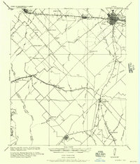
(29)- 1954 Map of Dallas, 1963 Print
 1954 Dallas1963 Print · USGSNorth Texas in the mid-fifties and early sixties reveals a landscape of rapid urban growth and water management. Genealogists and historians can trace the evolution of the metroplex through landmarks like Hensley Field, Boles Orphan Home, and the Texas & Pacific RR.4 unique versions available
 - 1956 Map of Kaufman
 1956 Kaufman1956 Print · USGSTexas cotton and rail country come alive in this survey of the northern Trinity River basin. Genealogists can trace family roots through specific landmarks like Convent Hall, the Negro School, and rural communities such as Scurry, Talty, and Gastonia.
 - 1958 Map of Dallas
 1958 Dallas1958 Print · USGSNorth Texas in the late fifties shows the dramatic expansion of the Metroplex as it absorbs surrounding farm towns. Genealogists and historians can trace old rail lines like the Missouri-Kansas-Texas and locate early lakefront developments at Eagle Mountain Lake and Lake Worth Village.
 - 1960 Map of Grays Prairie, 1962 Print
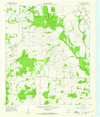 1960 Grays Prairie1962 Print · USGSKaufman County's rural landscape is preserved here during the early sixties, showing a world of small farm communities and creek-bottom timber. Researchers can locate family landmarks like Pyles Prairie Cem, the village of Lively, and the Coney Shilo Ch.3 unique versions available
 - 1962 Map of Scurry, 1966 Print
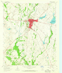
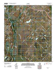
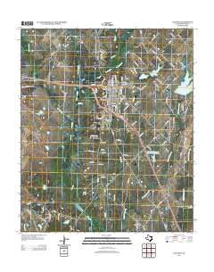
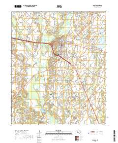
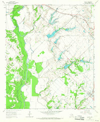 1962 Scurry1966 Print · USGSKaufman County agricultural land and flood control projects are documented here in the early sixties. Researchers can trace rural life through the Mt Olive Cem, the Pleasant Grove Ch, and the old Southern Pacific rail line.2 unique versions available
 - 1963 Map of Rosser
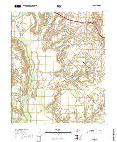
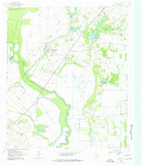 1963 Rosser1963 Print · USGSThe Trinity River bottomlands near the Kaufman and Ellis County line come to life in the early 1960s. Genealogists and local historians can trace family connections at Rosser Cemetery and Cottonwood Church or locate the site of the Scurry-Rosser School.2 unique versions available
 - 1963 Map of Kaufman, 1965 Print
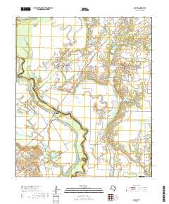
 1963 Kaufman1965 Print · USGSKaufman and its surrounding agricultural outskirts are captured in the early sixties as the town served as a bustling rail and civic center. Genealogists and researchers can trace the Southern Pacific line, locate family names near Jiba, and find local landmarks like St Ann Ch or the County Farm.
 - 1985 Map of Corsicana, 1986 Print
 1985 Corsicana1986 Print · USGSNorth Central Texas was defined by its expanding water reservoirs and deep-rooted rail corridors in the mid-eighties. Researchers can trace the heritage of local communities through landmarks like Southwestern Bible Institute, Navarro College, and rural markers such as Derrs Chapel.2 unique versions available
 - 1986 Map of Dallas
 1986 Dallas1986 Print · USGSThe North Texas metropolitan landscape comes into focus during the mid-eighties as urban growth expands toward the eastern reservoirs. Researchers can trace historic cemeteries like Oak Cliff Cem, rail corridors of the Texas & Pacific RR, and landmarks such as Southern Methodist University.3 unique versions available
 - 2010 Map of Grays Prairie, 2010 Print
 2010 Grays Prairie2010 Print · USGSCovers Scurry, including Kemp, Grays Prairie, and other nearby areas
 - 2010 Map of Rosser, 2010 Print
 2010 Rosser2010 Print · USGSCovers Scurry, including Ennis, Rosser, and other nearby areas
 - 2010 Map of Kaufman, 2010 Print
 2010 Kaufman2010 Print · USGSCovers Scurry, including Kaufman, Oak Grove, and other nearby areas
 - 2010 Map of Scurry, 2010 Print
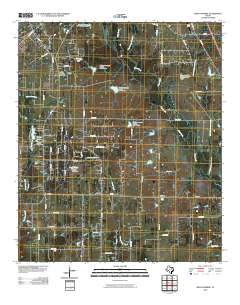
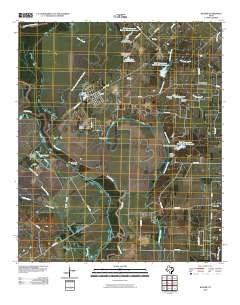
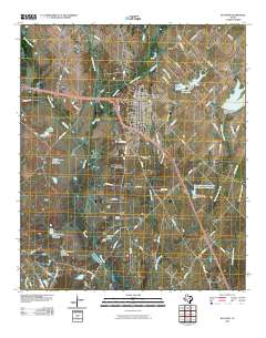
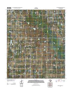
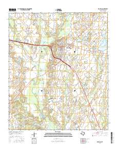
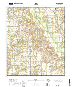
 2010 Scurry2010 Print · USGSCovers Scurry, including Kaufman, Combine, and other nearby areas
 - 2012 Map of Grays Prairie, 2012 Print
 2012 Grays Prairie2012 Print · USGSCovers Scurry, including Kemp, Grays Prairie, and other nearby areas
 - 2012 Map of Rosser, 2012 Print
 2012 Rosser2012 Print · USGSCovers Scurry, including Ennis, Rosser, and other nearby areas
 - 2012 Map of Scurry, 2012 Print
 2012 Scurry2012 Print · USGSCovers Scurry, including Kaufman, Combine, and other nearby areas
 - 2012 Map of Kaufman, 2012 Print
 2012 Kaufman2012 Print · USGSCovers Scurry, including Kaufman, Oak Grove, and other nearby areas
 - 2016 Map of Kaufman, 2016 Print
 2016 Kaufman2016 Print · USGSCovers Scurry, including Kaufman, Oak Grove, and other nearby areas
 - 2016 Map of Grays Prairie, 2016 Print
 2016 Grays Prairie2016 Print · USGSCovers Scurry, including Kemp, Grays Prairie, and other nearby areas
 - 2016 Map of Scurry, 2016 Print
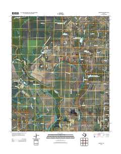
 2016 Scurry2016 Print · USGSCovers Scurry, including Kaufman, Combine, and other nearby areas
 - 2016 Map of Rosser, 2016 Print
 2016 Rosser2016 Print · USGSCovers Scurry, including Ennis, Rosser, and other nearby areas
 - 2019 Map of Kaufman, 2019 Print
 2019 Kaufman2019 Print · USGSCovers Scurry, including Kaufman, Oak Grove, and other nearby areas
 - 2019 Map of Grays Prairie, 2019 Print
 2019 Grays Prairie2019 Print · USGSCovers Scurry, including Kemp, Grays Prairie, and other nearby areas
 - 2019 Map of Scurry, 2019 Print
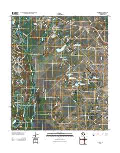
 2019 Scurry2019 Print · USGSCovers Scurry, including Kaufman, Combine, and other nearby areas
 - 2019 Map of Rosser, 2019 Print
 2019 Rosser2019 Print · USGSCovers Scurry, including Ennis, Rosser, and other nearby areas
Showing maps 1-25 of 29
Top cities near Scurry
- Dallas historical maps
- Mesquite historical maps
- Balch Springs historical maps
- Forney historical maps
- Ennis historical maps
- Terrell historical maps
See more
Frequently asked questions
- What are the different types of historical maps available for Scurry?
- What is the oldest map of Scurry?
- Where can I purchase historical maps of Scurry for my home or office?
- Where can I download high-res historical maps of Scurry?
- Are there historical topographic maps available for Scurry?
- Is there historical aerial imagery available for Scurry?
- Where are historical maps of Scurry sourced from?