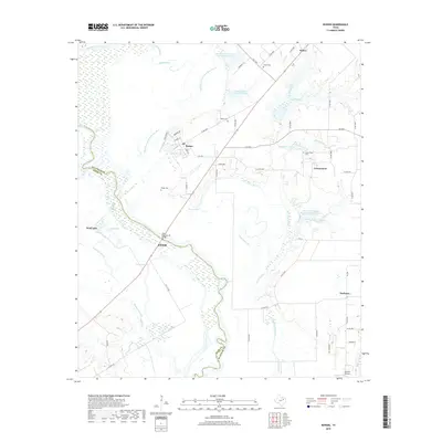
2019 Map of Rosser
USGS Topo · Published 2019About this map
The Trinity River and its meandering tributaries dominate this landscape on the border of Kaufman and Ellis counties. This environment is defined by an intricate network of sloughs and cutoffs, including the Old Channel E Fork Trinity River and Ezell Slough, which illustrate the natural shifting of the riverbed over time. Small settlements like Rosser, Scurry, and Cottonwood are connected by a web of rural roads and farm-to-market routes. The presence of the Rosser Cem, Cottonwood Cem, and Green Cem provides specific points of interest for genealogists tracing families in these small Texas communities. Large-scale water management is evident through features like the Soil Conservation Service Site 2 Reservoir and various lateral sites along the East Fork Trinity River, showing the ongoing efforts to control drainage in this flood-prone river valley.
Find a feature on this map
63 named features on this map. Tap any name to fly to it.
Don’t see what you’re looking for? This feature index may not catch every label — zoom into the map to look around manually.
Map Details
Editions of this 2019 Rosser Map
This is the sole edition of this map. No revisions or reprints were ever made.
Other maps of this area

1891 · Dallas
USGS Topo · 1:125,000

1893 · Dallas
USGS Topo · 1:125,000

1954 · Dallas
USGS Topo · 1:250,000

1956 · Ennis
USGS Topo · 1:62,500

1956 · Kaufman
USGS Topo · 1:62,500

1958 · Dallas
USGS Topo · 1:250,000

1959 · India
USGS Topo · 1:24,000

1959 · Seagoville
USGS Topo · 1:62,500

1960 · Grays Prairie
USGS Topo · 1:24,000

1962 · Ennis East
USGS Topo · 1:24,000