Old Maps of Kinney County, Texas for Metal Detecting
Plan your next treasure hunt with 212 historic maps of Kinney County. Find old homesites, ghost towns, trails, and gathering spots that may be lost to time — perfect for identifying promising metal detecting locations.
- Locate forgotten sites: Uncover places like long-lost settlements, abandoned rail lines, or gathering spots.
- Plan better hunts: Use map overlays combined with LiDAR or satellite views to narrow in on historically rich areas.
- Made for detectorists: Thousands of hobbyists use these maps to discover relics, coins, and hidden history.
Use these historic maps to boost your research and find new opportunities beneath the surface of Kinney County.
Kinney County, TX maps
(212)- 1893 Map of Nueces
 1893 Nueces1893 Print · USGSTexas ranching culture and the canyons of the Nueces River are captured here during the 1890s frontier era. Genealogists and local historians can trace early family landholdings like the Ford and Holliday Ranch and remote settlements such as Camp Wood or Barksdale.
 - 1896 Map of Nueces
 1896 Nueces1896 Print · USGSThe upper Nueces River valley in the 1890s is captured here as a network of isolated family ranches and riverfront settlements. Genealogists and historians can trace early landholders at the Ford and Holliday Ranch, Johnson Ranch, and Hillcoat Ranch.4 unique versions available
 - 1896 Map of Brackett
 1896 Brackett1896 Print · USGSSouthwest Texas ranching and military life come into focus in the 1890s, centered on the strategic presence of the frontier army. Genealogists can trace family holdings like Weymiller Ranch or find early communities such as the Seminole Settlement and Spofford.
 - 1897 Map of Brackett
 1897 Brackett1897 Print · USGSThe frontier of Kinney and Uvalde counties is captured here in the late nineteenth century, centered on the military and ranching hub of Brackett. Researchers can trace the Southern Pacific R. R. through Cline or locate the historic Seminole Settlement and Fort Clark.3 unique versions available
 - 1938 Map of Turkey Mountain
 1938 Turkey Mountain1938 Print · USGSKinney and Uvalde counties are shown here in the late 1930s, a period when isolated ranching estates and river crossings defined the local economy. Researchers can trace historic family lands like Harrison Ranch Headquarters and the Moss Ranch, or locate the rural Liveoak Sch.4 unique versions available
 - 1941 Map of Standart, 1965 Print
 1941 Standart1965 Print · USGSKinney County ranching country is documented here in the early 1940s, showing the intersection of rail transport and rural livestock life. Family historians can locate specific homesteads like Belcher Ranch and the community Mud Creek Sch along the Southern Pacific tracks.2 unique versions available
 - 1941 Map of Tequesquite Creek, 1977 Print
 1941 Tequesquite Creek1977 Print · USGSThe South Texas borderlands come alive in this early wartime survey of Kinney and Maverick Counties. Historians and genealogists can trace the footprint of the Southern Pacific railroad and family lands like Herbst Ranch or the Eagle Pass Auxiliary Landing Field No 2.
 - 1943 Map of Turkey Mountain
 1943 Turkey Mountain1943 Print · USGSKinney and Uvalde counties in the late 1930s reveal a landscape of remote ranching outposts and vital waterholes. Genealogists and historians can trace family-named lands like the Harrison Ranch Headquarters and Dave Rose Ranch or locate the rural Live Oak Sch.2 unique versions available
 - 1943 Map of Standart
 1943 Standart1943 Print · USGSKinney County ranching country and the railroad corridor are captured here during the early years of the Second World War. Researchers can trace the heritage of local families through landmarks like Mud Creek Sch, Stricklin Spr, and the Standart rail stop.
 - 1943 Map of Del Rio, 1969 Print
 1943 Del Rio1969 Print · USGSDel Rio and the Rio Grande borderlands are captured here during the mobilization of the early 1940s. Researchers can trace family ranching history at Brite Ranch or locate the burgeoning military operations at Laughlin Field.
 - 1944 Map of Sycamore Ranch
 1944 Sycamore Ranch1944 Print · USGSThe Texas-Mexico borderlands along the Rio Grande come into focus during the mid-forties, showing the complex network of ranching and irrigation. Researchers can trace family ranch lands such as Sycamore Ranch and Rancho Garza or locate early settlements like San Carlos.
 - 1944 Map of Tequesquite Creek
 1944 Tequesquite Creek1944 Print · USGSKinney and Maverick Counties are shown during the mid-1940s, a period defined by sprawling border ranchlands and wartime aviation. Local researchers can trace family holdings like Sockwell Ranch or locate aviation history at Eagle Pass Auxiliary Landing Field No 2.
 - 1944 Map of Barksdale
 1944 Barksdale1944 Print · USGSThe Edwards County ranching country of the mid-1940s is detailed here during the expansion of rural utility lines and cattle operations. Genealogists can locate family-named landmarks like Double Wells Ranch, Old Chapman Place, and the riverfront grounds of Camp Wood.
 - 1944 Map of Spofford
 1944 Spofford1944 Print · USGSThe rail junctions of southwest Texas come alive in the 1940s as the Southern Pacific meets the Texas and New Orleans at Spofford. Researchers can trace the sprawling ranching culture of the era through sites like Anacacho Headquarters Ranch, Beidler Ranch, and the siding at Nora.
 - 1944 Map of Flat Rock
 1944 Flat Rock1944 Print · USGSRanching life on the Edwards Plateau is captured during the mid-1940s, showing a landscape defined by seasonal creek forks and family-owned lands. Researchers can trace historic property boundaries and water sources like the Thurman Well, Askew Ranch, and Hayes Ranch.
 - 1944 Map of Brackettville
 1944 Brackettville1944 Print · USGSBrackettville and the surrounding Kinney County precincts are documented here in the 1940s, during a peak era of military activity at Fort Clark. Genealogists and local historians can trace family landholdings such as W G Lackey Ranch and Henderson Ranch alongside landmarks like Las Moras Spring.
 - 1944 Map of Indian Mountain
 1944 Indian Mountain1944 Print · USGSThe ranchlands of the Edwards Plateau are frozen in time during the 1940s, where the Nueces River winds through high hills and deep draws. Genealogists and historians can trace legacy family holdings like Covington Ranch, Seargeant Ranch, and McNealy Ranch across the county lines.
 - 1949 Map of Cline
 1949 Cline1949 Print · USGSSouthwest Texas ranching and asphalt mining are captured here in the late 1930s and 40s. Genealogists and historians can locate family landmarks like Finley Ranch and trace the specialized Asphalt Belt Line railroad serving Blewett.2 unique versions available
 - 1958 Map of Del Rio, 1970 Print
 1958 Del Rio1970 Print · USGSThe Texas-Mexico borderlands come alive in the late fifties, showing the confluence of the Rio Grande and the emerging Amistad Reservoir. Trace the lineage of the Southern Pacific rail line through stops at Pumpville, Shumla, and the mining vicinity of Blewett.2 unique versions available
 - 1964 Map of Del Rio
 1964 Del Rio1964 Print · USGSAlong the Mexican border during the mid-sixties, this area centered on the confluence of the Rio Grande and Devils River. Researchers can trace the Southern Pacific line through isolated stops like Pumpville or locate military and industrial sites such as Laughlin Air Force Base and the mines at Blewett.
 - 1972 Map of Del Rio SE, 1975 Print
 1972 Del Rio SE1975 Print · USGSThe Texas-Mexico borderlands come into sharp focus in the early seventies, centered on the strategic presence of Laughlin Air Force Base. Trace the rugged drainages of Zorro Creek and Sacatosa Creek as they meet the Rio Grande.
 - 1973 Map of Montell, 1976 Print
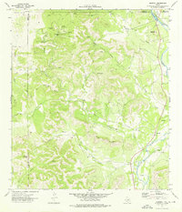 1973 Montell1976 Print · USGSThe Nueces River valley in the early seventies shows a landscape of remote ranching outposts and vital desert springs. Genealogists and researchers can trace local landmarks like Montell, Shoe Peg Mountain, and the family-named Hayes Mountain.
 - 1974 Map of Elm Mountain, 1976 Print
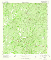 1974 Elm Mountain1976 Print · USGSKinney County ranch land and the prominent peak of Elm Mountain are captured here in the mid-1970s. Researchers can trace the winding course of Elm Creek and locate early infrastructure like the Roadside Park and local Gravel Pits.
 - 1974 Map of Turkey Mountain, 1976 Print
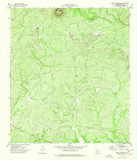 1974 Turkey Mountain1976 Print · USGSKinney County in the mid-1970s is a landscape of high summits and seasonal creek forks. Genealogists and researchers can trace land use through features like Turkey Mountain, the Gravel Pit, and various cattle-country Wells near Rough Hollow.
 - 1974 Map of Brackettville NE, 1976 Print
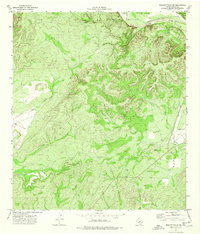 1974 Brackettville NE1976 Print · USGSKinney County in the mid-1970s is a landscape of winding river forks and cattle-country drainages. Trace the rugged terrain from the West Nueces River confluence down through Grass Valley to find remote landmarks like a lonely Landing Strip and a limestone Cave.
Showing maps 1-25 of 212
Top cities of Kinney County
Frequently asked questions
- What are the different types of historical maps available for Kinney County?
- What is the oldest map of Kinney County?
- Where can I purchase historical maps of Kinney County for my home or office?
- Where can I download high-res historical maps of Kinney County?
- Are there historical topographic maps available for Kinney County?
- Is there historical aerial imagery available for Kinney County?
- Where are historical maps of Kinney County sourced from?