1900s (20th Century) Maps of Lampasas County, Texas
Explore 42 historic maps of Lampasas County from the 1900s (20th Century). These maps offer a rare glimpse into what life looked like during the 1900s — showing old roads, neighborhoods, homes, and landmarks that have changed or disappeared over time.
Whether you're researching your family's past, planning a metal detecting trip, or studying how Lampasas County's landscape evolved across the 1900s, these high-resolution maps are a powerful tool for exploring the history of this region.
- Focus on a specific era: All maps on this page are from the 1900s, giving you a focused view of this time period.
- See what’s changed: Compare century-old streets, trails, and buildings to today's modern landscape using overlays and satellite layers.
- Research with precision: Use these maps for genealogy, historical research, land use analysis, or educational projects.
- View, download, or print: Maps are fully viewable online in high resolution, and can be downloaded or printed for your own records.
Start exploring Lampasas County's history through authentic maps from the 1900s. This is your window into the past.
Lampasas County, TX maps
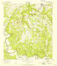
(42)- 1925 Map of San Saba 4-a
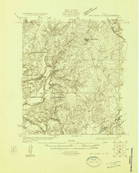
 1925 San Saba 4-a1925 Print · USGSTexas river life in the mid-twenties is defined by the winding paths of the Colorado and San Saba rivers as they meet near San Saba County. Genealogists can trace early rural communities through Bend Cem and a network of country schools including Colony School and Harmony Ridge School.
 - 1925 Map of San Saba 1-d
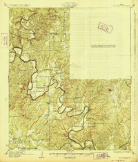
 1925 San Saba 1-d1925 Print · USGSThe Colorado River corridor between Mills and San Saba counties is captured here in the mid-1920s. Genealogists can locate rural community hubs like Nabors Creek School and Shaw Bend School or trace the early Santa Fe rail line.
 - 1928 Map of Goldthwaite
 1928 Goldthwaite1928 Print · USGSThe Colorado River snakes through the Mills and San Saba county line during the mid-twenties, a time of small schoolhouses and river fords. Genealogists can trace family landmarks like San Saba Peak, Big Valley Church, and the Rock Spring School.
 - 1931 Map of Bend
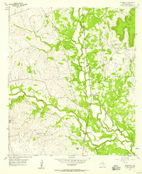
 1931 Bend1931 Print · USGSThe confluence of the Colorado and San Saba rivers in the mid-1920s reveals a rural Texas landscape of river crossings and country schools. Genealogists can trace early homesteads near Bend, the Bend Cem, and several local schoolhouses like Colony Sch.2 unique versions available
 - 1947 Map of Fort Hood
 1947 Fort Hood1947 Print · USGSCoryell and Lampasas Counties are shown here during the post-war expansion of military and rail infrastructure. Researchers can trace the layout of Fort Hood alongside rural landmarks like Willow Springs School, Starkle Cemetery, and the Variety Club Boys Ranch.
 - 1947 Map of Twin Moutains, 1953 Print
 1947 Twin Moutains1953 Print · USGSCoryell County is captured here in the late 1940s, as military expansion and railway transport defined the central Texas landscape. Researchers can trace family sites like Gotcher Cem and the early footprint of Copperas Cove alongside the Gulf Colorado and Santa Fe line.
 - 1947 Map of Copperas Cove, 1953 Print
 1947 Copperas Cove1953 Print · USGSCopperas Cove and Kempner are shown in the late 1940s as rural centers alongside the growing military presence at Fort Hood. Genealogists can locate family sites at Starkie Cem and Smith Cem or trace the early course of the Lampasas River.
 - 1948 Map of Goldthwaite, 1970 Print
 1948 Goldthwaite1970 Print · USGSMills and San Saba Counties come to life in the late 1940s as the railroad and the Colorado River define the local economy. Researchers can trace ancestral footprints at McMillan Cem, Rock Spring School, or the remote Big Valley Church.
 - 1950 Map of Goldthwaite
 1950 Goldthwaite1950 Print · USGSGoldthwaite and the surrounding ranchlands of Mills County are shown here at mid-century, following the winding meanders of the Colorado River. Researchers can locate several rural schools and churches like Flat Rock School and Lower Valley Church, or trace the path of the Gulf Colorado and Santa Fe Railway.
 - 1954 Map of Brownwood, 1955 Print
 1954 Brownwood1955 Print · USGSCentral Texas in the early fifties shows a landscape of rail-linked cattle towns and winding river valleys before modern highway expansion. Genealogists and historians can trace family-named peaks and vanished rail stops like Trickham, Santa Anna, and the Brady Mountains.3 unique versions available
 - 1954 Map of Evant, 1956 Print
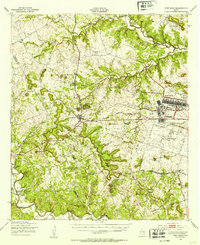
 1954 Evant1956 Print · USGSMid-century Central Texas comes to life through the springs and creek beds of Coryell and Hamilton Counties. Family historians can trace rural roots through Townsen Cem, Hines Chapel, and the USAF Practice Bombing Target near Adamsville.
 - 1954 Map of Lampasas, 1956 Print
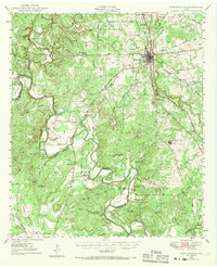
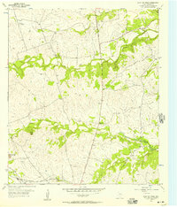
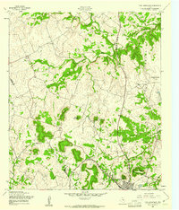
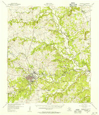 1954 Lampasas1956 Print · USGSLampasas and the surrounding ranchlands are shown here in the mid-fifties, centered on the confluence of several creeks and the rail corridor. Researchers can trace the layout of Kempner and Rumley, find rural landmarks like Clay Rock Ch, or locate family plots at Garner Cem.
 - 1954 Map of Evant, 1957 Print
 1954 Evant1957 Print · USGSEvant sits at the meeting point of three counties in the mid-1950s, serving as a crossroads for rural life and the regional cattle economy. Genealogists can trace family footprints through numerous small burial sites like Pilgrims Rest Cemetery or locate historical river landmarks such as Faubion Crossing.2 unique versions available
 - 1954 Map of Lampasas, 1957 Print
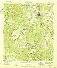
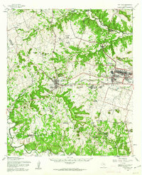
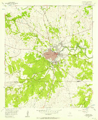 1954 Lampasas1957 Print · USGSMid-century Lampasas, Texas, serves as a railroad and highway crossroads where the hills meet the creek valleys. Trace the routes of the Santa Fe Railroad and find local landmarks like Hancock Park and Cook Cem.
 - 1954 Map of Izoro, 1957 Print
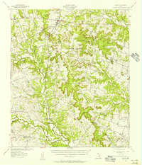
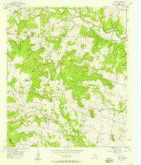
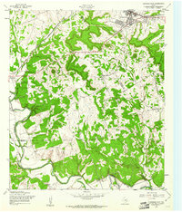
 1954 Izoro1957 Print · USGSThe borderlands of Coryell and Lampasas Counties in the mid-1950s show a traditional Texas landscape of isolated schools and spring-fed creeks. Researchers can locate family-named landmarks like Peabody Sch and the community of Izoro or trace the paths to Diamond Cave.2 unique versions available
 - 1954 Map of Flat Top Peak, 1957 Print
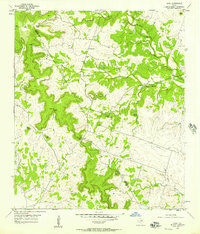
 1954 Flat Top Peak1957 Print · USGSLampasas County in the mid-fifties is captured here as a ranching landscape shaped by prominent limestone heights and winding creek beds. Researchers can locate the Pecan Grove Community Clubhouse, the Lampasas Airport, and the Gulf Colorado and Santa Fe railroad line.
 - 1954 Map of Pearl, 1957 Print
 1954 Pearl1957 Print · USGSCentral Texas ranching country in the mid-1950s reveals a network of isolated settlements and vital water sources. Genealogists and historians can trace family-named landmarks like Wayback Mountain and Fletchers Point or locate the communities of Pearl and Bee House.
 - 1954 Map of Rumley, 1957 Print
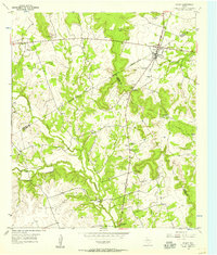
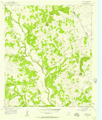 1954 Rumley1957 Print · USGSThe Lampasas River valley in the mid-1950s reveals a network of small Texas settlements and family landmarks. Genealogists can trace rural life through sites like Rock Church Cemetery, Rumley, and the School Creek Ch.2 unique versions available
 - 1954 Map of Kempner, 1957 Print
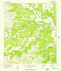 1954 Kempner1957 Print · USGSKempner and the Lampasas River valley are captured in the mid-fifties, showing a landscape shaped by the railroad and river crossings. Trace family history at Pickett Cem or explore rail landmarks like Deadmans Cut and the siding at Shortall.2 unique versions available
 - 1954 Map of Adamsville, 1957 Print
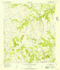
 1954 Adamsville1957 Print · USGSAdamsville and the Lampasas River valley are captured here in the mid-fifties, showing a rural Texas landscape shaped by creek-side settlement and military training. Researchers can locate the Friendship Sch, family burial grounds like Townsen Cem, and a USAF Practice Bomb Target.2 unique versions available
 - 1954 Map of Waco, 1964 Print
 1954 Waco1964 Print · USGSCentral Texas during the mid-fifties shows a landscape defined by the expansion of Fort Hood Military Reservation and the Brazos river system. Trace the rail lines and early airfields like James Connally Air Force Base and settlements like Temple or McGregor.2 unique versions available
 - 1955 Map of Waco
 1955 Waco1955 Print · USGSCentral Texas at the peak of the Cold War reveals a landscape defined by military expansion and major water projects. Researchers can trace the footprints of Fort Hood, the waters of Lake Waco, and regional hubs like Temple or Mexia.
 - 1958 Map of Twin Moutains, 1961 Print
 1958 Twin Moutains1961 Print · USGSThe hill country of Coryell and Lampasas Counties is captured here in the late fifties as military and rail interests shaped the land. Genealogists and local historians can trace the rural community of Topsey, the early growth of Copperas Cove, and local landmarks like Immanuel Ch.2 unique versions available
 - 1958 Map of Copperas Cove, 1961 Print
 1958 Copperas Cove1961 Print · USGSMid-century Copperas Cove and the Lampasas River valley are captured here as the region grew alongside the railroad. Genealogists can trace family landmarks like Kempner Cem, Smith Cem, and the passage through Ogletree Gap.3 unique versions available
 - 1958 Map of Fort Hood, 1962 Print
 1958 Fort Hood1962 Print · USGSThe Central Texas highlands meet military expansion in the late fifties as Fort Hood grows alongside Copperas Cove. Genealogists and historians can trace rural roots at Twin Mountains Cem or locate the Variety Club Boys Ranch.
Showing maps 1-25 of 42
Top cities of Lampasas County
Frequently asked questions
- What are the different types of historical maps available for Lampasas County?
- What is the oldest map of Lampasas County?
- Where can I purchase historical maps of Lampasas County for my home or office?
- Where can I download high-res historical maps of Lampasas County?
- Are there historical topographic maps available for Lampasas County?
- Is there historical aerial imagery available for Lampasas County?
- Where are historical maps of Lampasas County sourced from?