1980s Maps of Liberty County, Texas
Explore 21 historic maps of Liberty County from the 1980s. These maps offer a rare glimpse into what life looked like during the 1980s — showing old roads, neighborhoods, homes, and landmarks that have changed or disappeared over time.
Whether you're researching your family's past, planning a metal detecting trip, or studying how Liberty County's landscape evolved across the 1980s, these high-resolution maps are a powerful tool for exploring the history of this region.
- Focus on a specific era: All maps on this page are from the 1980s, giving you a focused view of this time period.
- See what’s changed: Compare century-old streets, trails, and buildings to today's modern landscape using overlays and satellite layers.
- Research with precision: Use these maps for genealogy, historical research, land use analysis, or educational projects.
- View, download, or print: Maps are fully viewable online in high resolution, and can be downloaded or printed for your own records.
Start exploring Liberty County's history through authentic maps from the 1980s. This is your window into the past.
Liberty County, TX maps
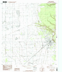
(21)- 1982 Map of Crosby
 1982 Crosby1982 Print · USGSEastern Harris County in the early eighties shows the expansion of lakeside communities alongside established railroad towns. Genealogists and historians can trace family plots at Simms Cem, locate the old High Sch in Crosby, and see the developing Newport area.
 - 1982 Map of Sheeks
 1982 Sheeks1982 Print · USGSCoastal Texas industry and rural life meet in the early eighties as petroleum production and complex canal systems reshape the Liberty County landscape. Genealogists and historians can locate the Harvey Cem, the Esperson D.O.M.E. Oil Field, and the Sheeks rail siding.
 - 1983 Map of Anahuac
 1983 Anahuac1983 Print · USGSThe Upper Texas Coast and its energy-driven landscape are detailed here in the early eighties. Genealogists and historians can trace coastal settlements like Anahuac and Winnie alongside the storied Spindletop Oil Field and the Anahuac National Wildlife Refuge.2 unique versions available
 - 1984 Map of Beaumont
 1984 Beaumont1984 Print · USGSSoutheast Texas in the late seventies and early eighties shows a landscape of expanding reservoirs and deep timber industry. Researchers can trace the development of the Sam Houston National Forest or locate regional landmarks like Grabbs Prairie and the Wynne State Prison Farm.3 unique versions available
 - 1984 Map of Nome, 1985 Print
 1984 Nome1985 Print · USGSThe Jefferson and Hardin county line comes alive in the mid-1970s, showing a landscape of coastal prairies and rail-side settlements. Genealogists and local researchers can trace the roads around Nome and Grayburg or locate landmarks like the Southern Pacific line and Swift Prairie.
 - 1984 Map of Rayburn, 1985 Print
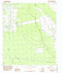
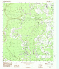
 1984 Rayburn1985 Print · USGSLiberty and San Jacinto Counties in the mid-1980s show a landscape of rural settlements and winding bayous along the Trinity River. Researchers can trace family sites near Shepherd, locate the Lookout Tower, and find old Cemeteries near Hightower and Dolen.
 - 1984 Map of Arizona Creek, 1985 Print
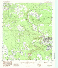
 1984 Arizona Creek1985 Print · USGSThe boundary between Hardin and Liberty counties in the mid-1980s shows a landscape of deep Texas piney woods and bayous. Researchers can trace the hydrology of Big Thicket National Preserve and find local landmarks like Batiste and Arizona Creek.
 - 1984 Map of Dayton, 1985 Print
 1984 Dayton1985 Print · USGSDayton and the surrounding Liberty County coastal plains are captured here in the mid-1970s and early 1980s. Local researchers can trace the rail-and-canal infrastructure near Dayton or locate smaller settlements like Stilson, Martha, and Gum Grove.2 unique versions available
 - 1984 Map of Hardin, 1985 Print
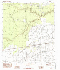
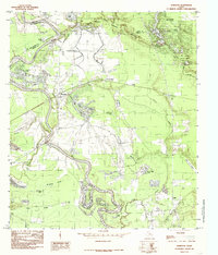
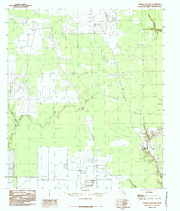
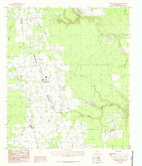
 1984 Hardin1985 Print · USGSIn the mid-1980s, the oil-rich coastal plains of East Texas were a grid of industrial pipelines and rural settlements. Genealogists and researchers can trace the limits of Hardin, Hull, and the Tanner Settlement alongside the expansive Daisetta Swamp.
 - 1984 Map of Liberty, 1985 Print
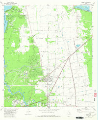
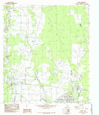
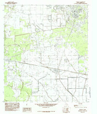
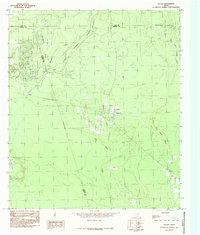
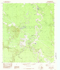
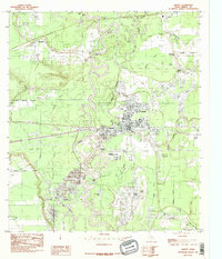 1984 Liberty1985 Print · USGSLiberty and the lower Trinity River valley are captured in the mid-eighties as a busy corridor of energy and river commerce. Genealogists and researchers can trace the roads through Kenefick, Ames, and South Liberty, or locate family sites near Graveyard Hill and the Port of Liberty.2 unique versions available
 - 1984 Map of Romayor, 1985 Print
 1984 Romayor1985 Print · USGSThe Trinity River bottomlands of East Texas come alive in the mid-eighties, showing the intersection of Liberty, San Jacinto, and Polk counties. Genealogists and local historians can trace family-named sites like Mc Anally Break or locate the Fields Landing Strip and Horn Crossing.
 - 1984 Map of Daisetta, 1985 Print
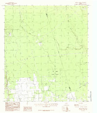
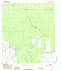
 1984 Daisetta1985 Print · USGSCoastal Texas industry and rural life meet in this mid-1980s survey of Liberty County. Researchers can trace the footprint of the local energy sector at the Oil Field or locate community landmarks like the Rodeo Ground and Cem.
 - 1984 Map of Thorson Gully, 1985 Print
 1984 Thorson Gully1985 Print · USGSHardin County during the mid-eighties shows a landscape defined by the dense woods of the Big Thicket National Preserve and active energy extraction. Researchers can trace the layout of Batson, find the small community of Strain, and locate the Oil + Gas Field near the Liberty County line.
 - 1984 Map of Votaw, 1985 Print
 1984 Votaw1985 Print · USGSEast Texas forest and wetlands are captured here in the early eighties as conservation and commerce intersected. Genealogists and historians can trace the rural layouts of Votaw, Fuqua, and Thicket or locate family landmarks near Pine Island Bayou and Wild Cow Marsh.
 - 1984 Map of Simmons Bottom, 1985 Print
 1984 Simmons Bottom1985 Print · USGSLiberty County's bottomlands are captured here in the mid-1980s, showing a landscape defined by seasonal waters and winding bayous. Genealogists and environmental researchers can trace the intricate paths of Luce Bayou, Tarkington Bayou, and the settlement at Simmons Bottom.
 - 1984 Map of Davis Hill, 1985 Print
 1984 Davis Hill1985 Print · USGSThe river bottomlands of Liberty County are captured here in the mid-1980s, centered on the rise of Davis Hill. Researchers can trace the complex network of oxbow lakes and bayous including Jack Williams Lake, Buzzard Roost Lake, and the winding Trinity River.
 - 1984 Map of Tarkington Prairie, 1985 Print
 1984 Tarkington Prairie1985 Print · USGSLiberty County in the mid-1980s shows a landscape of rural prairies and intricate drainage networks. Genealogists and local historians can locate early burial sites marked Cem and trace the flow of Gaylor Creek and Board Slough through the community.
 - 1984 Map of Devers, 1985 Print
 1984 Devers1985 Print · USGSThe coastal plains of Liberty County come into focus during the late seventies, showing the development of Devers and Felicia. Researchers can trace the intricate network of watercourses from Batiste Creek to the dense Devers Woods.
 - 1984 Map of Capers Ridge, 1986 Print
 1984 Capers Ridge1986 Print · USGSThe Trinity River bottoms in the late seventies reveal a complex landscape of oxbow lakes and winding bayous. Genealogists and local historians can trace the geography around Knight, the Barrett Trail, and water bodies like New Old River Lake or Hardin Lake.
 - 1985 Map of Conroe
 1985 Conroe1985 Print · USGSSoutheast Texas in the mid-eighties shows a landscape of timberlands and new lakeside developments. Researchers can trace the legacy of rail lines like the Southern Pacific RR or locate rural communities such as Plantersville, Yarboro, and Hufsmith.2 unique versions available
 - 1986 Map of Beaumont
 1986 Beaumont1986 Print · USGSThe East Texas piney woods and coastal prairies are captured here in the mid-eighties, a period of established energy production and conservation. Researchers can trace the industrial footprint of the Oil and Gas Field near Daisetta and Batson, or locate family sites at Graveyard Hill Cem.
End of results
Showing maps 1-21 of 21
Top cities of Liberty County
- Liberty historical maps
- Cleveland historical maps
- Dayton historical maps
- Daisetta historical maps
- Ames historical maps
- Plum Grove historical maps
See more
Frequently asked questions
- What are the different types of historical maps available for Liberty County?
- What is the oldest map of Liberty County?
- Where can I purchase historical maps of Liberty County for my home or office?
- Where can I download high-res historical maps of Liberty County?
- Are there historical topographic maps available for Liberty County?
- Is there historical aerial imagery available for Liberty County?
- Where are historical maps of Liberty County sourced from?