Old Maps of Liberty County, Texas for Metal Detecting
Plan your next treasure hunt with 196 historic maps of Liberty County. Find old homesites, ghost towns, trails, and gathering spots that may be lost to time — perfect for identifying promising metal detecting locations.
- Locate forgotten sites: Uncover places like long-lost settlements, abandoned rail lines, or gathering spots.
- Plan better hunts: Use map overlays combined with LiDAR or satellite views to narrow in on historically rich areas.
- Made for detectorists: Thousands of hobbyists use these maps to discover relics, coins, and hidden history.
Use these historic maps to boost your research and find new opportunities beneath the surface of Liberty County.
Liberty County, TX maps
(196)- 1916 Map of Crosby
 1916 Crosby1916 Print · USGSCoastal Texas prairie and river bottomlands come alive in this mid-1910s survey of Harris County. Researchers can trace early railroad junctions at Crosby or locate rural landmarks like Gum Gully School and the Adlong Ditch.2 unique versions available
 - 1916 Map of Huffman
 1916 Huffman1916 Print · USGSThe Harris and Liberty County border comes into focus during the early twentieth century as a landscape of bayous and rails. Genealogists can trace the early layout of Huffman and the path of the Beaumont Sour Lake and Western railroad near Luce Bayou.3 unique versions available
 - 1919 Map of Crosby
 1919 Crosby1919 Print · USGSHarris County at the height of its early twentieth-century growth shows a landscape of rail-connected towns and rural school districts. Genealogists and local historians can trace family locations near Gum Gully School, Ramsey School, or the early Oil Pumping Sta.3 unique versions available
 - 1920 Map of Huffman
 1920 Huffman1920 Print · USGSCoastal prairie and timberlands north of Houston come into focus during the early twentieth century as a burgeoning rail and road network took shape. Genealogists can trace family landmarks and early transit routes through Huffman, Scott Ranch, and the Lumber R R.2 unique versions available
 - 1943 Map of Whites Bayou
 1943 Whites Bayou1943 Print · USGSTexas coastal prairie life comes into focus during the early 1940s, showing the intersection of ranching, rice farming, and the oil industry. Genealogists and historians can trace the Hankamer Oil Field and the Abshier Cem near Hankamer.
 - 1943 Map of Liberty
 1943 Liberty1943 Print · USGSLiberty and the surrounding Big Thicket are documented here during the early twentieth-century boom in timber and oil. Researchers can locate vanished landmarks such as the Yellow School House, trace family lands like Mears Ranch, and follow the path of the Old Tram through the river bottomlands.
 - 1944 Map of Crosby
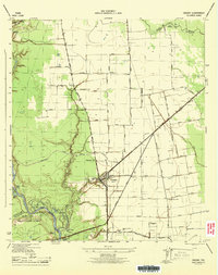 1944 Crosby1944 Print · USGSCoastal Texas near the Harris and Liberty county line comes to life in this mid-1940s survey of the river and rail landscape. Researchers can trace the heritage of Crosby through its early cemetery sites like Sacred Heart Cem and community hubs like Bohemian Hall.
 - 1945 Map of Nolte
 1945 Nolte1945 Print · USGSThe coastal prairie at the borders of Liberty, Chambers, and Jefferson Counties is captured here in the mid-1940s. Genealogists and researchers can trace early rural life through landmarks like the Pumping Station at Blair, Oak Island, and Willis Marsh.
 - 1950 Map of Houston, 1953 Print
 1950 Houston1953 Print · USGSCoastal Texas in the early fifties reveals a landscape of massive civil engineering and industrial transit. Genealogists and researchers can trace the growth of the Houston suburbs and the maritime infrastructure of Galveston Bay, including the Gulf Freeway and the Texas City Dike.
 - 1954 Map of Crosby, 1956 Print
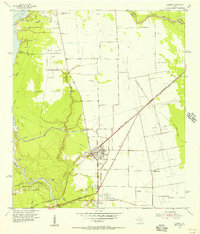 1954 Crosby1956 Print · USGSCoastal Harris County in the mid-fifties is characterized here by its booming oil fields and crossroads settlements. Genealogists and local historians can trace family roots through Crosby and Barrett, or locate early landmarks like Bohemian Hall and Sacred Heart Cem.
 - 1954 Map of Beaumont, 1964 Print
 1954 Beaumont1964 Print · USGSSoutheast Texas in the mid-fifties reveals a landscape of massive national forests, emerging reservoirs, and a booming oil economy. Genealogists and researchers can trace rural settlements like Dallardsville and Village Mills or locate early drilling sites at Sour Lake Oil Field.3 unique versions available
 - 1955 Map of Daisetta, 1956 Print
 1955 Daisetta1956 Print · USGSLiberty County was undergoing an industrial transition in the 1950s as oil fields and drainage canals reshaped the coastal prairie. Researchers can trace the development of salt dome operations near Daisetta or locate rural landmarks like Ames Cem and Sacred Heart Ch.3 unique versions available
 - 1955 Map of Saratoga, 1956 Print
 1955 Saratoga1956 Print · USGSHardin County oil and timber industries are on full display in the mid-fifties, showing the region's dense baygalls and rail towns. Genealogists and historians can trace family sites at Mt Calvary Ch or the Saratoga Oil Field.4 unique versions available
 - 1955 Map of Sour Lake, 1956 Print
 1955 Sour Lake1956 Print · USGSCoastal Texas prairies and oil fields are captured here in the mid-1950s as petroleum production shaped the local economy. Genealogists can locate family landmarks like Pine Ridge Ch, Henderson Sch, and the Grayburg Cem along the old rail lines.2 unique versions available
 - 1955 Map of Rayburn, 1957 Print
 1955 Rayburn1957 Print · USGSDeep in East Texas during the mid-fifties, this survey reveals the intricate oxbows of the Trinity River and the rural communities of Tarkington Prairie. Genealogists can locate family landmarks like Concord Cem and the Tarkington Prairie Sch.2 unique versions available
 - 1955 Map of Liberty, 1957 Print
 1955 Liberty1957 Print · USGSLiberty and Dayton thrived at the crossroads of the Trinity River and major rail lines during the mid-fifties. Genealogists and historians can trace family landmarks like Magnolia Cem, Daniel Ranch, and schools like Colbert High Sch.2 unique versions available
 - 1956 Map of Houston, 1963 Print
 1956 Houston1963 Print · USGSSoutheast Texas in the mid-fifties is captured here as a powerhouse of oil and maritime trade. Genealogists and historians can trace the foundations of Houston and its ports, alongside landmarks like the Rice Institute and the Spindletop Oil Field.2 unique versions available
 - 1957 Map of Beaumont
 1957 Beaumont1957 Print · USGSSoutheast Texas in the mid-fifties is defined by the timber-rich lands between the Trinity River and Beaumont. Trace the history of the Alabama and Coushatti Indian Reservation or locate early campus sites like Prairie View College.
 - 1958 Map of Fostoria, 1959 Print
 1958 Fostoria1959 Print · USGSThe timber country of southeast Texas is captured here in the late fifties, centered on the mill town of Fostoria. Researchers can trace old family landmarks and rural life at Pin Oak Cem, Pilgrim Rest Ch, and the logging stops along the Gulf Colorado and Santa Fe railroad.3 unique versions available
 - 1958 Map of Cleveland, 1959 Print
 1958 Cleveland1959 Print · USGSCleveland emerged as a bustling rail and timber crossroads in the late fifties, where major lines met at the edge of the national forest. Genealogists and historians can trace old community anchors like Pin Oak Cem, New Salem Ch, and the outlying settlement of Fostoria.2 unique versions available
 - 1958 Map of Westcott, 1959 Print
 1958 Westcott1959 Print · USGSThe Piney Woods of San Jacinto County meet the open grasslands in the late fifties, as rail lines drove the local timber economy. Researchers can locate family landmarks like Lovett Cem, the Big Creek Missionary Ch, and the rural school at Dixon High Sch.3 unique versions available
 - 1959 Map of Plum Grove, 1960 Print
 1959 Plum Grove1960 Print · USGSThe Texas coastal plains near the Liberty and Montgomery county lines come into focus in the late fifties. Researchers can trace family-named landmarks and water sources like Thompson Grass Pond, Sallas Lake, and the high point at Casey Ridge.3 unique versions available
 - 1959 Map of Splendora, 1960 Print
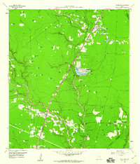 1959 Splendora1960 Print · USGSEast Texas oil production and railroad transit define the Splendora area in the late fifties. Genealogists and researchers can trace family landmarks and community hubs like Robinson Cem, Carver Sch, and the vanished tracks of the Old Grade Railroad.4 unique versions available
 - 1960 Map of Huffman, 1962 Print
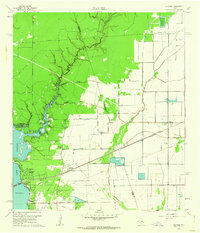 1960 Huffman1962 Print · USGSNortheast Harris County in the early sixties was a landscape of bayous and rail lines at the edge of the rising Houston Lake. Genealogists and local historians can trace the foundations of Huffman, locating the Huffman School, St Annes Church, and the historic Atascocita Road.4 unique versions available
 - 1961 Map of Shiloh, 1964 Print
 1961 Shiloh1964 Print · USGSCoastal Liberty and Chambers Counties are shown in the early sixties as a landscape of marshland and industrial sulphur extraction. Genealogists can locate family burial sites at Miller Cem and Norris Cem or trace the early community around Shiloh.2 unique versions available
Showing maps 1-25 of 196
Top cities of Liberty County
- Liberty historical maps
- Cleveland historical maps
- Dayton historical maps
- Daisetta historical maps
- Ames historical maps
- Plum Grove historical maps
See more
Frequently asked questions
- What are the different types of historical maps available for Liberty County?
- What is the oldest map of Liberty County?
- Where can I purchase historical maps of Liberty County for my home or office?
- Where can I download high-res historical maps of Liberty County?
- Are there historical topographic maps available for Liberty County?
- Is there historical aerial imagery available for Liberty County?
- Where are historical maps of Liberty County sourced from?